Related Keywords
world downloadsworld disney world downloads
world time downloads
world championship poker downloads
world clock downloads
world cup downloads
world map downloads
world cities downloads
world countries downloads
world war 2 downloads
world war iv downloads
world tv downloads
world s wonders downloads
world wide web downloads
world best websites downloads
world websites downloads
world champion downloads
world map in flash downloads
world cup 2006 downloads
world domination downloads
Top Software Keywords
autocad downloads3d cad downloads
cad downloads
drawing downloads
import downloads
design downloads
dwg downloads
pdf to dwg downloads
convert pdf to dwg downloads
dxf downloads
convert downloads
dxf to pdf downloads
dwg to pdf downloads
converter downloads
pdf to dxf downloads
dwf to dwg downloads
dwg converter downloads
dwg to jpg downloads
dwg to dxf downloads
dwg to bmp downloads
stl downloads
dxf to pcl downloads
dwg to tiff downloads
intellicad downloads
pdf to cad downloads
dwg to gif downloads
convert dwg to pdf downloads
dwg to png downloads
dwg to dwf downloads
dxf to ps downloads
Vista Download
Vista downloadVista antivirus download
Vista wallpaper download
Vista wallpapers download
Vista themes download
Vista pack download
Vista ultimate download
Vista home download
Vista basic download
Vista business download
Vista x64 download
Vista transformation download
Vista transformation pack download
Vista boot download
Vista dvd download
Vista sidebar download
Vista aero download
Vista product key download
Downloads RSS
Top Downloads
Top Rated
Navigation: Home
\ Graphic Apps
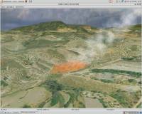
\ CAD \ Virtual Terrain Project for Windows
Virtual Terrain Project for Windows1.1 110804 by Ben Discoe |

|
Software Description:
... for easily constructing any part of the real world in interactive, 3D digital form.This goal will require a synergetic convergence of the fields of CAD, GIS, visual simulation, surveying and remote sensing. VTP gathers information and tracks progress in areas such as procedural scene construction, feature extraction, and rendering algorithms. ...
type: Open Source
Download Virtual Terrain Project for Windowscategories: libraries, demos, data, open source, VirtualTerrain Project, CAD, GIS, VTP Add to Download Basket Report virus or spyware |
 [ Zoom screenshot ] |
|
| Software Info | |
|
Best Vista Download periodically updates pricing and software information of Virtual Terrain Project for Windows full version from the publisher,
but some information may be out-of-date. You should confirm all information. Software piracy is theft, using crack, warez passwords, patches, serial numbers, registration codes, key generator, keymaker or keygen for Virtual Terrain Project for Windows license key is illegal and prevent future development of Virtual Terrain Project for Windows. Download links are directly from our mirrors or publisher's website, Virtual Terrain Project for Windows torrent files or shared files from rapidshare, yousendit or megaupload are not allowed! |
|
| Released: | September 08, 2011 |
| Filesize: | 1.00 MB |
| Platform: | Windows 2000, Windows 2003, Windows XP, Windows Vista |
| Install | Instal And Uninstall |
| Add Your Review or Windows Vista Compatibility Report |
Virtual Terrain Project for Windows- Releases History |
| Software: | Virtual Terrain Project for Windows 1.1 110804 |
| Date Released: | Sep 8, 2011 |
| Status: | New Release |
| Release Notes: | Enviro: Exposed support for more stereo modes: Horizontal and Vertical split. Options to enable joystick and spacenavigator, rather than just always using them if present. Smooth continuous update when making buildings. Option to constrain building point to right angles. Deter user from making bad points. Made support for Collada (.dae) more explicit in the UI. Display the version number in the startup dialog. Added 'every N meters' option to Contour dialog, making it significantly more useful. Changed 'Move' mode to use Alt modifier key for up/down, to be consistent. Fixed issues with: support for elevation grids with non-unit vertical scale; removing layers from a terrain; saving snapshot and high-resolution snapshot; buildings with a Geographic CRS; draping of 2D polylines on terrain with vertical exaggeration. VTBuilder: Raw layers: Draw polygon holes as dotted lines to tell them from outer edges. |
Most popular world in CAD downloads for Vista |
|
TNTatlas 2024 B20240606 download by MicroImages, Inc.
... distribute, and present the spatial information in your world in an easy, atlas-like manner. With TNTatlas, you ... the Internet and take advantage of the growing world-wide network, with ever-increasing bandwidth, and increased connectivity. ...
type: Freeware
View Details
Download
categories: geospatial viewer, view atlas, visualize geospatial data, atlas, map, viewer |
 |
|
Archiva 7.7.0.0.001 download by AngelSystems.net Inc.
... can be send to other users around the world. Archiva documents can be directly read by Microsoft Word, Corel Word Perfect, etc. · Super fast search engine. Multiple keywords and ...
type: Trialware ($29.00)
View Details
Download
categories: reference collection, database backup, collection mangement, collection, archive, collector |
 |
|
Oasys AdSec 8.4 Build 41 download by Oasys Limited
... and curvatures. Used by engineers around the world, AdSec is the leading analysis program for sections under load. ...
type: Trialware ($1 575.00)
View Details
Download
categories: beam section analysis, analyze beam, concrete beam behavior, beam, analyze, analysis |
 |
|
Home Plan Pro 5.8.2.1.5 download by Home Plan Software
... fax driver faxes your plans anywhere in the world. --Metric or USA Measurements --Dozens of Fill Patterns --Draw with Mouse and Keyboard --Hundreds of Resizeable, Rotatable Figures --Print on any ...
type: Shareware ($39.00)
View Details
Download
categories: cad, floor plans, blueprint, blueprints, drafting, home plans, home design |
 |
|
TrueSpace 7.61 download by Caligari Corporation
... you can place whatever you make into real world locations in Virtual Earth and share them with others! · trueSpace also supports import from a wide variety of formats, ...
type: Freeware
View Details
Download
categories: truespace 3, truespace 6.5, truespace 7, truespace 7.5, truespace, truespace 7.51, truespace trial, truespace models, True Space |
 |
|
ExpertGPS 8.64 download by TopoGrafix
... other ExpertGPS and EasyGPS users all over the world! ExpertGPS will change the way you use ... You'll discover a whole new view of the world with the aerial photos and maps in ExpertGPS. ...
View Details
Download
|
 |
|
LanDTM 6.1 download by Aplicaciones Topográficas S.L.
Note: The program’s installer and interface are presented in Spanish. There is not any professional program on internet like this and you can get it without any effort. I think ...
type: Freeware
View Details
Download
categories: Delaunay triangulation, Terrain Representation, CAD addon, Delaunay triangulation, Calculate, Terrain |
 |
|
Easy-PC 27.0 download by WestDev Ltd.
... Easy-PC brings you features normally found in the world's most expensive PCB design systems. Just take a ... many people are buying Easy-PC. FEATURES: World-beating value Delivering performance in Schematic Capture and ...
type: Demo ($417.00)
View Details
Download
categories: create PCB schematic, circuit board designer, generate netlist, create, creator, design |
 |
|
OpenAPC 2.5 download by OpenAPC Project Group
... ControlRoom offers open programming interfaces to the outer world you can utilitize without licensing restrictions. So you ... this: you can combine the features of different worlds within one application according to your needs. Integrated ...
View Details
Download
|
 |
|
Open Visual Trace Route 1.7.1 download by Leo Lewis
... Visual Trace Route. Route is displayed in a World Wind Java cartographic component. Now you can use this accessible and easy-to-use application to view the shortest route between where ...
View Details
Download
|
 |