Related Keywords
view area downloadsarea downloads
area codes downloads
area code downloads
area data downloads
area characteristic downloads
area code 212 downloads
area code 727 downloads
area code 310 downloads
area code 213 downloads
area code 650 downloads
area code 951 downloads
area code directory downloads
area code lookup downloads
area calculator downloads
area selection downloads
area chart downloads
area graphs into web pages downloads
area it provides downloads
area of belgrade downloads
Top Software Keywords
autocad downloads3d cad downloads
cad downloads
drawing downloads
import downloads
design downloads
dwg downloads
pdf to dwg downloads
dxf downloads
convert pdf to dwg downloads
convert downloads
dxf to pdf downloads
dwg to pdf downloads
converter downloads
pdf to dxf downloads
dwf to dwg downloads
dwg converter downloads
dwg to jpg downloads
dwg to dxf downloads
dwg to bmp downloads
stl downloads
dxf to pcl downloads
dwg to tiff downloads
intellicad downloads
pdf to cad downloads
dwg to gif downloads
convert dwg to pdf downloads
dwg to png downloads
dwg to dwf downloads
dxf to ps downloads
Vista Download
Vista downloadVista antivirus download
Vista wallpaper download
Vista wallpapers download
Vista themes download
Vista pack download
Vista ultimate download
Vista home download
Vista basic download
Vista business download
Vista x64 download
Vista transformation download
Vista transformation pack download
Vista boot download
Vista dvd download
Vista sidebar download
Vista aero download
Vista product key download
Downloads RSS
Top Downloads
Top Rated
Navigation: Home
\ Graphic Apps
\ CAD \ TopoLT
TopoLT15.2 by CADWARE Engineering |

|
Software Description:
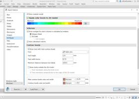
TopoLT is an application offering tools for 2D and 3D aplications and functionalities useful for all those who design topographical or cadastral plans in digital format, who develop 3D terrain models and contours, fill and cut volumes calculation, raster image georeferencing and automatic printing. 3D model of the terrain and contour lines can be generated, volumes can be calculated without any restrictions. ...
type: Trialware ($600.00)
Download TopoLTcategories: topographical plan, cadastral plan, terrain model, topography, cadaster, terrain Add to Download Basket Report virus or spyware |
 [ Zoom screenshot ] |
|
| Software Info | |
|
Best Vista Download periodically updates pricing and software information of TopoLT full version from the publisher,
but some information may be out-of-date. You should confirm all information. Software piracy is theft, using crack, warez passwords, patches, serial numbers, registration codes, key generator, keymaker or keygen for TopoLT license key is illegal and prevent future development of TopoLT. Download links are directly from our mirrors or publisher's website, TopoLT torrent files or shared files from rapidshare, yousendit or megaupload are not allowed! |
|
| Released: | October 16, 2023 |
| Filesize: | 67.80 MB |
| Platform: | Windows XP, Windows Vista, Windows Vista x64, Windows 7, Windows 7 x64, Windows 8, Windows 8 x64, Windows 10, Windows 10 x64, Windows 11 |
| Install | Instal And Uninstall |
| Add Your Review or Windows Vista Compatibility Report |
TopoLT- Releases History |
| Software: | TopoLT 15.2 |
| Date Released: | Oct 16, 2023 |
| Status: | New Release |
| Software: | TopoLT 15.1 |
| Date Released: | Mar 3, 2023 |
| Status: | New Release |
| Software: | TopoLT 14.0 |
| Date Released: | Feb 24, 2022 |
| Status: | New Release |
Most popular view area in CAD downloads for Vista |
|
BricsCad Classic 24.2.06-1 download by Bricsys Inc.
... Wipe Out · Settings Manager · Smooth fast view panning. · Smart selection highlighting. · Cycling through ... Hatches. · Arc Length dimensions. · Rectangle with Area and Dimension support. · Block Units for insertion ...
View Details
Download
|
 |
|
Gerbview x64 10.21 download by Software Companions
An advanced, but easy to use Gerber viewer. View, markup, print and convert your Gerber, Excellon and ... easy to use application that enables you to view, print, convert and markup Gerber, HPGL, HPGL/2, Excellon ...
type: Trialware ($80.00)
View Details
Download
categories: x64 print Gerber image, view plot x64, convert Gerber x64, convert x64, Gerber x64, print x64 |
 |
|
IGES Viewer alias ABViewer 14 download by CADSoftTools
IGES Viewer is a professional software to work with 3D ... formats, including STP/STEP, SAT, STL, OBJ, BREP. The viewer has different visual styles and all necessary tools ... get more detailed information about a 3D model: area, height between two parallel surfaces, the distance between ...
type: Shareware ($66.00)
View Details
Download
categories: IGS, IGES, .igs, IGS viewer, 3D viewer, IGS to DWG, IGS to STL, IGS to JPEG, IGS to OBJ, IGS to DXF, convert, converter, measure, measuring, view, viewer, print, printing |
 |
|
PicoScope 7.1.21 download by Pico Technology
... of measurements and statistics · Spectrum analyzer – view signals in the frequency domain · Arbitrary waveform ... a waveform or spectrum goes outside a specified area · Serial decoding – decode data from a ...
type: Freeware
View Details
Download
categories: oscilloscope software, spectrum analyzer, waveform generator, oscilloscope, spectrum, analyzer |
 |
|
TopoLT 15.2 download by CADWARE Engineering
... to the codes interpretation file; · tables with areas calculation can be created in the drawing or in the arr.tab file. These areas can be recorded in arr.txt file which can ...
type: Trialware ($600.00)
View Details
Download
categories: topographical plan, cadastral plan, terrain model, topography, cadaster, terrain |
 |
|
MagicPlot Viewer 2.0 download by MagicPlot.com
Plotvisor is a tool for viewing plots and thumbnails from multiple text/ASCII files. ... appearance is similar to that of popular image viewers: there is the directory tree, thumbnails and preview ...
View Details
Download
|
 |
|
SeiSee 2.22.6 download by Sergey I. Pavlukhin
... useful application for the users that need to view and to analyze the data about earthquakes stored in SEG-Y files. The program can also view the content of CWP, CGG and CST files ...
type: Freeware
View Details
Download
categories: seismic data viewer, analyze earthquake data, view SEG-Y, sesmic, view, viewer |
|
|
NetLogo 6.0.4 download by Uri Wilensky
... or multiple variables, which you can adjust to view the results. For instance, climate change hinges on ... sliders, switches, choosers, monitors, text boxes, notes, output area Info tab for annotating your model with formatted ...
type: Freeware
View Details
Download
categories: Analyze simple or complex social and natural phenomena |
 |
|
Shadow Analyzer 2.2.1.1.1 download by Dr. Baum Research e.K.
... most daytime hours). You can also transfer 3D views of the project into other applications like MS ... tools for the negotiations with clients. The '3D View' windows highly improve the impression from your project ...
type: Demo ($1 985.00)
View Details
Download
categories: Parametric CAD, Shading Analysis, sun-tracking and static PV-systems, Solar Energy Engineering |
 |
|
3D FastView 1.0 download by Gstarsoft Co.,Ltd.
... CAD Model before manufacturing by calculating the projected area, undercut analysis, draft angle analysis, 2D/3D model compare, ... CAD model using various methods including generating exploded views according to a different axis, creating perspective views ...
View Details
Download
|
 |