Related Keywords
vector library downloadsvector graphics downloads
vector downloads
vector drawing downloads
vector conversion downloads
vector icons downloads
vector map downloads
vector based downloads
vector art downloads
vector graphic editor downloads
vector graphic downloads
vector editor downloads
vector icon downloads
vector ultima spell checker downloads
vector con downloads
vector images downloads
vector magic downloads
vector layers downloads
vector shapes downloads
vector edior downloads
Top Software Keywords
autocad downloadscad downloads
3d cad downloads
drawing downloads
import downloads
design downloads
dwg downloads
pdf to dwg downloads
dxf downloads
convert downloads
convert pdf to dwg downloads
dwg to pdf downloads
dxf to pdf downloads
converter downloads
pdf to dxf downloads
dwf to dwg downloads
dwg to dxf downloads
dwg converter downloads
dwg to jpg downloads
dwg to bmp downloads
stl downloads
dxf to pcl downloads
dwg to tiff downloads
intellicad downloads
pdf to cad downloads
dwg to gif downloads
convert dwg to pdf downloads
dwg to png downloads
dwg to dwf downloads
dxf to ps downloads
Vista Download
Vista downloadVista antivirus download
Vista wallpaper download
Vista wallpapers download
Vista themes download
Vista pack download
Vista ultimate download
Vista home download
Vista basic download
Vista business download
Vista x64 download
Vista transformation download
Vista transformation pack download
Vista boot download
Vista dvd download
Vista sidebar download
Vista aero download
Vista product key download
Downloads RSS
Top Downloads
Top Rated
Navigation: Home
\ Graphic Apps
\ CAD \ QGIS
QGIS3.36.1 by Gary Sherman |

|
Software Description:
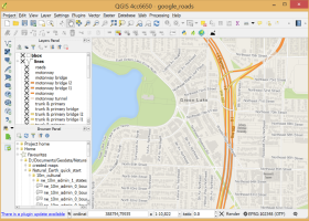
QGIS supports vector, raster, and database formats and lets you browse and create map data on your computer.QGIS supports many common spatial data formats (e.g. ESRI ShapeFile, geotiff). QGIS supports plugins to do things like display tracks from your GPS. QGIS aims to be an easy to use GIS, providing common functions and features. The initial goal was to provide a GIS data viewer. ...
type: Open Source
Download QGIScategories: geographic information system, map creator, map viewer, GIS, geographic information, create, QGIS Add to Download Basket Report virus or spyware |
 [ Zoom screenshot ] |
|
| Software Info | |
|
Best Vista Download periodically updates pricing and software information of QGIS full version from the publisher,
but some information may be out-of-date. You should confirm all information. Software piracy is theft, using crack, warez passwords, patches, serial numbers, registration codes, key generator, keymaker or keygen for QGIS license key is illegal and prevent future development of QGIS. Download links are directly from our mirrors or publisher's website, QGIS torrent files or shared files from rapidshare, yousendit or megaupload are not allowed! |
|
| Released: | March 26, 2024 |
| Filesize: | 1000.00 MB |
| Platform: | Windows XP, Windows Vista, Windows Vista x64, Windows 7, Windows 7 x64, Windows 8, Windows 8 x64, Windows 10, Windows 10 x64, Windows 11 |
| Install | Instal And Uninstall |
| Add Your Review or Windows Vista Compatibility Report |
QGIS- Releases History |
| Software: | QGIS 3.36.1 |
| Date Released: | Mar 26, 2024 |
| Status: | New Release |
| Software: | QGIS 3.36.2 |
| Date Released: | Apr 25, 2024 |
| Status: | New Release |
| Software: | QGIS 3.36.1 |
| Date Released: | Mar 26, 2024 |
| Status: | New Release |
Most popular vector library in CAD downloads for Vista |
|
TinyCAD 3.00.04 download by Tinycad.sourceforge.net
... a bitmap, the image is pasted as a vector graphic, making it higher quality for use in ... symbol. Although there is no formal Spice symbol library supplied with TinyCAD there are some examples of ...
type: Open Source
View Details
Download
categories: JPEG, PNG, BMP or EMF, geometry editor, Constructive, Geometry, Tiny CAD |
 |
|
Origin 10.5.70 download by OriginLab Corp.
... as windrose, stock (OHLC), ternary (including ternary-contour), 2D vector and 3D vector, and several statistical plots. Programming Origin includes ... with graph templates and organize templates using Template Library · Plot Setup dialog for quick plotting of ...
type: Trialware ($69.00)
View Details
Download
categories: Create Graph, Create Plot, Vector Analysis, Graph, Vector, Statistics |
 |
|
Multiwfn 3.7 download by sobereva
... plotting softwares are required: · A high-level graphical library DISLIN is invoked internally and automatically by Multiwfn ... contour map, relief map (with/without projection), gradient map, vector field map. · Outputting properties in a spatial ...
type: Open Source
View Details
Download
categories: wavefunction analysis, topology analysis, molecular structure, analysis, analize, wavefunction |
 |
|
SCaVis 2.3 download by Dr. Sergei Chekanov
... classes and methods are packed in 50 MB library pack (this excludes those from the native Java ... raster formats (PDF, PNG, JPG, etc.) and high-quality vector formats (PostScript, EPS) ready to be included into ...
type: Freeware
View Details
Download
categories: data-analysis framework, data manipulation, data plotting, analyze, analysis, analyzer |
 |
|
NetLogo 6.0.4 download by Uri Wilensky
... in either 2D and 3D Scalable and rotatable vector shapes Turtle and patch labels ...
type: Freeware
View Details
Download
categories: Analyze simple or complex social and natural phenomena |
 |
|
QGIS 3.36.1 download by Gary Sherman
... and Open Source Software (FOSS). QGIS supports vector, raster, and database formats and lets you browse ... needs. QGIS supports a number of raster and vector data formats, with new support easily added using ...
type: Open Source
View Details
Download
categories: geographic information system, map creator, map viewer, GIS, geographic information, create, QGIS |
 |
|
jHepWork 3.9 download by Dr. Sergei Chekanov
... classes and methods are packed in 50 MB library pack (this excludes those from the native Java ... raster formats (PDF, PNG, JPG, etc.) and high-quality vector formats (PostScript, EPS) ready to be included into ...
type: Freeware
View Details
Download
categories: data-analysis framework, data manipulation, data plotting, analyze, analysis, analyzer |
 |
|
Schematics Maker 8 download by EdrawSoft
... program and categorized into different libraries. Choose a library title to get the symbols you need. They are vector symbols that can be stretched or modified without ...
View Details
Download
|
 |