Related Keywords
vector layers downloadslayers downloads
vector graphics downloads
vector downloads
vector drawing downloads
vector conversion downloads
vector icons downloads
vector map downloads
vector based downloads
vector art downloads
vector graphic editor downloads
vector graphic downloads
vector editor downloads
vector icon downloads
vector ultima spell checker downloads
vector con downloads
vector images downloads
vector magic downloads
vector shapes downloads
vector edior downloads
Top Software Keywords
autocad downloadscad downloads
3d cad downloads
drawing downloads
import downloads
design downloads
dwg downloads
pdf to dwg downloads
dxf downloads
convert downloads
convert pdf to dwg downloads
dwg to pdf downloads
dxf to pdf downloads
converter downloads
pdf to dxf downloads
dwf to dwg downloads
dwg to dxf downloads
dwg converter downloads
dwg to jpg downloads
dwg to bmp downloads
stl downloads
dxf to pcl downloads
dwg to tiff downloads
intellicad downloads
pdf to cad downloads
dwg to gif downloads
convert dwg to pdf downloads
dwg to png downloads
dwg to dwf downloads
dxf to ps downloads
Vista Download
Vista downloadVista antivirus download
Vista wallpaper download
Vista wallpapers download
Vista themes download
Vista pack download
Vista ultimate download
Vista home download
Vista basic download
Vista business download
Vista x64 download
Vista transformation download
Vista transformation pack download
Vista boot download
Vista dvd download
Vista sidebar download
Vista aero download
Vista product key download
Downloads RSS
Top Downloads
Top Rated
Navigation: Home
\ Graphic Apps
\ CAD \ QGIS
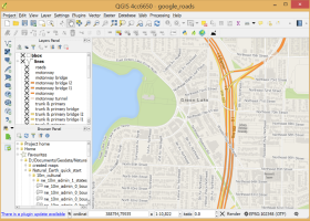
QGIS3.36.1 by Gary Sherman |

|
Software Description:
QGIS supports vector, raster, and database formats and lets you browse and create map data on your computer.QGIS supports many common spatial data formats (e.g. ESRI ShapeFile, geotiff). QGIS supports plugins to do things like display tracks from your GPS. QGIS aims to be an easy to use GIS, providing common functions and features. The initial goal was to provide a GIS data viewer. ...
type: Open Source
Download QGIScategories: geographic information system, map creator, map viewer, GIS, geographic information, create, QGIS Add to Download Basket Report virus or spyware |
 [ Zoom screenshot ] |
|
| Software Info | |
|
Best Vista Download periodically updates pricing and software information of QGIS full version from the publisher,
but some information may be out-of-date. You should confirm all information. Software piracy is theft, using crack, warez passwords, patches, serial numbers, registration codes, key generator, keymaker or keygen for QGIS license key is illegal and prevent future development of QGIS. Download links are directly from our mirrors or publisher's website, QGIS torrent files or shared files from rapidshare, yousendit or megaupload are not allowed! |
|
| Released: | March 26, 2024 |
| Filesize: | 1000.00 MB |
| Platform: | Windows XP, Windows Vista, Windows Vista x64, Windows 7, Windows 7 x64, Windows 8, Windows 8 x64, Windows 10, Windows 10 x64, Windows 11 |
| Install | Instal And Uninstall |
| Add Your Review or Windows Vista Compatibility Report |
QGIS- Releases History |
| Software: | QGIS 3.36.1 |
| Date Released: | Mar 26, 2024 |
| Status: | New Release |
| Software: | QGIS 3.36.2 |
| Date Released: | Apr 25, 2024 |
| Status: | New Release |
| Software: | QGIS 3.36.1 |
| Date Released: | Mar 26, 2024 |
| Status: | New Release |
Most popular vector layers in CAD downloads for Vista |
|
Home Plan Pro 5.8.2.1.5 download by Home Plan Software
... good-quality, straightforward designs. --Integrated on-line help --Multiple drawing layers --Built-in fax driver faxes your plans anywhere in ... when zoomed in --Save Drawing in bitmap or vector format --Optional, Adjustable Snap Grid --keep an Activity ...
type: Shareware ($39.00)
View Details
Download
categories: cad, floor plans, blueprint, blueprints, drafting, home plans, home design |
 |
|
R2V 3.66 download by MR Soft
... is a tool for converting raster images to vector by drawing centerlines and outlines. R2V converts architect, ... drawings, maps and other types from raster to vector format. A vector format can be imported into ...
type: Shareware ($42.00)
View Details
Download
categories: vector, r2v, vectorize, cnc, photo, engraving, bmp, hobby, carving, mill, cad, cam, stl, image, hpgl, dxf, raster, grayscale, conversion, g-code |
 |
|
Easy Plan Pro 1.1.36.1 download by Home Plan Software
... good-quality, straightforward designs. --Integrated on-line help --Multiple drawing layers --Metric or USA Measurements --Dozens of Fill Patterns ... when zoomed in --Save Drawing in bitmap or vector format --Optional, Adjustable Snap Grid --keep an Activity ...
type: Shareware ($29.00)
View Details
Download
categories: cad, floor plans, blueprint, blueprints, drafting, home plans, home design |
 |
|
Thuban for Windows 1.2.2 download by Thuban Development Team
... Data Viewer with the following features: # Vector Data Support: Shapefile, PostGIS Layer and OGR # ... and Joins # Projection Support # Printing and Vector Export # API for Add-Ons (Extensions) # Multi-Language ...
type: Open Source
View Details
Download
categories: geographic data viewer, gis viewer, analyze geographic information, information, geographic, viewer |
 |
|
BabaCAD 2.0.0 download by Mirza Coralic
... high precision Organize and group objects with layers and blocks Draw and modify 2D vector objects like point, line, rectangle, polyline with arc ...
View Details
Download
|
 |
|
JMARS for Windows 3.1.5 download by Arizona State University
... NASA orbiter data, and has basic image and vector processing features to conveniently compare, plot, and blend ... Contour maps may be created. * Groups of layers can be composed by transparency blending or building ...
type: Freeware
View Details
Download
categories: mission analysis, geospatial information, GIS analysis, mission, analysis, GIS |
 |
|
TNTmips 20240404 download by MicroImages, Inc.
... price without costly add-ons. Precisely overlay geodata layers in a variety of data types and a multitude of Coordinate Reference Systems. Include layers in a wide variety of external formats without ...
type: Freeware
View Details
Download
categories: GIS data analysis, analyze geodetic data, edit GIS dataset, GIS, dataset, editor, analysis |
 |
|
CARIS Easy View 4.2.13 download by CARIS
... of files. It allows you to load multiple layers, change their order and adjust object parameters. View ... Users can load multiple raster, point cloud and vector data sources, change the order in which they ...
View Details
Download
|
 |
|
QGIS 3.36.1 download by Gary Sherman
... and Open Source Software (FOSS). QGIS supports vector, raster, and database formats and lets you browse ... needs. QGIS supports a number of raster and vector data formats, with new support easily added using ...
type: Open Source
View Details
Download
categories: geographic information system, map creator, map viewer, GIS, geographic information, create, QGIS |
 |
|
Fluchtplan Creator 14 download by CADSoftTools
... blocks etc.). There are templates with drawing borders, layers etc. Moreover, you can not only draw plans ... print it. Fluchtplan Creator supports saving plans into vector formats (DWG, DXF, SVG, PLT etc.) and into ...
type: Shareware ($169.00)
View Details
Download
categories: Fluchtplan Creator, escape plan, escape and evacuation plan, German DIN ISO 23601, escape routes, Flucht- und Rettungsplan, Fluchtplan, Fluchtwegplan, Fluchtplan erstellen, Flucht- und Rettungsplan erstellen, ISO 7010, Brandschutzzeichen, Fluchtwege |
 |