Top Software Keywords
autocad downloads3d cad downloads
cad downloads
drawing downloads
import downloads
design downloads
dwg downloads
pdf to dwg downloads
convert pdf to dwg downloads
dxf downloads
convert downloads
dxf to pdf downloads
dwg to pdf downloads
converter downloads
pdf to dxf downloads
dwf to dwg downloads
dwg converter downloads
dwg to jpg downloads
dwg to dxf downloads
dwg to bmp downloads
stl downloads
dxf to pcl downloads
dwg to tiff downloads
intellicad downloads
pdf to cad downloads
dwg to gif downloads
convert dwg to pdf downloads
dwg to png downloads
dwg to dwf downloads
dxf to ps downloads
Vista Download
Vista downloadVista antivirus download
Vista wallpaper download
Vista wallpapers download
Vista themes download
Vista pack download
Vista ultimate download
Vista home download
Vista basic download
Vista business download
Vista x64 download
Vista transformation download
Vista transformation pack download
Vista boot download
Vista dvd download
Vista sidebar download
Vista aero download
Vista product key download
Downloads RSS
Top Downloads
Top Rated
Navigation: Home
\ Graphic Apps
\ CAD \ TRIANGULATION for AutoCAD
TRIANGULATION for AutoCAD2.3 by Rcad Software |

|
Software Description:
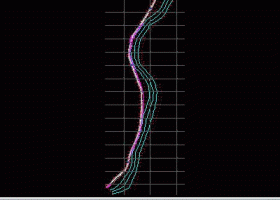
An add-on for AUTOCAD or BricsCAD, for the triangulation of a set of POINTS, isolines, DWG to Google Earth, the volume and center of gravity of a set of bodies or between surfaces composed of 3DFACE. You can load a file of points having the format: Number X Y Z Code. You can make cross sections, longitudinal profile and color-filled contour map. You can determine the flatness of the surfaces and you can import and export LandXML file type! ...
type: Shareware ($49.00)
Download TRIANGULATION for AutoCADcategories: AutoCAD Add-ons, Topography, KML creator, KML 3D, XYZ File, LandXML, Triangulation, Isolines, Color-filled contour map, Sections, Volume, surface flatness, BricsCAD add Add to Download Basket Report virus or spyware |
 [ Zoom screenshot ] |
|
| Software Info | |
|
Best Vista Download periodically updates pricing and software information of TRIANGULATION for AutoCAD full version from the publisher,
but some information may be out-of-date. You should confirm all information. Software piracy is theft, using crack, warez passwords, patches, serial numbers, registration codes, key generator, keymaker or keygen for TRIANGULATION for AutoCAD license key is illegal and prevent future development of TRIANGULATION for AutoCAD. Download links are directly from our mirrors or publisher's website, TRIANGULATION for AutoCAD torrent files or shared files from rapidshare, yousendit or megaupload are not allowed! |
|
| Released: | December 29, 2022 |
| Filesize: | 2.46 MB |
| Language: | English |
| Platform: | Win2000, Windows XP, Windows 7 x32, Windows 7 x64, Windows 8, Windows 10, WinServer, WinOther, Windows Vista, Windows Vista x64 |
| Requirements: | AUTOCAD version at least 2010 or BricsCAD at least V14 |
| Install | Install and Uninstall |
| Add Your Review or Windows Vista Compatibility Report |
TRIANGULATION for AutoCAD- Releases History |
| Software: | TRIANGULATION for AutoCAD 2.3 |
| Date Released: | Nov 15, 2022 |
| Status: | New Release |
| Release Notes: | It can be purchased with 3 months subscription. |
Most popular topography in CAD downloads for Vista |
|
TopoLT 15.2 download by CADWARE Engineering
... of over 25 years, TopoLT is the oldest topography application in Romania, created to help surveyors to ... cadastral works. TopoLT is a complete solution for topography and cadastre projects. FEATURES: · draws ...
type: Trialware ($600.00)
View Details
Download
categories: topographical plan, cadastral plan, terrain model, topography, cadaster, terrain |
 |
|
TRIANGULATION for IntelliCAD 3.9d download by Rcad Software
TRIANGULATION, ISOLINES, VOLUME, LOADING of XYZ points files, 3DINTERSECTION, cross sections and a longitudinal profile, color-filled contour map; 7 functions for IntelliCAD versions which can load SDS applications (dll). TRIANGULATION performs ...
type: Shareware ($29.00)
View Details
Download
categories: TRIANGULATION, ISOLINES, VOLUME, INTERSECTION, XYZ points files, IntelliCAD, TOPOGRAPHY, Software, SHAREWARE, XYZ POINTS, CROSS SECTIONS, LONGITUDINAL PROFILES, Surveying, CAD, DXF |
 |
|
RTOPO Hydrology 3.4 download by Rcad Software
Simple, powerful and inexpensive CAD software for surveying. You can do triangulation, isolines, color-filled contour maps, sections, intersections, volume and much more. You can process hundreds of thousands of points or ...
type: Shareware ($125.00)
View Details
Download
categories: CAD for Topography, XYZ File editor, hydrology, LandXML, Triangulation, Isolines, Cross sections, Longitudinal profile, Intersection of two triangulations, quartic triangular patches |
 |
|
MountainsMap Scanning Topography 6.2.6266 download by Digital Surf
MountainsMap Scanning Topography is a professional application designed to perform surface ... for 3D surface profilometers. With MountainsMap Scanning Topography, users will be able to easily analyze measurements ... surface texture parameters. FEATURES: MountainsMap® Scanning Topography is the best in class surface analysis solution ...
type: Trialware
View Details
Download
categories: surface profilometer, scanning opography, surface analysis, topography, profilometer, surface |
 |
|
JMARS for Windows 3.1.5 download by Arizona State University
... OMEGA instruments; mosaics from THEMIS, Viking, and CTX; topography from MOLA; compositional maps from TES and GRS/HEND; ... Lunar Orbiter imaging, Arecibo radar, and laser altimetry topography from Kaguya (Selene) and Lunar Reconnaissance Orbiter. ...
type: Freeware
View Details
Download
categories: mission analysis, geospatial information, GIS analysis, mission, analysis, GIS |
 |
|
FlashPoints 3.0 download by DeliCAD
FlashPoints is a tool for creating and managing points Groups (topographic points for example). FlashPoints allows you to : * import/export points coordinates from and to a file * create points ...
type: Demo ($70.00)
View Details
Download
categories: autocad, cad, dxf, xls, excel, gps, xyz, nxyz, points, import, cogo, survey, coordinates, gis, topography |
 |
|
GeoMapApp 3.7.1 download by William Haxby
GeoMapApp is a map-based application for browsing, visualizing and analyzing a diverse suite of curated global and regional geoscience data sets. These cover geophysics, geology, geochemistry, physical oceanography, climatology, and more. ...
type: Freeware
View Details
Download
categories: geological map, geologic exploration, explore map, explore, geologic, map |
 |
|
TRIANGULATION for AutoCAD 2.3 download by Rcad Software
An add-on for AUTOCAD or BricsCAD, which makes the triangulation of a set of POINT entities, the intersection curves (isolines) between a set of 3DFACE entities and a set of equidistance ...
type: Shareware ($49.00)
View Details
Download
categories: AutoCAD Add-ons, Topography, KML creator, KML 3D, XYZ File, LandXML, Triangulation, Isolines, Color-filled contour map, Sections, Volume, surface flatness, BricsCAD add |
 |