Related Keywords
topographic downloadsload topographic maps downloads
view topographic map downloads
create topographic map downloads
Top Software Keywords
autocad downloads3d cad downloads
cad downloads
drawing downloads
import downloads
design downloads
dwg downloads
pdf to dwg downloads
dxf downloads
convert downloads
convert pdf to dwg downloads
dwg to pdf downloads
dxf to pdf downloads
converter downloads
pdf to dxf downloads
dwf to dwg downloads
dwg converter downloads
dwg to dxf downloads
dwg to jpg downloads
dwg to bmp downloads
stl downloads
dxf to pcl downloads
dwg to tiff downloads
intellicad downloads
pdf to cad downloads
dwg to gif downloads
convert dwg to pdf downloads
dwg to png downloads
dwg to dwf downloads
dxf to ps downloads
Vista Download
Vista downloadVista antivirus download
Vista wallpaper download
Vista wallpapers download
Vista themes download
Vista pack download
Vista ultimate download
Vista home download
Vista basic download
Vista business download
Vista x64 download
Vista transformation download
Vista transformation pack download
Vista boot download
Vista dvd download
Vista sidebar download
Vista aero download
Vista product key download
Downloads RSS
Top Downloads
Top Rated
Navigation: Home
\ Graphic Apps
\ CAD \ TopoLT
TopoLT15.2 by CADWARE Engineering |

|
Software Description:
... and functionalities useful for all those who design topographical or cadastral plans in digital format, who develop 3D terrain models and contours, fill and cut volumes calculation, raster image georeferencing and automatic printing. 3D model of the terrain and contour lines can be generated, volumes can be calculated without any restrictions. ...
type: Trialware ($600.00)
Download TopoLTcategories: topographical plan, cadastral plan, terrain model, topography, cadaster, terrain Add to Download Basket Report virus or spyware |
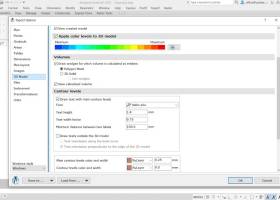 [ Zoom screenshot ] |
|
| Software Info | |
|
Best Vista Download periodically updates pricing and software information of TopoLT full version from the publisher,
but some information may be out-of-date. You should confirm all information. Software piracy is theft, using crack, warez passwords, patches, serial numbers, registration codes, key generator, keymaker or keygen for TopoLT license key is illegal and prevent future development of TopoLT. Download links are directly from our mirrors or publisher's website, TopoLT torrent files or shared files from rapidshare, yousendit or megaupload are not allowed! |
|
| Released: | October 16, 2023 |
| Filesize: | 67.80 MB |
| Platform: | Windows XP, Windows Vista, Windows Vista x64, Windows 7, Windows 7 x64, Windows 8, Windows 8 x64, Windows 10, Windows 10 x64, Windows 11 |
| Install | Instal And Uninstall |
| Add Your Review or Windows Vista Compatibility Report |
TopoLT- Releases History |
| Software: | TopoLT 15.2 |
| Date Released: | Oct 16, 2023 |
| Status: | New Release |
| Software: | TopoLT 15.1 |
| Date Released: | Mar 3, 2023 |
| Status: | New Release |
| Software: | TopoLT 14.0 |
| Date Released: | Feb 24, 2022 |
| Status: | New Release |
Most popular topographic in CAD downloads for Vista |
|
JMARS for Windows 3.1.5 download by Arizona State University
... into a single, registered multilayer image. * Make topographic profiles, extract surface temperatures (day or night), plot ... images from orbiters. * Correlate mineral compositions with topographic data. * Combine surface roughness data with thermal ...
type: Freeware
View Details
Download
categories: mission analysis, geospatial information, GIS analysis, mission, analysis, GIS |
 |
|
TopoLT 15.2 download by CADWARE Engineering
... and functionalities useful for all those who design topographical or cadastral plans in digital format, who develop ... platform and adding specific functions necessary to create topographical and cadastral plans in digital format. With ...
type: Trialware ($600.00)
View Details
Download
categories: topographical plan, cadastral plan, terrain model, topography, cadaster, terrain |
 |
|
FlashPoints 3.0 download by DeliCAD
FlashPoints is a tool for creating and managing points Groups (topographic points for example). FlashPoints allows you to : * import/export points coordinates from and to a file * create points ...
type: Demo ($70.00)
View Details
Download
categories: autocad, cad, dxf, xls, excel, gps, xyz, nxyz, points, import, cogo, survey, coordinates, gis, topography |
 |
|
Terra Excess 25.1217 download by Terra Excess Software
... AND LABELING CONTOUR LINES IN ORDER TO PRODUCE TOPOGRAPHIC PLANS AND MAPS: Terra Excess can generate contour lines from topographic survey data in a very simple way. All ... designing and implementing various construction projects or creating topographic plans and maps; CALCULATING ACCURATE VOLUMES OF STOCKPILES ...
type: Shareware ($298.00)
View Details
Download
categories: land surveying, civil engineering, topographic, contour lines, contour map, triangulated irregular network, earthworks, volumetric, volume calculation, cut and fill, volumes, estimating volumes, survey points, CAD, DXF, quarries, tin surface |
 |