Related Keywords
terrain downloadsterrain builder downloads
terrain for rhino downloads
terrain mesh downloads
terrain modeling downloads
terrain for autocad downloads
terrain generator downloads
terrain map downloads
terrain chapter 1 downloads
terrain chapter 2 downloads
terrain render downloads
terrain representation downloads
terrain calculation downloads
terrain model downloads
terrain analysis downloads
virtual terrain downloads
google maps terrain downloads
itu terrain downloads
digital terrain model downloads
3d terrain file viewer downloads
Top Software Keywords
autocad downloads3d cad downloads
cad downloads
drawing downloads
import downloads
design downloads
dwg downloads
pdf to dwg downloads
convert pdf to dwg downloads
dxf downloads
convert downloads
dxf to pdf downloads
dwg to pdf downloads
converter downloads
pdf to dxf downloads
dwf to dwg downloads
dwg converter downloads
dwg to jpg downloads
dwg to dxf downloads
dwg to bmp downloads
stl downloads
dxf to pcl downloads
dwg to tiff downloads
intellicad downloads
pdf to cad downloads
dwg to gif downloads
convert dwg to pdf downloads
dwg to png downloads
dwg to dwf downloads
dxf to ps downloads
Vista Download
Vista downloadVista antivirus download
Vista wallpaper download
Vista wallpapers download
Vista themes download
Vista pack download
Vista ultimate download
Vista home download
Vista basic download
Vista business download
Vista x64 download
Vista transformation download
Vista transformation pack download
Vista boot download
Vista dvd download
Vista sidebar download
Vista aero download
Vista product key download
Downloads RSS
Top Downloads
Top Rated
Navigation: Home
\ Graphic Apps
\ CAD \ InnerSoft CAD for AutoCAD 2015
InnerSoft CAD for AutoCAD 20154.0 by InnerSoft |

|
Software Description:
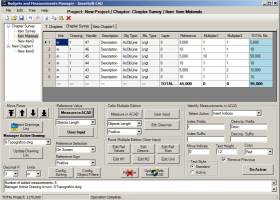
... individual files, Draw the longitudinal profile of a terrain. Triangulate a set of points or mesh a model surface, Draw the longitudinal profile of a terrain.... ...
type: Demo ($60.00)
Download InnerSoft CAD for AutoCAD 2015categories: autocad, excel, import, export, measurements, Civil and Survey, Counting, Estimating, construction project budgets Add to Download Basket Report virus or spyware |
 [ Zoom screenshot ] |
|
| Software Info | |
|
Best Vista Download periodically updates pricing and software information of InnerSoft CAD for AutoCAD 2015 full version from the publisher,
but some information may be out-of-date. You should confirm all information. Software piracy is theft, using crack, warez passwords, patches, serial numbers, registration codes, key generator, keymaker or keygen for InnerSoft CAD for AutoCAD 2015 license key is illegal and prevent future development of InnerSoft CAD for AutoCAD 2015. Download links are directly from our mirrors or publisher's website, InnerSoft CAD for AutoCAD 2015 torrent files or shared files from rapidshare, yousendit or megaupload are not allowed! |
|
| Released: | March 14, 2014 |
| Filesize: | 10.27 MB |
| Language: | English, Spanish |
| Platform: | Win2000, Windows XP, Windows 7 x32, Windows 7 x64, Windows 8, Windows 10, WinServer, WinOther, Windows Vista, Windows Vista x64 |
| Requirements: | 10 MB Available Hard-Disk Space. AutoCAD 2015 Installed. |
| Install | Install and Uninstall |
| Add Your Review or Windows Vista Compatibility Report |
InnerSoft CAD for AutoCAD 2015- Releases History |
| Software: | InnerSoft CAD for AutoCAD 2015 4.0 |
| Date Released: | Mar 14, 2014 |
| Status: | New Release |
| Release Notes: | New tool to draw a catenary in AutoCAD. Catenaries added to Geometric Tools. |
Most popular terrain in CAD downloads for Vista |
|
TopoLT 15.2 download by CADWARE Engineering
... cadastral plans in digital format, who develop 3D terrain models and contours, fill and cut volumes calculation, ... for station points; · 3D model of the terrain and contour lines can be generated, volumes can ...
type: Trialware ($600.00)
View Details
Download
categories: topographical plan, cadastral plan, terrain model, topography, cadaster, terrain |
 |
|
ExpertGPS 8.64 download by TopoGrafix
... Excel and popular mapping programs like Topo! and Terrain Navigator. ExpertGPS connects your GPS to the best mapping and information sites on the Internet, giving you one-click access to ...
View Details
Download
|
 |
|
ProfLT 16.0 download by CADWARE Engineering
... offers functionalities for configuring, drawing and modifying longitudinal terrain profiles and cross sections.The author of TopoLT is 3D Space architecture office, which has a rich experience in office buildings and ...
type: Trialware ($300.00)
View Details
Download
categories: AutoCAD tool, draw longitudinal profile, cross profiles, AutoCAD, Draw, Profile |
 |
|
IrriPro 3.1 download by Irriworks
... (such as outlets, pipes, etc) and of a terrain, not only as edge and nodes, but as objects containing hydraulic characteristics, geometries, materials and GIS informations obtained by Google Earth. ...
View Details
Download
|
 |
|
LanDTM 6.1 download by Aplicaciones Topográficas S.L.
... break-lines to get a real representation of the terrain. The first version of this program came onto the market in 1992 and there are more of 3000 professionals ...
type: Freeware
View Details
Download
categories: Delaunay triangulation, Terrain Representation, CAD addon, Delaunay triangulation, Calculate, Terrain |
 |
|
Virtual Terrain Project for Windows 1.1 110804 download by Ben Discoe
The goal of VTP is to foster the creation of tools for easily constructing any part of the real world in interactive, 3D digital form. This goal will require a ...
type: Open Source
View Details
Download
categories: libraries, demos, data, open source, VirtualTerrain Project, CAD, GIS, VTP |
 |
|
TriSpace 2021.24.3.652 download by GEOSTRU
Trispace resolves the requirement to effect three dimensional terrain studies through the generation of: digital elevation plans, contoured elevation plans, dynamic sections, three dimensional views, distances or areas and volume ...
type: Trialware ($500.00)
View Details
Download
categories: Terrain Calculation, 3D Terrain Viewer, View 3D Surface, Calculation, Terrain, Surface |
 |
|
InnerSoft CAD for AutoCAD 2014 3.8 download by InnerSoft CAD
... the drawing; Draw the longitudinal profile of a terrain or set of surfaces. Triangulate a set of points or mesh a model surface; Take measurements on AutoCAD for construction project ...
type: Demo ($60.00)
View Details
Download
categories: autocad, excel, import, export, measurements, Civil and Survey, Counting, Estimating, construction project budgets |
 |
|
TNTmips 20240404 download by MicroImages, Inc.
... virtually any type of geospatial data including imagery, terrain surfaces, and map data with associated database attributes. ... data. Construct and transform representations of natural terrains and mathematical surfaces from 3D information. Fast and ...
type: Freeware
View Details
Download
categories: GIS data analysis, analyze geodetic data, edit GIS dataset, GIS, dataset, editor, analysis |
 |
|
InnerSoft CAD for AutoCAD 2014 3.8 download by InnerSoft
... the drawing; Draw the longitudinal profile of a terrain or set of surfaces. Triangulate a set of points or mesh a model surface; Take measurements on AutoCAD for construction project ...
type: Demo ($60.00)
View Details
Download
categories: autocad, excel, import, export, measurements, Civil and Survey, Counting, Estimating, construction project budgets |
 |