Related Keywords
systems utility tool downloadssystems utility downloads
utility tool downloads
admin utility tool downloads
windows backup utility tool downloads
exchange recovery utility tool downloads
systems downloads
systems management downloads
systems smart audio burner downloads
systems theory software downloads
systems setting downloads
systems monitor downloads
systems administrator downloads
systems icon downloads
systems icons downloads
systems administration downloads
systems of partial differential equations downloads
tool ie tool downloads
tool fix mdf tool downloads
utility downloads
Top Software Keywords
autocad downloadscad downloads
3d cad downloads
drawing downloads
import downloads
design downloads
dwg downloads
pdf to dwg downloads
dxf downloads
convert downloads
convert pdf to dwg downloads
dwg to pdf downloads
dxf to pdf downloads
converter downloads
pdf to dxf downloads
dwf to dwg downloads
dwg to dxf downloads
dwg converter downloads
dwg to jpg downloads
dwg to bmp downloads
stl downloads
dxf to pcl downloads
dwg to tiff downloads
intellicad downloads
pdf to cad downloads
dwg to gif downloads
convert dwg to pdf downloads
dwg to png downloads
dwg to dwf downloads
dxf to ps downloads
Vista Download
Vista downloadVista antivirus download
Vista wallpaper download
Vista wallpapers download
Vista themes download
Vista pack download
Vista ultimate download
Vista home download
Vista basic download
Vista business download
Vista x64 download
Vista transformation download
Vista transformation pack download
Vista boot download
Vista dvd download
Vista sidebar download
Vista aero download
Vista product key download
Downloads RSS
Top Downloads
Top Rated
Navigation: Home
\ Graphic Apps
\ CAD \ wxGIS
wxGIS0.2.0 by Dmitry Barishnikov |

|
Software Description:
... that is able to store the geographic coordinate systems in folders. It also includes a vector file export utility and a tool for correcting the orthographic data from raster TIFF files. ...
type: Open Source
Download wxGIScategories: GIS catalog, manage geography data, geographic coordinate system, manage, catalog, geography Add to Download Basket Report virus or spyware |
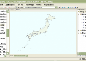 [ Zoom screenshot ] |
|
| Software Info | |
|
Best Vista Download periodically updates pricing and software information of wxGIS full version from the publisher,
but some information may be out-of-date. You should confirm all information. Software piracy is theft, using crack, warez passwords, patches, serial numbers, registration codes, key generator, keymaker or keygen for wxGIS license key is illegal and prevent future development of wxGIS. Download links are directly from our mirrors or publisher's website, wxGIS torrent files or shared files from rapidshare, yousendit or megaupload are not allowed! |
|
| Released: | November 15, 2012 |
| Filesize: | 9.70 MB |
| Platform: | Windows XP, Windows Vista, Windows Vista x64, Windows 7, Windows 7 x64 |
| Install | Instal And Uninstall |
| Add Your Review or Windows Vista Compatibility Report |
wxGIS- Releases History |
| Software: | wxGIS 0.2.0 |
| Date Released: | Nov 15, 2012 |
| Status: | New Release |
| Release Notes: | · The DEM interpolation switch (bilinear or cubic) in orthocorrect tool · Russian interface translation · Rename item support · Automatic rename output files in batch export · The ortho-correction tool become more accurate and speedy |
Most popular systems utility tool in CAD downloads for Vista |
|
wxGIS 0.2.0 download by Dmitry Barishnikov
... that is able to store the geographic coordinate systems in folders. It also includes a vector file export utility and a tool for correcting the orthographic data from raster TIFF
type: Open Source
View Details
Download
categories: GIS catalog, manage geography data, geographic coordinate system, manage, catalog, geography |
 |
|
wxGIS Portable 0.4.1 download by Dmitry Barishnikov
... that is able to store the geographic coordinate systems in folders. It also includes a vector file export utility and a tool for correcting the orthographic data from raster TIFF
type: Open Source
View Details
Download
categories: GIS catalog, manage geography data, geographic coordinate system, manage, catalog, geography |
 |
|
Fun3D 1.0.4.15 Beta download by Bojan Mitrovic
... Fun3D is an advanced stand alone 3D visualization tool. Features: 2D Export (JPG, PNG) 3D Export (JavaView - jvx, DXF, 3DM) Video Export (AVI) Animation 3D Surfaces 3D ...
type: Open Source
View Details
Download
categories: 3D function editor, function inspector, 3D curve, 3D function, function, curve |
 |
|
Fun3D Portable 1.0.4.15 Beta download by Bojan Mitrovic
... Fun3D is an advanced stand alone 3D visualization tool. Features: 2D Export (JPG, PNG) 3D Export (JavaView - jvx, DXF, 3DM) Video Export (AVI) Animation 3D Surfaces 3D ...
type: Open Source
View Details
Download
categories: 3D function editor, function inspector, 3D curve, 3D function, function, curve |
 |