Related Keywords
surveying downloadssurveying software downloads
surveying calculator downloads
surveying calculation software downloads
bulding surveying downloads
engineering surveying software downloads
land surveying downloads
Top Software Keywords
autocad downloads3d cad downloads
cad downloads
drawing downloads
import downloads
design downloads
dwg downloads
pdf to dwg downloads
dxf downloads
convert pdf to dwg downloads
convert downloads
dxf to pdf downloads
dwg to pdf downloads
converter downloads
pdf to dxf downloads
dwf to dwg downloads
dwg converter downloads
dwg to jpg downloads
dwg to dxf downloads
dwg to bmp downloads
stl downloads
dxf to pcl downloads
dwg to tiff downloads
intellicad downloads
pdf to cad downloads
dwg to gif downloads
convert dwg to pdf downloads
dwg to png downloads
dwg to dwf downloads
dxf to ps downloads
Vista Download
Vista downloadVista antivirus download
Vista wallpaper download
Vista wallpapers download
Vista themes download
Vista pack download
Vista ultimate download
Vista home download
Vista basic download
Vista business download
Vista x64 download
Vista transformation download
Vista transformation pack download
Vista boot download
Vista dvd download
Vista sidebar download
Vista aero download
Vista product key download
Downloads RSS
Top Downloads
Top Rated
Navigation: Home
\ Graphic Apps
\ CAD \ LanDTM
LanDTM6.1 by Aplicaciones Topográficas S.L. |

|
Software Description:
There is not any professional program on internet like this and you can get it without any effort. I think this could be a handicap because it's dificult to believe, but it's true; try it and you'll be surprised. It's not only a program to calculate a delaunay triangulation but you can input break-lines to get a real representation of the terrain. ...
type: Freeware
Download LanDTMcategories: Delaunay triangulation, Terrain Representation, CAD addon, Delaunay triangulation, Calculate, Terrain Add to Download Basket Report virus or spyware |
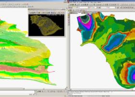 [ Zoom screenshot ] |
|
| Software Info | |
|
Best Vista Download periodically updates pricing and software information of LanDTM full version from the publisher,
but some information may be out-of-date. You should confirm all information. Software piracy is theft, using crack, warez passwords, patches, serial numbers, registration codes, key generator, keymaker or keygen for LanDTM license key is illegal and prevent future development of LanDTM. Download links are directly from our mirrors or publisher's website, LanDTM torrent files or shared files from rapidshare, yousendit or megaupload are not allowed! |
|
| Released: | April 23, 2017 |
| Filesize: | 58.80 MB |
| Platform: | Windows XP, Windows Vista, Windows Vista x64, Windows 7, Windows 7 x64, Windows 8, Windows 8 x64, Windows 10, Windows 10 x64 |
| Install | Instal And Uninstall |
| Add Your Review or Windows Vista Compatibility Report |
LanDTM- Releases History |
| Software: | LanDTM 6.1 |
| Date Released: | Apr 23, 2017 |
| Status: | New Release |
| Software: | LanDTM 6.1.6 |
| Date Released: | Feb 16, 2012 |
| Status: | New Release |
| Release Notes: | · New installers of the program to 32 and 64 bits platforms. · LanDTM on BricsCAD v12. · LanDTM on Autocad 2012. · Separator/discriminator of points. · Compatibility with "gsf" grid files REDNAP of Geoid ondulation. · Elevation modification of PPuntos. · Importation/exportationn of Points to PPuntos. · Compatibility between formats. Trimble M3, GPS Trimble, GSI of Stonex. |
| Software: | LanDTM 6.1.5 |
| Date Released: | Oct 5, 2011 |
| Status: | New Release |
| Release Notes: | · You can digitalize lines and points in Google Earth and export them to the CAD. It Works in BricsCAD v11. |
Most popular surveying in CAD downloads for Vista |
|
Terra Excess 25.1217 download by Terra Excess Software
Terra Excess is land surveying and civil engineering CAD software developed to be extremely intuitive. Even by those without previous experience, Terra Excess will allow you to handle the following ...
type: Shareware ($298.00)
View Details
Download
categories: land surveying, civil engineering, topographic, contour lines, contour map, triangulated irregular network, earthworks, volumetric, volume calculation, cut and fill, volumes, estimating volumes, survey points, CAD, DXF, quarries, tin surface |
 |
|
LanDTM 6.1 download by Aplicaciones Topográficas S.L.
... "Protopo" libraries, (a famous spanish engineering civil and surveying program), and I've built this program. And the best feature is that you can edit and draw triangulation lines, as ...
type: Freeware
View Details
Download
categories: Delaunay triangulation, Terrain Representation, CAD addon, Delaunay triangulation, Calculate, Terrain |
 |
|
Virtual Terrain Project for Windows 1.1 110804 download by Ben Discoe
... of the fields of CAD, GIS, visual simulation, surveying and remote sensing. VTP gathers information and tracks progress in areas such as procedural scene construction, feature extraction, and rendering algorithms. ...
type: Open Source
View Details
Download
categories: libraries, demos, data, open source, VirtualTerrain Project, CAD, GIS, VTP |
 |