Related Keywords
spatial analysis downloadsspatial analysis component downloads
spatial analysis library downloads
spatial network analysis downloads
spatial downloads
spatial skills downloads
spatial index downloads
spatial database engine downloads
spatial database downloads
spatial frequency response downloads
spatial domain downloads
spatial puzzles downloads
spatial simulation downloads
spatial resolution downloads
spatial data editor downloads
spatial data downloads
spatial data viewer downloads
spatial thinking downloads
spatial intelligence downloads
spatial reverb downloads
Top Software Keywords
autocad downloadscad downloads
3d cad downloads
drawing downloads
import downloads
design downloads
dwg downloads
pdf to dwg downloads
dxf downloads
convert downloads
convert pdf to dwg downloads
dwg to pdf downloads
dxf to pdf downloads
converter downloads
pdf to dxf downloads
dwf to dwg downloads
dwg to dxf downloads
dwg converter downloads
dwg to jpg downloads
dwg to bmp downloads
stl downloads
dxf to pcl downloads
dwg to tiff downloads
intellicad downloads
pdf to cad downloads
dwg to gif downloads
convert dwg to pdf downloads
dwg to png downloads
dwg to dwf downloads
dxf to ps downloads
Vista Download
Vista downloadVista antivirus download
Vista wallpaper download
Vista wallpapers download
Vista themes download
Vista pack download
Vista ultimate download
Vista home download
Vista basic download
Vista business download
Vista x64 download
Vista transformation download
Vista transformation pack download
Vista boot download
Vista dvd download
Vista sidebar download
Vista aero download
Vista product key download
Downloads RSS
Top Downloads
Top Rated
Navigation: Home
\ Graphic Apps
\ CAD \ QGIS
QGIS3.36.1 by Gary Sherman |

|
Software Description:
... on your computer.QGIS supports many common spatial data formats (e.g. ESRI ShapeFile, geotiff). QGIS supports plugins to do things like display tracks from your GPS. QGIS aims to be an easy to use GIS, providing common functions and features. The initial goal was to provide a GIS data viewer. ...
type: Open Source
Download QGIScategories: geographic information system, map creator, map viewer, GIS, geographic information, create, QGIS Add to Download Basket Report virus or spyware |
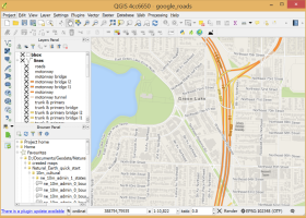 [ Zoom screenshot ] |
|
| Software Info | |
|
Best Vista Download periodically updates pricing and software information of QGIS full version from the publisher,
but some information may be out-of-date. You should confirm all information. Software piracy is theft, using crack, warez passwords, patches, serial numbers, registration codes, key generator, keymaker or keygen for QGIS license key is illegal and prevent future development of QGIS. Download links are directly from our mirrors or publisher's website, QGIS torrent files or shared files from rapidshare, yousendit or megaupload are not allowed! |
|
| Released: | March 26, 2024 |
| Filesize: | 1000.00 MB |
| Platform: | Windows XP, Windows Vista, Windows Vista x64, Windows 7, Windows 7 x64, Windows 8, Windows 8 x64, Windows 10, Windows 10 x64, Windows 11 |
| Install | Instal And Uninstall |
| Add Your Review or Windows Vista Compatibility Report |
QGIS- Releases History |
| Software: | QGIS 3.36.1 |
| Date Released: | Mar 26, 2024 |
| Status: | New Release |
| Software: | QGIS 3.36.2 |
| Date Released: | Apr 25, 2024 |
| Status: | New Release |
| Software: | QGIS 3.36.1 |
| Date Released: | Mar 26, 2024 |
| Status: | New Release |
Most popular spatial analysis in CAD downloads for Vista |
|
Amira 2019.2 download by Visage Imaging, Inc.
... Vector fields · Tensors · Filament tracing · Spatial grids · Molecular visualization Analyze: · Measurement tools · Tissue statistics · Co-localization analysis · Arithmetic operations · Densitometry · Molecular analysis ...
type: Trialware
View Details
Download
categories: 3D visualization platform, medical data viewer, Life Science visualizer, 3D visualization, Life Science, medical data |
 |
|
UCL Depthmap 0.8.0 download by University College London
... single software platform to perform a set of spatial network analyses designed to understand social processes within ... example, intervisibility or overlap) and then perform graph analysis of the resulting network. The objective of the ...
type: Open Source
View Details
Download
categories: urban environment, urban map, spatial network analysis, environment, map, analysis |
 |
|
Multiwfn 3.7 download by sobereva
... an interactive interface. Thus the procedure of wavefunction analysis is remarkably simplified, especially for studying distribution of ... vector field map. · Outputting properties in a spatial scope, data can be exported to Gaussian-type grid ...
type: Open Source
View Details
Download
categories: wavefunction analysis, topology analysis, molecular structure, analysis, analize, wavefunction |
 |
|
ANTz 2019-03-18 download by Shane Saxon
... it as 'spreadsheet meets cyberspace.' An immersive multi-dimensional spatially based environment for realtime analysis and decision making. Capable of combining stored ... such as geometry, transparency, velocity and position. Spatial cues based on shape, color, size and texture ...
type: Freeware
View Details
Download
categories: 3D viewer, complex system viewer, view complex system, viewer, complex system, view |
 |
|
TNTmips 20240404 download by MicroImages, Inc.
... JPEG2000, PNG, MrSID, ECW, shapefile, File Geodatabase, Oracle Spatial, DGN, TAB, DXF, DWG ... Full-featured GIS that integrates imagery along with geometric data including vector, CAD, shape, pinmap, and ...
type: Freeware
View Details
Download
categories: GIS data analysis, analyze geodetic data, edit GIS dataset, GIS, dataset, editor, analysis |
 |
|
CARIS Easy View 4.2.13 download by CARIS
... a simple application that enables you to view spatial data imported from numerous types of files. It ... their order and adjust object parameters. View your spatial data using the free CARIS viewer. CARIS Easy ...
View Details
Download
|
 |
|
QGIS 3.36.1 download by Gary Sherman
... on your computer. QGIS supports many common spatial data formats (e.g. ESRI ShapeFile, geotiff). QGIS supports ... key features of "QGIS": · Support for spatially enabled PostgreSQL tables using PostGIS · Support for ...
type: Open Source
View Details
Download
categories: geographic information system, map creator, map viewer, GIS, geographic information, create, QGIS |
 |