Top Software Keywords
autocad downloadscad downloads
3d cad downloads
drawing downloads
import downloads
design downloads
dwg downloads
pdf to dwg downloads
dxf downloads
convert downloads
convert pdf to dwg downloads
dwg to pdf downloads
converter downloads
dxf to pdf downloads
pdf to dxf downloads
dwf to dwg downloads
dwg to dxf downloads
dwg converter downloads
dwg to jpg downloads
dwg to bmp downloads
stl downloads
dxf to pcl downloads
dwg to tiff downloads
intellicad downloads
pdf to cad downloads
dwg to gif downloads
convert dwg to pdf downloads
dwg to png downloads
dwg to dwf downloads
dxf to ps downloads
Vista Download
Vista downloadVista antivirus download
Vista wallpaper download
Vista wallpapers download
Vista themes download
Vista pack download
Vista ultimate download
Vista home download
Vista basic download
Vista business download
Vista x64 download
Vista transformation download
Vista transformation pack download
Vista boot download
Vista dvd download
Vista sidebar download
Vista aero download
Vista product key download
Downloads RSS
Top Downloads
Top Rated
Navigation: Home
\ Graphic Apps
\ CAD \ Virtual Terrain Project for Windows
Virtual Terrain Project for Windows1.1 110804 by Ben Discoe |

|
Software Description:
... digital form.This goal will require a synergetic convergence of the fields of CAD, GIS, visual simulation, surveying and remote sensing. VTP gathers information and tracks progress in areas such as procedural scene construction, feature extraction, and rendering algorithms. ...
type: Open Source
Download Virtual Terrain Project for Windowscategories: libraries, demos, data, open source, VirtualTerrain Project, CAD, GIS, VTP Add to Download Basket Report virus or spyware |
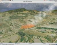 [ Zoom screenshot ] |
|
| Software Info | |
|
Best Vista Download periodically updates pricing and software information of Virtual Terrain Project for Windows full version from the publisher,
but some information may be out-of-date. You should confirm all information. Software piracy is theft, using crack, warez passwords, patches, serial numbers, registration codes, key generator, keymaker or keygen for Virtual Terrain Project for Windows license key is illegal and prevent future development of Virtual Terrain Project for Windows. Download links are directly from our mirrors or publisher's website, Virtual Terrain Project for Windows torrent files or shared files from rapidshare, yousendit or megaupload are not allowed! |
|
| Released: | September 08, 2011 |
| Filesize: | 1.00 MB |
| Platform: | Windows 2000, Windows 2003, Windows XP, Windows Vista |
| Install | Instal And Uninstall |
| Add Your Review or Windows Vista Compatibility Report |
Virtual Terrain Project for Windows- Releases History |
| Software: | Virtual Terrain Project for Windows 1.1 110804 |
| Date Released: | Sep 8, 2011 |
| Status: | New Release |
| Release Notes: | Enviro: Exposed support for more stereo modes: Horizontal and Vertical split. Options to enable joystick and spacenavigator, rather than just always using them if present. Smooth continuous update when making buildings. Option to constrain building point to right angles. Deter user from making bad points. Made support for Collada (.dae) more explicit in the UI. Display the version number in the startup dialog. Added 'every N meters' option to Contour dialog, making it significantly more useful. Changed 'Move' mode to use Alt modifier key for up/down, to be consistent. Fixed issues with: support for elevation grids with non-unit vertical scale; removing layers from a terrain; saving snapshot and high-resolution snapshot; buildings with a Geographic CRS; draping of 2D polylines on terrain with vertical exaggeration. VTBuilder: Raw layers: Draw polygon holes as dotted lines to tell them from outer edges. |
Most popular require in CAD downloads for Vista |
|
MagicPlot Viewer 2.0 download by MagicPlot.com
... Fullscreen mode Only 2 MB and does not require installation ...
View Details
Download
|
 |
|
Virtual Terrain Project for Windows 1.1 110804 download by Ben Discoe
... interactive, 3D digital form. This goal will require a synergetic convergence of the fields of CAD, GIS, visual simulation, surveying and remote sensing. VTP gathers information and tracks progress ...
type: Open Source
View Details
Download
categories: libraries, demos, data, open source, VirtualTerrain Project, CAD, GIS, VTP |
 |
|
enCIFer 1.4 download by Cambridge Crystallographic Data Centre
... Union of Crystallography (IUCr) and most major journals require electronic data depositions in CIF format. enCIFer enables users to validate CIFs and ensure their files are format-compliant for deposition ...
View Details
Download
|
 |
|
Maxsurf 17.07 download by Bentley Systems
... hull shape changes with dynamic updating · Match required hull parameters using parametric transformation · Extract key ... tables of offsets. Data exchange is a key requirement in the modern design office and Maxsurf supports ...
View Details
Download
|
 |
|
PowerStar 5.22 download by Megasys Software
PowerStar Electrical was designed for use with most electrical engineering design and analysis applications. Use it for commercial building services, industrial plants, distribution systems, power factor correction. Any project where you ...
type: Trialware ($160.00)
View Details
Download
categories: Electrical Design, Voltage Analysis, Analyze Voltage, Design, Voltage, Circuit |
 |
|
Aqsis Renderer for Windows 1.8.2 download by Aqsis Team
... of the rendering pipeline, in any way they require, providing much more flexibility and control than more ... perfectly smooth silhouette edge. Some other renderers would require, for instance NURBS geometry to be polygonised before ...
type: Freeware
View Details
Download
categories: 3D render solution, programmable shade, true displacement, render, renderer, shade, aqsis, aqsis rendererhttp://pads.websys.sk/pads.php?action=edit_pad&pID=3997 |
 |
|
Maxsurf 17.07 download by Bentley Systems
... hull shape changes with dynamic updating · Match required hull parameters using parametric transformation · Extract key ... tables of offsets. Data exchange is a key requirement in the modern design office and Maxsurf supports ...
View Details
Download
|
|
|
McCad Schematics 3.8.20 download by McCAD
... process differs from many other CAE systems that require the user to first create the complete schematic and then use post-processing utilities to describe the circuit. As a result, McCAD ...
type: Shareware ($295.00)
View Details
Download
categories: create circuit schematic, electronic circuit schematic, schematic designer, schematic, designer, circuit |
 |
|
Pulsonix 11.0 download by WestDev Ltd.
... node-locked or fully network floating options as you require. Flexible and versatile, Pulsonix can be expanded as your needs grow. Node locked gives you a single system whereas the ...
type: Trialware
View Details
Download
categories: PCB creator, design circuit board, PCB schematic capture, circuit board, create, design |
 |
|
Fluchtplan Creator 14 download by CADSoftTools
... from the former standard DIN 4844-3 too if required. This software has a multifunctional editor that includes ... Fluchtplan Creator is a standalone software that doesnt require installation of any other CAD applications. The program ...
type: Shareware ($169.00)
View Details
Download
categories: Fluchtplan Creator, escape plan, escape and evacuation plan, German DIN ISO 23601, escape routes, Flucht- und Rettungsplan, Fluchtplan, Fluchtwegplan, Fluchtplan erstellen, Flucht- und Rettungsplan erstellen, ISO 7010, Brandschutzzeichen, Fluchtwege |
 |