Related Keywords
map viewer downloadsmap downloads
map drive downloads
map component downloads
map engine downloads
map network drive downloads
map serial port downloads
map files downloads
map open ports to process downloads
map point downloads
map middle earth downloads
map software downloads
map maker downloads
map editor downloads
map plot points downloads
map creator downloads
map plus personal media downloads
map plus downloads
map folder downloads
map programs downloads
Top Software Keywords
autocad downloadscad downloads
3d cad downloads
drawing downloads
import downloads
design downloads
dwg downloads
pdf to dwg downloads
dxf downloads
convert downloads
convert pdf to dwg downloads
dwg to pdf downloads
dxf to pdf downloads
converter downloads
pdf to dxf downloads
dwf to dwg downloads
dwg to dxf downloads
dwg converter downloads
dwg to jpg downloads
dwg to bmp downloads
stl downloads
dxf to pcl downloads
dwg to tiff downloads
intellicad downloads
pdf to cad downloads
dwg to gif downloads
convert dwg to pdf downloads
dwg to png downloads
dwg to dwf downloads
dxf to ps downloads
Vista Download
Vista downloadVista antivirus download
Vista wallpaper download
Vista wallpapers download
Vista themes download
Vista pack download
Vista ultimate download
Vista home download
Vista basic download
Vista business download
Vista x64 download
Vista transformation download
Vista transformation pack download
Vista boot download
Vista dvd download
Vista sidebar download
Vista aero download
Vista product key download
Downloads RSS
Top Downloads
Top Rated
Navigation: Home
\ Graphic Apps
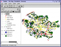
\ CAD \ Thuban for Windows
Thuban for Windows1.2.2 by Thuban Development Team |

|
Software Description:
Thuban is an Interactive Geographic Data Viewer with the following features:# ... Support: GeoTIFF Layer and GDAL # Comfortable Map Navigation # Object Identification and Annotation # Legend Editor and Classification # Table Queries and Joins # Projection Support # Printing and Vector Export # API for Add-Ons (Extensions) ...
type: Open Source
Download Thuban for Windowscategories: geographic data viewer, gis viewer, analyze geographic information, information, geographic, viewer Add to Download Basket Report virus or spyware |
 [ Zoom screenshot ] |
|
| Software Info | |
|
Best Vista Download periodically updates pricing and software information of Thuban for Windows full version from the publisher,
but some information may be out-of-date. You should confirm all information. Software piracy is theft, using crack, warez passwords, patches, serial numbers, registration codes, key generator, keymaker or keygen for Thuban for Windows license key is illegal and prevent future development of Thuban for Windows. Download links are directly from our mirrors or publisher's website, Thuban for Windows torrent files or shared files from rapidshare, yousendit or megaupload are not allowed! |
|
| Released: | August 18, 2009 |
| Filesize: | 11.22 MB |
| Language: | English, French, German, Hungarian, Italian, Russian, Czech and Spanish |
| Platform: | Windows 2000, Windows 2003, Windows XP, Windows Vista |
| Install | Instal And Uninstall |
| Add Your Review or Windows Vista Compatibility Report |
Thuban for Windows- Releases History |
| Software: | Thuban for Windows 1.2.2 |
| Date Released: | Aug 18, 2009 |
| Status: | New Release |
Most popular map viewer in CAD downloads for Vista |
|
CueMol 2.2.3.442 download by BKR Laboratory
... format), MSMS surface data, and GRASP electrostatic potential map. ...
type: Freeware
View Details
Download
categories: view macromolecular structure, macromolecular structure visualization, visualize macromolecular structure, viewer, view, visualize |
 |
|
DX Central 2.20 download by AD5XJ KEN
... different views of the sun · Doppler MDI map of the sun's far side · D-Region X-Ray absorption map from NOAA SWPC · Updates automatically every 10 ...
View Details
Download
|
 |
|
Thuban for Windows 1.2.2 download by Thuban Development Team
Thuban is an interactive geographic data viewer (GIS viewer) which features methods to visualize, explore, and analyze ... information. Thuban is an Interactive Geographic Data Viewer with the following features: # Vector Data ...
type: Open Source
View Details
Download
categories: geographic data viewer, gis viewer, analyze geographic information, information, geographic, viewer |
 |
|
TNTatlas 2024 B20240606 download by MicroImages, Inc.
TNTatlas is a powerful free geodata viewer that lets you publish and distribute your maps ... — from a single geodata file to complex map layouts prepared using TNTmips. TNTatlas lets you display ...
type: Freeware
View Details
Download
categories: geospatial viewer, view atlas, visualize geospatial data, atlas, map, viewer |
 |
|
ArcReader 10.5.0 B6491 download by ESRI
... and print maps that are published as Published Map Files (PMF) by the ArcGIS Publisher extension to ... and professionals alike. Zoom, pan, and switch between map and page layout views. Communicate more efficiently with ...
View Details
Download
|
 |
|
CARIS Easy View 4.2.13 download by CARIS
... View your spatial data using the free CARIS viewer. CARIS Easy View allows users to view spatial ... It is important for a geographical data viewer to offer support for multiple types of files, ...
View Details
Download
|
 |
|
QGIS 3.36.1 download by Gary Sherman
... database formats and lets you browse and create map data on your computer. QGIS supports many ... initial goal was to provide a GIS data viewer. QGIS has reached that point in its evolution ...
type: Open Source
View Details
Download
categories: geographic information system, map creator, map viewer, GIS, geographic information, create, QGIS |
 |
|
Panoply 5.4.3 download by Robert B. Schmunk
... Plot lon-lat data on a global or regional map (using any of over 75 map projections) or make a zonal average lineplot. * ... PDF or PostScript graphics files. * Export lon-lat map plots in KMZ format. ...
type: Freeware
View Details
Download
categories: plot raster image, longitude image, pole-to-pole image, raster image, rasterize, raster |
 |