Related Keywords
map downloadsmap drive downloads
map component downloads
map engine downloads
map network drive downloads
map serial port downloads
map files downloads
map open ports to process downloads
map point downloads
map middle earth downloads
map viewer downloads
map software downloads
map maker downloads
map editor downloads
map plot points downloads
map creator downloads
map plus personal media downloads
map plus downloads
map folder downloads
map programs downloads
Top Software Keywords
autocad downloads3d cad downloads
cad downloads
drawing downloads
import downloads
design downloads
dwg downloads
pdf to dwg downloads
dxf downloads
convert downloads
convert pdf to dwg downloads
dwg to pdf downloads
dxf to pdf downloads
converter downloads
pdf to dxf downloads
dwf to dwg downloads
dwg to dxf downloads
dwg converter downloads
dwg to jpg downloads
dwg to bmp downloads
stl downloads
dxf to pcl downloads
dwg to tiff downloads
intellicad downloads
pdf to cad downloads
dwg to gif downloads
convert dwg to pdf downloads
dwg to png downloads
dwg to dwf downloads
dxf to ps downloads
Vista Download
Vista downloadVista antivirus download
Vista wallpaper download
Vista wallpapers download
Vista themes download
Vista pack download
Vista ultimate download
Vista home download
Vista basic download
Vista business download
Vista x64 download
Vista transformation download
Vista transformation pack download
Vista boot download
Vista dvd download
Vista sidebar download
Vista aero download
Vista product key download
Downloads RSS
Top Downloads
Top Rated
Navigation: Home
\ Graphic Apps
\ CAD \ QGIS
QGIS3.36.1 by Gary Sherman |

|
Software Description:
... database formats and lets you browse and create map data on your computer.QGIS supports many common spatial data formats (e.g. ESRI ShapeFile, geotiff). QGIS supports plugins to do things like display tracks from your GPS. QGIS aims to be an easy to use GIS, providing common functions and features. The initial goal was to provide a GIS data viewer. ...
type: Open Source
Download QGIScategories: geographic information system, map creator, map viewer, GIS, geographic information, create, QGIS Add to Download Basket Report virus or spyware |
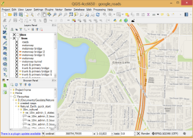 [ Zoom screenshot ] |
|
| Software Info | |
|
Best Vista Download periodically updates pricing and software information of QGIS full version from the publisher,
but some information may be out-of-date. You should confirm all information. Software piracy is theft, using crack, warez passwords, patches, serial numbers, registration codes, key generator, keymaker or keygen for QGIS license key is illegal and prevent future development of QGIS. Download links are directly from our mirrors or publisher's website, QGIS torrent files or shared files from rapidshare, yousendit or megaupload are not allowed! |
|
| Released: | March 26, 2024 |
| Filesize: | 1000.00 MB |
| Platform: | Windows XP, Windows Vista, Windows Vista x64, Windows 7, Windows 7 x64, Windows 8, Windows 8 x64, Windows 10, Windows 10 x64, Windows 11 |
| Install | Instal And Uninstall |
| Add Your Review or Windows Vista Compatibility Report |
QGIS- Releases History |
| Software: | QGIS 3.36.1 |
| Date Released: | Mar 26, 2024 |
| Status: | New Release |
| Software: | QGIS 3.36.2 |
| Date Released: | Apr 25, 2024 |
| Status: | New Release |
| Software: | QGIS 3.36.1 |
| Date Released: | Mar 26, 2024 |
| Status: | New Release |
Most popular map in CAD downloads for Vista |
|
Open Visual Trace Route 1.7.1 download by Leo Lewis
... Traceroute Packet sniffer Whois 3D and 2D Map visualisation Export data to image or text Gantt view ...
View Details
Download
|
 |
|
GpsTools Studio 2.3.1 build 227 download by Franson Technology
... devices. The program allows you to import a map from a popular image file and to export ... The user can easily scale the map image by using the wizard available in the ...
View Details
Download
|
 |
|
TransLT 15.0 download by 3D Space
... operations: * coordinates conversions (including using a map projection); * polynomial transformations; * transformations using grid files (files containing corrections values); * transformations with parameters: 1D, 2D or 3D; ...
type: Trialware ($250.00)
View Details
Download
categories: calculate transformation parameter, coordinate transformation, transformation parameter, calculate, geodetic, GPS |
 |
|
MagicPlot Student 2.9.3 download by MagicPlot.com
... - Data processing - Multiple axes - Color map plots - Figure templates - Batch processing ...
View Details
Download
|
 |
|
ExpertGPS 8.64 download by TopoGrafix
... you can draw your route directly on a map, search for nearby features from the millions of ... so you can quickly define an area to map and let ExpertGPS gather the data later. ExpertGPS ...
View Details
Download
|
 |
|
CueMol 2.2.3.442 download by BKR Laboratory
... format), MSMS surface data, and GRASP electrostatic potential map. ...
type: Freeware
View Details
Download
categories: view macromolecular structure, macromolecular structure visualization, visualize macromolecular structure, viewer, view, visualize |
 |
|
GPS Utility 5.51 download by GPS Utility Ltd.
... text formats. The program converts between different map datums and many coordinate formats (Lat/Long, UTM/UPS, country ... You can plot your GPS information as a map and add map annotations in text or image ...
type: Demo ($60.00)
View Details
Download
categories: Waypoint Manager, GPS Receiver, Digitise GPS, Waypoint, GPD, Digitise |
 |
|
Mobile Atlas Creator 2.2.1 download by Fredrik Moller
... exported as one large PNG image with calibration MAP file for OziExplorer. As source for an offline ... OpenStreetMap, Google Maps, Yahoo Maps and other online map providers. Features: Create offline atlases for ...
View Details
Download
|
 |
|
UCL Depthmap 0.8.0 download by University College London
... aim of the software is to produce a map of open space elements, connect them via some ... Depthmap can be used to derive an ‘axial map’ of a layout. That is, derive a reduced ...
type: Open Source
View Details
Download
categories: urban environment, urban map, spatial network analysis, environment, map, analysis |
 |
|
Thuban for Windows 1.2.2 download by Thuban Development Team
... Data Support: GeoTIFF Layer and GDAL # Comfortable Map Navigation # Object Identification and Annotation # Legend ... falls into five major parts: * Map * Legend * Statusbar * Toolbar and * ...
type: Open Source
View Details
Download
categories: geographic data viewer, gis viewer, analyze geographic information, information, geographic, viewer |
 |