Related Keywords
map projection downloadsprojection downloads
projection alarm clock radios downloads
projection mapping downloads
map downloads
map drive downloads
map component downloads
map engine downloads
map network drive downloads
map serial port downloads
map files downloads
map open ports to process downloads
map point downloads
map middle earth downloads
map viewer downloads
map software downloads
map maker downloads
map editor downloads
map plot points downloads
map creator downloads
Top Software Keywords
autocad downloadscad downloads
3d cad downloads
drawing downloads
import downloads
design downloads
dwg downloads
pdf to dwg downloads
dxf downloads
convert downloads
convert pdf to dwg downloads
dwg to pdf downloads
converter downloads
dxf to pdf downloads
pdf to dxf downloads
dwf to dwg downloads
dwg to dxf downloads
dwg converter downloads
dwg to jpg downloads
dwg to bmp downloads
stl downloads
dxf to pcl downloads
dwg to tiff downloads
intellicad downloads
pdf to cad downloads
dwg to gif downloads
convert dwg to pdf downloads
dwg to png downloads
dwg to dwf downloads
dxf to ps downloads
Vista Download
Vista downloadVista antivirus download
Vista wallpaper download
Vista wallpapers download
Vista themes download
Vista pack download
Vista ultimate download
Vista home download
Vista basic download
Vista business download
Vista x64 download
Vista transformation download
Vista transformation pack download
Vista boot download
Vista dvd download
Vista sidebar download
Vista aero download
Vista product key download
Downloads RSS
Top Downloads
Top Rated
Navigation: Home
\ Graphic Apps
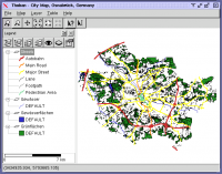
\ CAD \ Thuban for Windows
Thuban for Windows1.2.2 by Thuban Development Team |

|
Software Description:
... Support: GeoTIFF Layer and GDAL# Comfortable Map Navigation # Object Identification and Annotation ... >/ # Table Queries and Joins # Projection Support # Printing and Vector Export # API for Add-Ons (Extensions) ...
type: Open Source
Download Thuban for Windowscategories: geographic data viewer, gis viewer, analyze geographic information, information, geographic, viewer Add to Download Basket Report virus or spyware |
 [ Zoom screenshot ] |
|
| Software Info | |
|
Best Vista Download periodically updates pricing and software information of Thuban for Windows full version from the publisher,
but some information may be out-of-date. You should confirm all information. Software piracy is theft, using crack, warez passwords, patches, serial numbers, registration codes, key generator, keymaker or keygen for Thuban for Windows license key is illegal and prevent future development of Thuban for Windows. Download links are directly from our mirrors or publisher's website, Thuban for Windows torrent files or shared files from rapidshare, yousendit or megaupload are not allowed! |
|
| Released: | August 18, 2009 |
| Filesize: | 11.22 MB |
| Language: | English, French, German, Hungarian, Italian, Russian, Czech and Spanish |
| Platform: | Windows 2000, Windows 2003, Windows XP, Windows Vista |
| Install | Instal And Uninstall |
| Add Your Review or Windows Vista Compatibility Report |
Thuban for Windows- Releases History |
| Software: | Thuban for Windows 1.2.2 |
| Date Released: | Aug 18, 2009 |
| Status: | New Release |
Most popular map projection in CAD downloads for Vista |
|
TransLT 15.0 download by 3D Space
... operations: * coordinates conversions (including using a map projection); * polynomial transformations; * transformations using grid files ...
type: Trialware ($250.00)
View Details
Download
categories: calculate transformation parameter, coordinate transformation, transformation parameter, calculate, geodetic, GPS |
 |
|
Thuban for Windows 1.2.2 download by Thuban Development Team
... Data Support: GeoTIFF Layer and GDAL # Comfortable Map Navigation # Object Identification and Annotation # Legend ... and Classification # Table Queries and Joins # Projection Support # Printing and Vector Export # API ...
type: Open Source
View Details
Download
categories: geographic data viewer, gis viewer, analyze geographic information, information, geographic, viewer |
 |
|
Multiwfn 3.7 download by sobereva
... Outputting properties in a line and plotting curve map. · Outputting properties in a plane and plotting graph. Supported graph types including filled-color map, contour map, relief map (with/without projection), gradient map, ...
type: Open Source
View Details
Download
categories: wavefunction analysis, topology analysis, molecular structure, analysis, analize, wavefunction |
 |
|
QGIS 3.36.1 download by Gary Sherman
... database formats and lets you browse and create map data on your computer. QGIS supports many ... view, edit, and analysis · On the fly projection of vector layers · Map composer · Identify ...
type: Open Source
View Details
Download
categories: geographic information system, map creator, map viewer, GIS, geographic information, create, QGIS |
 |