Related Keywords
map point downloadspoint to point tunneling downloads
point to point communication downloads
point of sale downloads
point of sale software downloads
point of sale system downloads
point of purchase downloads
point of sale retail software downloads
point sale inventory software downloads
point downloads
point of sales downloads
point sale software downloads
point retail sale software downloads
point restaurant sale software downloads
point charts downloads
point list downloads
point import downloads
point speak downloads
point hunter downloads
point q downloads
Top Software Keywords
autocad downloads3d cad downloads
cad downloads
drawing downloads
import downloads
design downloads
dwg downloads
pdf to dwg downloads
dxf downloads
convert downloads
convert pdf to dwg downloads
dwg to pdf downloads
dxf to pdf downloads
converter downloads
pdf to dxf downloads
dwf to dwg downloads
dwg to dxf downloads
dwg converter downloads
dwg to jpg downloads
dwg to bmp downloads
stl downloads
dxf to pcl downloads
dwg to tiff downloads
intellicad downloads
pdf to cad downloads
dwg to gif downloads
convert dwg to pdf downloads
dwg to png downloads
dwg to dwf downloads
dxf to ps downloads
Vista Download
Vista downloadVista antivirus download
Vista wallpaper download
Vista wallpapers download
Vista themes download
Vista pack download
Vista ultimate download
Vista home download
Vista basic download
Vista business download
Vista x64 download
Vista transformation download
Vista transformation pack download
Vista boot download
Vista dvd download
Vista sidebar download
Vista aero download
Vista product key download
Downloads RSS
Top Downloads
Top Rated
Navigation: Home
\ Graphic Apps
\ CAD \ QGIS
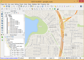
QGIS3.36.1 by Gary Sherman |

|
Software Description:
... database formats and lets you browse and create map data on your computer.QGIS supports many common spatial data formats (e.g. ESRI ShapeFile, geotiff). QGIS supports plugins to do things like display tracks from your GPS. QGIS aims to be an easy to use GIS, providing common functions and features. The initial goal was to provide a GIS data viewer. ...
type: Open Source
Download QGIScategories: geographic information system, map creator, map viewer, GIS, geographic information, create, QGIS Add to Download Basket Report virus or spyware |
 [ Zoom screenshot ] |
|
| Software Info | |
|
Best Vista Download periodically updates pricing and software information of QGIS full version from the publisher,
but some information may be out-of-date. You should confirm all information. Software piracy is theft, using crack, warez passwords, patches, serial numbers, registration codes, key generator, keymaker or keygen for QGIS license key is illegal and prevent future development of QGIS. Download links are directly from our mirrors or publisher's website, QGIS torrent files or shared files from rapidshare, yousendit or megaupload are not allowed! |
|
| Released: | March 26, 2024 |
| Filesize: | 1000.00 MB |
| Platform: | Windows XP, Windows Vista, Windows Vista x64, Windows 7, Windows 7 x64, Windows 8, Windows 8 x64, Windows 10, Windows 10 x64, Windows 11 |
| Install | Instal And Uninstall |
| Add Your Review or Windows Vista Compatibility Report |
QGIS- Releases History |
| Software: | QGIS 3.36.1 |
| Date Released: | Mar 26, 2024 |
| Status: | New Release |
| Software: | QGIS 3.36.2 |
| Date Released: | Apr 25, 2024 |
| Status: | New Release |
| Software: | QGIS 3.36.1 |
| Date Released: | Mar 26, 2024 |
| Status: | New Release |
Most popular map point in CAD downloads for Vista |
|
UCL Depthmap 0.8.0 download by University College London
... aim of the software is to produce a map of open space elements, connect them via some ... in a number of ways. It can produce point isovists, that is, polygons representing the visually accessible ...
type: Open Source
View Details
Download
categories: urban environment, urban map, spatial network analysis, environment, map, analysis |
 |
|
Multiwfn 3.7 download by sobereva
... etc.). · Outputting all supported properties at a point. · Outputting properties in a line and plotting curve map. · Outputting properties in a plane and plotting graph. Supported graph types including filled-color map, contour map, relief map (with/without projection), gradient map, ...
type: Open Source
View Details
Download
categories: wavefunction analysis, topology analysis, molecular structure, analysis, analize, wavefunction |
 |
|
Doodles 3D 0.76 download by Luigi Pino
... to help you create 3D models by adding points and connecting them to form shapes. The program allows you to change the position of a point by using the mouse or by entering the ...
type: Freeware
View Details
Download
categories: create 3D model, doodle creator, shape designer, create, design, designed |
 |
|
Engauge Digitizer for Windows 12.0 download by Mark Mitchell
... converts an image file showing a graph or map, into numbers. The image file can come from ... with an image file containing a graph or map. The final result is digitized data that can ...
type: Open Source
View Details
Download
categories: digitize image, image to number, process image, digitize, convert, digitizer |
 |
|
GetNexrad 4.4.2 download by Carson
... radar rainfall loops and to generate the basin point file (NexradPointESX10210.txt) used by GetRealtime.exe for computing the ... and graphical storm tracking. Storm ETA at any point of interest. Alarms! for Weather Service issued warnings. ...
type: Freeware
View Details
Download
categories: extract rainfall amount, DBZ analysis, view radar rainfall, view, extract, rainfall |
 |
|
CARIS Easy View 4.2.13 download by CARIS
... of the data. Users can load multiple raster, point cloud and vector data sources, change the order in which they are drawn and adjust each layer's display parameters. Users can ...
View Details
Download
|
 |
|
QGIS 3.36.1 download by Gary Sherman
... database formats and lets you browse and create map data on your computer. QGIS supports many ... a GIS data viewer. QGIS has reached that point in its evolution and is being used by ...
type: Open Source
View Details
Download
categories: geographic information system, map creator, map viewer, GIS, geographic information, create, QGIS |
 |
|
BimRoad Plus download by HaneeSoft
... road. Automatic connection road plan by editing nose point. Automatic correction of road plan design element using ... English/Chinese support. Automatic Three-dimensional converting from two-dimensional digital map. Automatic extraction of GIS information in the digital ...
View Details
Download
|
 |
|
TrueSpace 7.61 download by Caligari Corporation
... as faces; the option to hide geometry while point editing to make it easier to work on ... quadrifying polygons to ensure a workable mesh; new point edit selection tools to grow, shrink, invert, and ...
type: Freeware
View Details
Download
categories: truespace 3, truespace 6.5, truespace 7, truespace 7.5, truespace, truespace 7.51, truespace trial, truespace models, True Space |
 |