Related Keywords
layer tool downloadslayer downloads
layer 3 downloads
layer 2 downloads
layer mask downloads
layer addin downloads
layer depth downloads
layer comps downloads
layer names downloads
layer string downloads
layer title downloads
layer x64 downloads
layer filter downloads
layer editing downloads
layer groups downloads
tool ie tool downloads
tool fix mdf tool downloads
tool downloads
tool bar downloads
tool bar for internet explorer downloads
Top Software Keywords
autocad downloadscad downloads
3d cad downloads
drawing downloads
import downloads
design downloads
dwg downloads
pdf to dwg downloads
dxf downloads
convert downloads
convert pdf to dwg downloads
dwg to pdf downloads
converter downloads
dxf to pdf downloads
pdf to dxf downloads
dwf to dwg downloads
dwg to dxf downloads
dwg converter downloads
dwg to jpg downloads
dwg to bmp downloads
stl downloads
dxf to pcl downloads
dwg to tiff downloads
intellicad downloads
pdf to cad downloads
dwg to gif downloads
convert dwg to pdf downloads
dwg to png downloads
dwg to dwf downloads
dxf to ps downloads
Vista Download
Vista downloadVista antivirus download
Vista wallpaper download
Vista wallpapers download
Vista themes download
Vista pack download
Vista ultimate download
Vista home download
Vista basic download
Vista business download
Vista x64 download
Vista transformation download
Vista transformation pack download
Vista boot download
Vista dvd download
Vista sidebar download
Vista aero download
Vista product key download
Downloads RSS
Top Downloads
Top Rated
Navigation: Home
\ Graphic Apps
\ CAD \ QGIS
QGIS3.36.1 by Gary Sherman |

|
Software Description:
QGIS supports vector, raster, and database formats and lets you browse and create map data on your computer.QGIS supports many common spatial data formats (e.g. ESRI ShapeFile, geotiff). QGIS supports plugins to do things like display tracks from your GPS. QGIS aims to be an easy to use GIS, providing common functions and features. The initial goal was to provide a GIS data viewer. ...
type: Open Source
Download QGIScategories: geographic information system, map creator, map viewer, GIS, geographic information, create, QGIS Add to Download Basket Report virus or spyware |
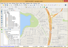 [ Zoom screenshot ] |
|
| Software Info | |
|
Best Vista Download periodically updates pricing and software information of QGIS full version from the publisher,
but some information may be out-of-date. You should confirm all information. Software piracy is theft, using crack, warez passwords, patches, serial numbers, registration codes, key generator, keymaker or keygen for QGIS license key is illegal and prevent future development of QGIS. Download links are directly from our mirrors or publisher's website, QGIS torrent files or shared files from rapidshare, yousendit or megaupload are not allowed! |
|
| Released: | March 26, 2024 |
| Filesize: | 1000.00 MB |
| Platform: | Windows XP, Windows Vista, Windows Vista x64, Windows 7, Windows 7 x64, Windows 8, Windows 8 x64, Windows 10, Windows 10 x64, Windows 11 |
| Install | Instal And Uninstall |
| Add Your Review or Windows Vista Compatibility Report |
QGIS- Releases History |
| Software: | QGIS 3.36.1 |
| Date Released: | Mar 26, 2024 |
| Status: | New Release |
| Software: | QGIS 3.36.2 |
| Date Released: | Apr 25, 2024 |
| Status: | New Release |
| Software: | QGIS 3.36.1 |
| Date Released: | Mar 26, 2024 |
| Status: | New Release |
Most popular layer tool in CAD downloads for Vista |
|
TriSpace 2021.24.3.652 download by GEOSTRU
... volume calculations. Thus this program becomes a useful tool both in geological fields due to the extreme ... from Geostru SRTM , from text files; Multi layer management: work plans can be associated on each ...
type: Trialware ($500.00)
View Details
Download
categories: Terrain Calculation, 3D Terrain Viewer, View 3D Surface, Calculation, Terrain, Surface |
 |
|
BabaCAD 2.0.0 download by Mirza Coralic
... industry.Why ??? - You have power of professional tools (which cost 1,000 - 2000 $) - it's ... need 10,000 $ worth machine to use this tool.You can do it with 500$ machine like boss ...
View Details
Download
|
 |
|
TriSpace 2021.24.3.652 download by GEOSTRU
... volume calculations. Thus this program becomes a useful tool both in geological fields due to the extreme ... from Geostru SRTM , from text files; Multi layer management: work plans can be associated on each ...
type: Trialware ($500.00)
View Details
Download
categories: Terrain Calculation, 3D Terrain Viewer, View 3D Surface, Calculation, Terrain, Surface |
 |
|
R2V 3.66 download by MR Soft
R2V is a tool for converting raster images to vector by drawing ... into vector. R2V can use up to 256 layers. The following properties can be applied to each layer: color, pen width, visible. ...
type: Shareware ($42.00)
View Details
Download
categories: vector, r2v, vectorize, cnc, photo, engraving, bmp, hobby, carving, mill, cad, cam, stl, image, hpgl, dxf, raster, grayscale, conversion, g-code |
 |
|
Balancer 2.1.0.448 download by Atangeo Ltd.
Atangeo Balancer is a tool that puts your 3D polygonal models in balance. ... your model. The model features, normals, texture coordinates, layer boundaries are all honored. Optimize your models even ... boundaries · Boundaries defined by discontinuities of materials, layers, texture coordinates are supported · Visualization of boundaries ...
type: Demo ($26.00)
View Details
Download
categories: 3D optimizer, optimize polygon count, optimize 3d model, optimizer, optimize, simplification |
 |
|
DataNumen DWG Recovery 4.0 download by DataNumen, Inc.
DataNumen DWG Recovery is a powerful tool to repair and recover corrupt AutoCAD DWG files. ... (DIAMETER), LEADER, TOLERANCE, BLOCK CONTROL OBJ, BLOCK HEADER, LAYER CONTROL OBJ, LAYER, STYLE CONTROL OBJ, STYLE, LTYPE ...
type: Shareware ($299.95)
View Details
Download
categories: DWG, AutoCAD, repair, recover, recovery, fix, dwg recovery, recover dwg, repair dwg, dwg repair, dwg fix, fix dwg, corrupt dwg, corrupted dwg, damaged dwg, dwg corruption, autocad recovery, recover autocad, repair autocad, autocad repair, fix autocad, autocad fix |
 |
|
QGIS 3.36.1 download by Gary Sherman
... analysis · On the fly projection of vector layers · Map composer · Identify features · Display ... Improved vector and attribute editing · Improved measure tools with area measuring · Attribute searching · New ...
type: Open Source
View Details
Download
categories: geographic information system, map creator, map viewer, GIS, geographic information, create, QGIS |
 |