Related Keywords
land downloadsland features database downloads
land survey downloads
land line downloads
land plot maps downloads
land photo screensaver downloads
land meditation downloads
land of runes downloads
land rover downloads
land development downloads
land for sale downloads
land survey software downloads
land desktop downloads
land survey database software downloads
land survey record management downloads
land grabbers downloads
land surveying downloads
tile land downloads
tiles land downloads
take over the entire land downloads
Top Software Keywords
api downloadsvisual studio downloads
library downloads
dll downloads
free downloads
image downloads
pdf downloads
net downloads
control downloads
sdk downloads
windows downloads
delphi downloads
java downloads
component downloads
net component downloads
programming downloads
asp downloads
visual basic downloads
email downloads
barcode downloads
html downloads
com downloads
activex downloads
dotnet downloads
ocx downloads
vista basic downloads
database downloads
vb net downloads
internet downloads
codabar downloads
Vista Download
Vista downloadVista antivirus download
Vista wallpaper download
Vista wallpapers download
Vista themes download
Vista pack download
Vista ultimate download
Vista home download
Vista basic download
Vista business download
Vista x64 download
Vista transformation download
Vista transformation pack download
Vista boot download
Vista dvd download
Vista sidebar download
Vista aero download
Vista product key download
Top Downloads
Top Rated
Navigation: Home
\ Development
\ Components & Libraries \ GEODLL32
GEODLL3224.33 by C. Killet Software Ing.-GbR |

|
Software Description:
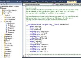
GeoDLL is a component which helps developers to create geodetic software on various platforms by providing geodetic functions. GeoDLL contains precise functions of the themes 2D and 3D coordinate transformation, geodetic datum shift and reference system convertion, meridian strip changing, user defined coordinate and reference systems, distance calculation, Digital Elevation Model, NTv2 handling and map function. ...
type: Trialware ($500.00)
Download GEODLL32categories: Geodetic Function, Reference System, Coordinate Transformation, Coordinate, Refecrence, Function Add to Download Basket Report virus or spyware |
 [ Zoom screenshot ] |
|
| Software Info | |
|
Best Vista Download periodically updates pricing and software information of GEODLL32 full version from the publisher,
but some information may be out-of-date. You should confirm all information. Software piracy is theft, using crack, warez passwords, patches, serial numbers, registration codes, key generator, keymaker or keygen for GEODLL32 license key is illegal and prevent future development of GEODLL32. Download links are directly from our mirrors or publisher's website, GEODLL32 torrent files or shared files from rapidshare, yousendit or megaupload are not allowed! |
|
| Released: | June 26, 2024 |
| Filesize: | 5.50 MB |
| Platform: | Windows XP, Windows Vista, Windows Vista x64, Windows 7, Windows 7 x64, Windows 8, Windows 8 x64, Windows 10, Windows 10 x64, Windows 11 |
| Install | Instal And Uninstall |
| Add Your Review or Windows Vista Compatibility Report |
GEODLL32- Releases History |
| Software: | GEODLL32 24.33 |
| Date Released: | Jun 26, 2024 |
| Status: | New Release |
| Software: | GEODLL32 24.27 |
| Date Released: | Mar 3, 2024 |
| Status: | New Release |
| Software: | GEODLL32 24.26 |
| Date Released: | Feb 15, 2024 |
| Status: | New Release |
Most popular land in Components & Libraries downloads for Vista |
|
GEODLL32 24.33 download by C. Killet Software Ing.-GbR
... and new federal states, the 40 Prussian Soldner Land Registers, the German ‘Lagestatus’, and exact reference systems of the German federal states. User coordinate systems, local reference systems and earth ...
type: Trialware ($500.00)
View Details
Download
categories: Geodetic Function, Reference System, Coordinate Transformation, Coordinate, Refecrence, Function |
 |
|
LAnd Survey Tools 1.1.0-6 Beta download by Don Church
LAnd Survey Tools or LAST was created to preserve ... invested in an old, privately used, DOS based land survey construction and data collection application. This was built by porting ...
View Details
Download
|
 |