Related Keywords
it tools downloadstools for it professionals downloads
it asset management downloads
it administration downloads
it help desk downloads
it audit downloads
it automation downloads
it certification kit downloads
it troubleshooting downloads
it documentation downloads
it security downloads
it asset tracking downloads
it certification tool downloads
it compliance downloads
it consultant downloads
it solution downloads
it services downloads
it contractor downloads
it features great graphics downloads
it management downloads
Top Software Keywords
autocad downloads3d cad downloads
cad downloads
drawing downloads
import downloads
design downloads
dwg downloads
pdf to dwg downloads
convert pdf to dwg downloads
dxf downloads
convert downloads
dxf to pdf downloads
dwg to pdf downloads
converter downloads
pdf to dxf downloads
dwf to dwg downloads
dwg converter downloads
dwg to jpg downloads
dwg to dxf downloads
dwg to bmp downloads
stl downloads
dxf to pcl downloads
dwg to tiff downloads
intellicad downloads
pdf to cad downloads
dwg to gif downloads
convert dwg to pdf downloads
dwg to png downloads
dwg to dwf downloads
dxf to ps downloads
Vista Download
Vista downloadVista antivirus download
Vista wallpaper download
Vista wallpapers download
Vista themes download
Vista pack download
Vista ultimate download
Vista home download
Vista basic download
Vista business download
Vista x64 download
Vista transformation download
Vista transformation pack download
Vista boot download
Vista dvd download
Vista sidebar download
Vista aero download
Vista product key download
Downloads RSS
Top Downloads
Top Rated
Navigation: Home
\ Graphic Apps
\ CAD \ Virtual Terrain Project for Windows
Virtual Terrain Project for Windows1.1 110804 by Ben Discoe |

|
Software Description:
... of VTP is to foster the creation of tools for easily constructing any part of the real world in interactive, 3D digital form.This goal will require a synergetic convergence of the fields of CAD, GIS, visual simulation, surveying and remote sensing. VTP gathers information and tracks progress in areas such as procedural scene construction, feature extraction, and rendering algorithms. ...
type: Open Source
Download Virtual Terrain Project for Windowscategories: libraries, demos, data, open source, VirtualTerrain Project, CAD, GIS, VTP Add to Download Basket Report virus or spyware |
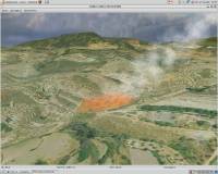 [ Zoom screenshot ] |
|
| Software Info | |
|
Best Vista Download periodically updates pricing and software information of Virtual Terrain Project for Windows full version from the publisher,
but some information may be out-of-date. You should confirm all information. Software piracy is theft, using crack, warez passwords, patches, serial numbers, registration codes, key generator, keymaker or keygen for Virtual Terrain Project for Windows license key is illegal and prevent future development of Virtual Terrain Project for Windows. Download links are directly from our mirrors or publisher's website, Virtual Terrain Project for Windows torrent files or shared files from rapidshare, yousendit or megaupload are not allowed! |
|
| Released: | September 08, 2011 |
| Filesize: | 1.00 MB |
| Platform: | Windows 2000, Windows 2003, Windows XP, Windows Vista |
| Install | Instal And Uninstall |
| Add Your Review or Windows Vista Compatibility Report |
Virtual Terrain Project for Windows- Releases History |
| Software: | Virtual Terrain Project for Windows 1.1 110804 |
| Date Released: | Sep 8, 2011 |
| Status: | New Release |
| Release Notes: | Enviro: Exposed support for more stereo modes: Horizontal and Vertical split. Options to enable joystick and spacenavigator, rather than just always using them if present. Smooth continuous update when making buildings. Option to constrain building point to right angles. Deter user from making bad points. Made support for Collada (.dae) more explicit in the UI. Display the version number in the startup dialog. Added 'every N meters' option to Contour dialog, making it significantly more useful. Changed 'Move' mode to use Alt modifier key for up/down, to be consistent. Fixed issues with: support for elevation grids with non-unit vertical scale; removing layers from a terrain; saving snapshot and high-resolution snapshot; buildings with a Geographic CRS; draping of 2D polylines on terrain with vertical exaggeration. VTBuilder: Raw layers: Draw polygon holes as dotted lines to tell them from outer edges. |
Most popular it tools in CAD downloads for Vista |
|
Gmsh 4.13.1 download by Christophe Geuzaine
... mesh. It comes packed with a few handy tools for advanced users. Gmsh is a CAD software that helps you to design 3D elements. The modules are split into ...
type: Open Source
View Details
Download
categories: CAD engine, design, model, 3D design, mesh, grid generator, CAD, engine |
 |
|
DirectMath x64 3.2.3 download by Joe Gregg
... system, and a collection of powerful technical drawing tools. The DirectMath x64 editor is a simple, streamlined ... DirectMath x64 includes a set of drawing tools that allow you create sophisticated "live" drawings to ...
type: Freeware
View Details
Download
categories: x64 math calculation, x64 algebra calculation, x64 solve equation, x64 math, x64 algebra, x64 calculation |
 |
|
2D/3D cad: dwg, dxf, plt, cgm, svg, pdf 14 download by CADSoftTools
... Editing. The software has a wide range of tools to create and edit files. The special Redline mode allows users to add markups and comments to a drawing. Converting. ABViewer ...
type: Shareware ($48.00)
View Details
Download
categories: CAD, DWG, DXF, CGM, SVG, HGL, PLT, HP2, STP, STEP, IGES, STL, PDF to DWG, edit, editor, view, viewer, converter, TIFF, DXF to TIFF, HPGL, Print, Printing, AutoCAD, EMF, BMP, format, convert, Vector, g-code |
 |
|
Aqsis Renderer for Windows 1.8.2 download by Aqsis Team
... surfaces, subpixel displacements and more. The Aqsis tools provide a comprehensive list of features that are ... through plugins (DSO/Procedurals) Features: The Aqsis tools provide a comprehensive list of features that are ...
type: Freeware
View Details
Download
categories: 3D render solution, programmable shade, true displacement, render, renderer, shade, aqsis, aqsis rendererhttp://pads.websys.sk/pads.php?action=edit_pad&pID=3997 |
 |
|
MagicPlot Pro 2.9.3 download by MagicPlot.com
... Explore hidden details of your plot with navigation tools: Mouse wheel with Shift/Ctrl changes scale and scrolls. Hand tool is also available. Batch Processing The simplest way to process ...
type: Trialware ($198.00)
View Details
Download
categories: Nonlinear Fitting, Create Plot, customizable plot, Plotter, Plot, fitter |
 |
|
Deskcalc Pro 9.0.7 download by PmaSoft
... math operations, but it also offers currency conversion tools. DeskCalc offers built-in formula interpreters, percentage calculations, and many other useful options. It also includes a floating window that displays all ...
type: Trialware ($29.95)
View Details
Download
categories: calculation machine, percentage calculation, formula interpreter, calculation, calculate, calculator |
 |
|
Kalkules 1.11.0.28 download by Jardo
... students. It also offers a wide range of tools, which make your calculations easier and faster. FEATURES: · evaluating whole expressions ( ex: 5 + 10 / ...
type: Freeware
View Details
Download
categories: scientific calculator, solve math equation, calculate fraction, solve, calculator, calculate |
 |
|
Ctrax 0.5.19b download by Caltech Ethomics Project
... this project is to provide quantitative behavior analysis tools to the neuroethology community, thus we've endeavored to make the system adaptable to other lab's setups. We have assessed the quality ...
type: Open Source
View Details
Download
categories: walking fly tracker, fly behavior analysis, fly monitor, fly, tracker, fly behavior |
 |
|
SDMetrics 2.5 download by Jürgen Wüst
... to a design problem. Interoperability with UML tools: · SDMetrics is designed to work with all UML modeling tools with XMI export. SDMetrics supports all XMI ... to deal with proprietary UML metamodel extensions, and tools that deviate from XMI standards. · Use SDMetrics ...
type: Freeware
View Details
Download
categories: analyze structural property, design metrics, establish benchmark, analyzer, analyze, measurement |
 |
|
NetLogo 6.0.4 download by Uri Wilensky
... run simulations for various phenomena, providing 3D modeling tools and multiple visualization options. Generated models can be exported locally, turned into a movie or saved as applets and used in ...
type: Freeware
View Details
Download
categories: Analyze simple or complex social and natural phenomena |
 |