Related Keywords
gps data downloadsgps data splitter downloads
collect gps data downloads
export gps data downloads
decode gps data downloads
gps downloads
gps clock downloads
gps decoder downloads
gps nmea sentence downloads
gps toolkit downloads
gps serial port component downloads
gps c downloads
gps component vb downloads
gps component c downloads
gps navigation downloads
gps receivers downloads
gps express downloads
gps software downloads
gps harta downloads
gps source code module downloads
Top Software Keywords
autocad downloads3d cad downloads
cad downloads
drawing downloads
import downloads
design downloads
dwg downloads
pdf to dwg downloads
dxf downloads
convert downloads
convert pdf to dwg downloads
dwg to pdf downloads
dxf to pdf downloads
converter downloads
pdf to dxf downloads
dwf to dwg downloads
dwg to dxf downloads
dwg converter downloads
dwg to jpg downloads
dwg to bmp downloads
stl downloads
dxf to pcl downloads
dwg to tiff downloads
intellicad downloads
pdf to cad downloads
dwg to gif downloads
convert dwg to pdf downloads
dwg to png downloads
dwg to dwf downloads
dxf to ps downloads
Vista Download
Vista downloadVista antivirus download
Vista wallpaper download
Vista wallpapers download
Vista themes download
Vista pack download
Vista ultimate download
Vista home download
Vista basic download
Vista business download
Vista x64 download
Vista transformation download
Vista transformation pack download
Vista boot download
Vista dvd download
Vista sidebar download
Vista aero download
Vista product key download
Downloads RSS
Top Downloads
Top Rated
Navigation: Home
\ Graphic Apps
\ CAD \ QGIS
QGIS3.36.1 by Gary Sherman |

|
Software Description:
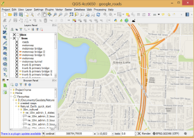
QGIS supports vector, raster, and database formats and lets you browse and create map data on your computer.QGIS supports many common spatial data formats (e.g. ESRI ShapeFile, geotiff). QGIS supports plugins to do things like display tracks from your GPS. QGIS aims to be an easy to ... The initial goal was to provide a GIS data viewer. ...
type: Open Source
Download QGIScategories: geographic information system, map creator, map viewer, GIS, geographic information, create, QGIS Add to Download Basket Report virus or spyware |
 [ Zoom screenshot ] |
|
| Software Info | |
|
Best Vista Download periodically updates pricing and software information of QGIS full version from the publisher,
but some information may be out-of-date. You should confirm all information. Software piracy is theft, using crack, warez passwords, patches, serial numbers, registration codes, key generator, keymaker or keygen for QGIS license key is illegal and prevent future development of QGIS. Download links are directly from our mirrors or publisher's website, QGIS torrent files or shared files from rapidshare, yousendit or megaupload are not allowed! |
|
| Released: | March 26, 2024 |
| Filesize: | 1000.00 MB |
| Platform: | Windows XP, Windows Vista, Windows Vista x64, Windows 7, Windows 7 x64, Windows 8, Windows 8 x64, Windows 10, Windows 10 x64, Windows 11 |
| Install | Instal And Uninstall |
| Add Your Review or Windows Vista Compatibility Report |
QGIS- Releases History |
| Software: | QGIS 3.36.1 |
| Date Released: | Mar 26, 2024 |
| Status: | New Release |
| Software: | QGIS 3.36.2 |
| Date Released: | Apr 25, 2024 |
| Status: | New Release |
| Software: | QGIS 3.36.1 |
| Date Released: | Mar 26, 2024 |
| Status: | New Release |
Most popular gps data in CAD downloads for Vista |
|
TransLT 15.0 download by 3D Space
... contains a module that extracts information from EPSG database. TransLT is aimed at specialists who use GPS technology to perform geodetic works. The program interface is intuitive, easy to use, the data can be imported from txt or csv files, ...
type: Trialware ($250.00)
View Details
Download
categories: calculate transformation parameter, coordinate transformation, transformation parameter, calculate, geodetic, GPS |
 |
|
ExpertGPS 8.64 download by TopoGrafix
... ultimate mapping software for Garmin, Magellan, and Lowrance GPS owners. ExpertGPS displays your waypoints, routes, and tracks ... from the millions of waypoints available in our database, and transfer your trip directly to your GPS ...
View Details
Download
|
 |
|
GPS Utility 5.51 download by GPS Utility Ltd.
GPS Utility is an easy-to-use application that provides management and manipulation of GPS information. You can use it to transfer data to/from a GPS receiver and store the data in PC files ...
type: Demo ($60.00)
View Details
Download
categories: Waypoint Manager, GPS Receiver, Digitise GPS, Waypoint, GPD, Digitise |
 |
|
NemaStudio 1.36.6465.25714 download by Sailsoft
... of various nautical instruments and target objects including GPS, AIS and Radar. All instruments, targets and ports ... via user configurable PC serial communications ports. The data can be picked up and processed by various ...
type: Demo ($364.89)
View Details
Download
categories: nautical navigation, simulate nautical, navigation simulator, simulate, simulator, nautical |
 |
|
IPaNema 1.1.0 download by Sailsoft
IPaNema reads any NMEA data from one of the serial ports (Com1-15) and delivers the NMEA data to any user selectable port and IP address ... IPaNema can be used to make received NMEA data (like GPS streams) available to any or all ...
type: Freeware
View Details
Download
categories: receive NMEA sentence, forward NMEA data, read GPS stream, receive, NMEA, forward |
 |
|
Engauge Digitizer for Windows 12.0 download by Mark Mitchell
... graph or map. The final result is digitized data that can be used by other tools such ... * You are a graduate student gathering historical data from charts for your thesis. * You are ...
type: Open Source
View Details
Download
categories: digitize image, image to number, process image, digitize, convert, digitizer |
 |
|
TNTmips 20240404 download by MicroImages, Inc.
... you work with virtually any type of geospatial data including imagery, terrain surfaces, and map data with associated database attributes. It provides all the tools you need ... georeference, interpret, and publish any type of geospatial data. TNTmips provides professional geospatial tools in a single ...
type: Freeware
View Details
Download
categories: GIS data analysis, analyze geodetic data, edit GIS dataset, GIS, dataset, editor, analysis |
 |
|
QGIS 3.36.1 download by Gary Sherman
... Software (FOSS). QGIS supports vector, raster, and database formats and lets you browse and create map data on your computer. QGIS supports many common spatial data formats (e.g. ESRI ShapeFile, geotiff). QGIS supports plugins ...
type: Open Source
View Details
Download
categories: geographic information system, map creator, map viewer, GIS, geographic information, create, QGIS |
 |
|
SierraSoft Land 4.0 download by SierraSoft S.r.l.
... various types of tools, such as total stations, GPS, laser scanners or drones. The entire flow of restitution of acquired data, 3D surface modeling, and section and volume calculation ...
View Details
Download
|
 |
|
Elshayal Smart 23.02 download by Elshayal Smart Web On Line Software
... Maps from Google Earth, and Trace & save GPS route and View and Rectify Raster Images gif, ... remove layers, swap layers, save layer, set layer data source, layer properties, zoom in & zoom out, ...
View Details
Download
|
 |