Related Keywords
google maps downloadsgoogle maps images downloader downloads
google maps locations downloads
google maps terrain downloads
google maps downloader downloads
google maps for dreamweaver downloads
google maps phone number downloads
google maps business downloads
google maps download downloads
google maps email downloads
google maps address downloads
google maps database downloads
google maps software downloads
google maps store locator downloads
google maps in 3d downloads
google maps editor downloads
google maps extractor downloads
google maps grabber downloads
google maps contact extractor downloads
google maps locator downloads
Top Software Keywords
tool downloadsdigital downloads
pdf downloads
adobe downloads
design downloads
image downloads
images downloads
photo downloads
jpeg downloads
scanner downloads
color downloads
processing downloads
bmp downloads
graphics downloads
photos downloads
photoshop downloads
jpg downloads
screen downloads
picture downloads
graphic downloads
zoom downloads
print downloads
utility downloads
pictures downloads
corel downloads
video downloads
printing downloads
gif downloads
watermark downloads
paint downloads
Vista Download
Vista downloadVista antivirus download
Vista wallpaper download
Vista wallpapers download
Vista themes download
Vista pack download
Vista ultimate download
Vista home download
Vista basic download
Vista business download
Vista x64 download
Vista transformation download
Vista transformation pack download
Vista boot download
Vista dvd download
Vista sidebar download
Vista aero download
Vista product key download
Downloads RSS

Top Downloads
Top Rated
Navigation: Home
\ Graphic Apps
\ Other \ PixGPS
PixGPS1.1.8 by BR Software |

|
Software Description:
PixGPS is a simple application that makes it simple to insert the exact position of each photo (latitude and longitude) into the photos EXIF meta data. GeoGPS makes geotagging your digital photos easy. Just download the photos from your camera and get the track log from your GPS Receiver. The PixGPS Geotagger will in matter of seconds calculate the latitude and longitude for each of the photos. ...
type: Trialware ($19.95)
Download PixGPScategories: digital photo geotagging, photos EXIF metadata, photo GPS, metadata, geotag, GPS Add to Download Basket Report virus or spyware |
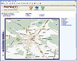 [ Zoom screenshot ] |
|
| Software Info | |
|
Best Vista Download periodically updates pricing and software information of PixGPS full version from the publisher,
but some information may be out-of-date. You should confirm all information. Software piracy is theft, using crack, warez passwords, patches, serial numbers, registration codes, key generator, keymaker or keygen for PixGPS license key is illegal and prevent future development of PixGPS. Download links are directly from our mirrors or publisher's website, PixGPS torrent files or shared files from rapidshare, yousendit or megaupload are not allowed! |
|
| Released: | August 09, 2017 |
| Filesize: | 3.40 MB |
| Platform: | Windows XP, Windows Vista, Windows Vista x64, Windows 7, Windows 7 x64, Windows 8, Windows 8 x64, Windows 10, Windows 10 x64 |
| Install | Instal And Uninstall |
| Add Your Review or Windows Vista Compatibility Report |
PixGPS- Releases History |
| Software: | PixGPS 1.1.8 |
| Date Released: | Aug 9, 2017 |
| Status: | New Release |
| Release Notes: | Fixed a problem that caused the program to fail if installed after a certain date. Making it possible to choose between several maps. Some minor bug fixes. |
| Software: | PixGPS 1.1.7 |
| Date Released: | Sep 9, 2015 |
| Status: | New Release |
| Release Notes: | Fixed a problem that caused the program to fail if installed after a certain date. Making it possible to choose between several maps. Some minor bug fixes. |
| Software: | PixGPS 1.1.6 |
| Date Released: | Oct 3, 2013 |
| Status: | New Release |
| Release Notes: | · can now also show location in Google Maps. · improved error handling when updating image files. · several bug fixes. |
Most popular google maps in Other downloads for Vista |
|
ATOM GPS 1.0.5 download by VSO-Software
... easy browsing, and also upload your pictures to Google Earth, Google maps, Panoramio, LOCR, Flickr. - Supports many GPS Devices ... and travel itineraries by geotagging your photos. - Google Earth export - Languages: English ...
type: Freeware
View Details
Download
categories: geotagging, geolocation, kml, gpx, gps software, track log, geotag, gps devives, gps, google earth, exif |
 |
|
GeoSetter 3.5.3 download by Friedemann Schmidt
... geo coordinates, image directions and tracks on embedded Google Maps map (requires internet connection) Setting geo data by using embedded Google Maps map (requires internet connection) or by entering known ... between RAW images and their corresponding JPEG images) Google Earth export Localizable user interface – English, German, ...
type: Freeware
View Details
Download
categories: change geographical data, change picture date, geo tag images, synchronize, geographic, localication |
 |
|
PixGPS 1.1.8 download by BR Software
... function in PixGPS to view the location in Google Maps or MapQuest (requires an Internet connection). For ...
type: Trialware ($19.95)
View Details
Download
categories: digital photo geotagging, photos EXIF metadata, photo GPS, metadata, geotag, GPS |
 |
|
Google Maps Plot Multiple Locations Software 7.0 download by Sobolsoft
... who want to map multiple addresses on one Google Map. Addresses are loaded from a text file (each address should be on a separate line). The result will be saved ...
type: Shareware ($19.99)
View Details
Download
categories: locations, plotting, plotter, plotable, address, coordinates, zip codes, post, jpgs, directions, points, waypoints, dynamically, static, searches, api, web, application, plotted, directions, earth, geographic area, capture, capturing, export, mapped |
 |
|
SlimPublisher 5.0 download by BinaryNow
... it in the project. Use built-in integration with Google Maps to insert the map of your location on ... project. Insert Map Use built-in integration with Google Maps to insert the map of your location ...
type: Trialware ($24.95)
View Details
Download
categories: desktop, design, graphic, create, design business card, flyer creator, business card, letterhead |
 |
|
GPX Editor 1.7.14 B1740 download by Pixel K
... easily edit fields, as well as switch to Google Maps viewing mode. Data is importable from NMEA, NGT ...
View Details
Download
|
 |
|
BreezeBrowser Pro 1.12.4.1 download by Breeze Systems Ltd.
... also enables photographers to: Geo-tag images using Google Earth™ and automatically show image locations in Google Earth™ when viewing in BreezeBrowser Pro Link geo-tagged images to online maps and create web galleries using the GPS template ...
type: Trialware ($95.00)
View Details
Download
categories: web galleries, process pictures, digital camera, picture, image, digital |
 |
|
Terra Incognita 2.45 download by Zubak
Program for downloading web source maps or local files maps for various programs or GPS devices. Requires Microsoft® ... software application built specifically for helping you view maps from various online sources, such as Google, OpenStreetMap, ...
type: Open Source
View Details
Download
categories: Map Downloader, View Map, Waypoint Manager, Downloader, Viewer, GPS, Mapper |
 |