Related Keywords
gis downloadsgis technology downloads
gis map downloads
gis mapping software downloads
gis sdk downloads
gis software downloads
gis translator downloads
gis convertor downloads
gis calculator downloads
gis icons downloads
gis maps downloads
gis data downloads
gis editor downloads
gis viewer downloads
gis imagery downloads
gis analysis downloads
gis designer downloads
gis catalog downloads
gis map management downloads
gis library downloads
Top Software Keywords
autocad downloads3d cad downloads
cad downloads
drawing downloads
import downloads
design downloads
dwg downloads
pdf to dwg downloads
dxf downloads
convert pdf to dwg downloads
convert downloads
dxf to pdf downloads
dwg to pdf downloads
converter downloads
pdf to dxf downloads
dwf to dwg downloads
dwg converter downloads
dwg to jpg downloads
dwg to dxf downloads
dwg to bmp downloads
stl downloads
dxf to pcl downloads
dwg to tiff downloads
intellicad downloads
pdf to cad downloads
dwg to gif downloads
convert dwg to pdf downloads
dwg to png downloads
dwg to dwf downloads
dxf to ps downloads
Vista Download
Vista downloadVista antivirus download
Vista wallpaper download
Vista wallpapers download
Vista themes download
Vista pack download
Vista ultimate download
Vista home download
Vista basic download
Vista business download
Vista x64 download
Vista transformation download
Vista transformation pack download
Vista boot download
Vista dvd download
Vista sidebar download
Vista aero download
Vista product key download
Downloads RSS
Top Downloads
Top Rated
Navigation: Home
\ Graphic Apps
\ CAD \ Thuban for Windows
Thuban for Windows1.2.2 by Thuban Development Team |

|
Software Description:
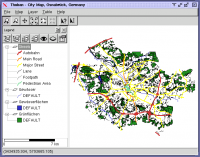
Thuban is an Interactive Geographic Data Viewer with the following features:# Vector Data Support: Shapefile, PostGIS Layer and OGR # Raster Data Support: GeoTIFF Layer and GDAL # Comfortable Map Navigation # Object Identification and Annotation # Legend Editor and Classification # Table Queries and Joins # Projection Support # Printing and Vector Export # API for Add-Ons (Extensions) ...
type: Open Source
Download Thuban for Windowscategories: geographic data viewer, gis viewer, analyze geographic information, information, geographic, viewer Add to Download Basket Report virus or spyware |
 [ Zoom screenshot ] |
|
| Software Info | |
|
Best Vista Download periodically updates pricing and software information of Thuban for Windows full version from the publisher,
but some information may be out-of-date. You should confirm all information. Software piracy is theft, using crack, warez passwords, patches, serial numbers, registration codes, key generator, keymaker or keygen for Thuban for Windows license key is illegal and prevent future development of Thuban for Windows. Download links are directly from our mirrors or publisher's website, Thuban for Windows torrent files or shared files from rapidshare, yousendit or megaupload are not allowed! |
|
| Released: | August 18, 2009 |
| Filesize: | 11.22 MB |
| Language: | English, French, German, Hungarian, Italian, Russian, Czech and Spanish |
| Platform: | Windows 2000, Windows 2003, Windows XP, Windows Vista |
| Install | Instal And Uninstall |
| Add Your Review or Windows Vista Compatibility Report |
Thuban for Windows- Releases History |
| Software: | Thuban for Windows 1.2.2 |
| Date Released: | Aug 18, 2009 |
| Status: | New Release |
Most popular gis in CAD downloads for Vista |
|
WindRose PRO 3.1.54.0 download by Enviroware s.r.l.
... DXF format for CAD environments, as shapefiles for GIS environments and as KML files for Google Earth. ... wind rose plots as SHP (ESRI shapefiles) for GIS environments Exports wind rose plots as KML files ...
type: Trialware ($99.00)
View Details
Download
categories: plot wind rose, save plot, plot directional data, plot, wind rose, directional |
 |
|
Virtual Terrain Project for Windows 1.1 110804 download by Ben Discoe
... a synergetic convergence of the fields of CAD, GIS, visual simulation, surveying and remote sensing. VTP gathers information and tracks progress in areas such as procedural scene construction, feature extraction, ...
type: Open Source
View Details
Download
categories: libraries, demos, data, open source, VirtualTerrain Project, CAD, GIS, VTP |
 |
|
GHydraulics 2.1.8 download by Steffen Macke
GHydraulics is a Quantum GIS plugin that allows to export water supply networks ... flowrates. The functions are accessible from the Quantum GIS plugin menu and toolbars.
type: Open Source
View Details
Download
categories: Quantum GIS plugin, water supply network, pipe diameter, plugin, Quantum GIS, calculate |
 |
|
wxGIS 0.2.0 download by Dmitry Barishnikov
wxGIS is a useful application that allows you to manage and to organize multiple types of geographic information. The program has an Explorer-like interface that is able to store the geographic ...
type: Open Source
View Details
Download
categories: GIS catalog, manage geography data, geographic coordinate system, manage, catalog, geography |
 |
|
JMARS for Windows 3.1.5 download by Arizona State University
JMARS is an acronym that stands for Java Mission-planning and Analysis for Remote Sensing. It is a geospatial information system (GIS) developed by ASU's Mars Space Flight Facility to provide mission ...
type: Freeware
View Details
Download
categories: mission analysis, geospatial information, GIS analysis, mission, analysis, GIS |
 |
|
CARIS Easy View 4.2.13 download by CARIS
... support for multiple types of files, as various GIS applications save maps and models to a wide array of formats. CARIS Easy View supports a wide range file types, enabling ...
View Details
Download
|
 |
|
FlashPoints 3.0 download by DeliCAD
FlashPoints is a tool for creating and managing points Groups (topographic points for example). FlashPoints allows you to : * import/export points coordinates from and to a file * create points ...
type: Demo ($70.00)
View Details
Download
categories: autocad, cad, dxf, xls, excel, gps, xyz, nxyz, points, import, cogo, survey, coordinates, gis, topography |
 |
|
BimRoad Plus download by HaneeSoft
... converting from two-dimensional digital map. Automatic extraction of GIS information in the digital map. Design of large file using three-dimensional TIN data and road(100km) at a time. Various visualization of ...
View Details
Download
|
 |
|
IrriPro 3.1 download by Irriworks
... as objects containing hydraulic characteristics, geometries, materials and GIS informations obtained by Google Earth. Thanks to IrriPro's innovative technology it's now possible to calculate all the hydraulic parameters and design ...
View Details
Download
|
 |
|
Thuban for Windows 1.2.2 download by Thuban Development Team
... FreeGIS Project provides an overview of Free Software GIS projects. Many valuable and highly sophisticated tools exist, ... information. Thuban makes use of several Free GIS Software components and is itself the basis of ...
type: Open Source
View Details
Download
categories: geographic data viewer, gis viewer, analyze geographic information, information, geographic, viewer |
 |