Related Keywords
gis map downloadsgis map management downloads
gis downloads
gis technology downloads
gis mapping software downloads
gis sdk downloads
gis software downloads
gis translator downloads
gis convertor downloads
gis calculator downloads
gis icons downloads
gis maps downloads
gis data downloads
gis editor downloads
gis viewer downloads
gis imagery downloads
gis analysis downloads
gis designer downloads
gis catalog downloads
gis library downloads
Top Software Keywords
tool downloadsdigital downloads
pdf downloads
image downloads
design downloads
photo downloads
images downloads
jpeg downloads
adobe downloads
photos downloads
processing downloads
color downloads
scanner downloads
graphics downloads
bmp downloads
jpg downloads
screen downloads
photoshop downloads
picture downloads
graphic downloads
zoom downloads
print downloads
utility downloads
pictures downloads
corel downloads
video downloads
gif downloads
printing downloads
watermark downloads
paint downloads
Vista Download
Vista downloadVista antivirus download
Vista wallpaper download
Vista wallpapers download
Vista themes download
Vista pack download
Vista ultimate download
Vista home download
Vista basic download
Vista business download
Vista x64 download
Vista transformation download
Vista transformation pack download
Vista boot download
Vista dvd download
Vista sidebar download
Vista aero download
Vista product key download
Top Downloads
Top Rated
Navigation: Home
\ Graphic Apps
\ Other \ ACDSee Canvas 12 with GIS+
ACDSee Canvas 12 with GIS+12.00.1389 by ACD Systems |

|
Software Description:
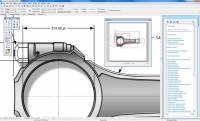
Canvas is the integrated application that accelerates your technical illustration workflow. Professionals in high tech environments that require accurate visualization of technical data rely on Canvas to collaborate and improve productivity. Experience Canvas 12, the preferred solution for technical illustration in precision industries like aerospace, biotechnology, education, government, manufacturing, oil, gas and technology. ...
type: Shareware ($899.00)
Download ACDSee Canvas 12 with GIS+categories: Technical illustration, CAD, precision drawing, aerospace, biotechnology manufacturing, oil, gas, vector, raster, WebCGM, CGM, CGM4, flowchart, GIS, visualization, technical graphics, dimensioning, IEEE Add to Download Basket Report virus or spyware |
 [ Zoom screenshot ] |
|
| Software Info | |
|
Best Vista Download periodically updates pricing and software information of ACDSee Canvas 12 with GIS+ full version from the publisher,
but some information may be out-of-date. You should confirm all information. Software piracy is theft, using crack, warez passwords, patches, serial numbers, registration codes, key generator, keymaker or keygen for ACDSee Canvas 12 with GIS+ license key is illegal and prevent future development of ACDSee Canvas 12 with GIS+. Download links are directly from our mirrors or publisher's website, ACDSee Canvas 12 with GIS+ torrent files or shared files from rapidshare, yousendit or megaupload are not allowed! |
|
| Released: | October 15, 2010 |
| Filesize: | 130.00 MB |
| Language: | English |
| Platform: | Windows 7 x32, Windows 7 x64, Windows Vista, Windows Vista x64, Windows XP |
| Requirements: | Pentium 4, 512MB RAM, 700MB HD, 1024x768res, DVD drive |
| Install | Install and Uninstall |
| Add Your Review or Windows Vista Compatibility Report |
ACDSee Canvas 12 with GIS+- Releases History |
| Software: | ACDSee Canvas 12 with GIS+ 12.00.1389 |
| Date Released: | Oct 15, 2010 |
| Status: | New Release |
| Release Notes: | 3D View, Geometric Import/Export, New Vector Drawing Tools, Automatic Flowcharting Tools, Symbol Pen |
Most popular gis map in Other downloads for Vista |
|
WeatherStudio 2 download by PaulMarv Software
... data, products, maps, and charts into a single map that the user can pan and zoom. GFS/NDFD/NAM/RAP Model Data, Placefiles, Radar Loops, Satellite, Storm Reports, Hurricane Paths, Surface Observations, Watches/Warnings, ...
type: Shareware ($80.00)
View Details
Download
categories: weather, weather tracking software, storm tracking software, weather data, noaa, nws, radar, satellite, software, hurricanes, storms, blizzards, graphics, animations, meteorology, storm chasing, tornadoes, severe weather, spotter, placefiles, model data, GFS, NAM, RAP |
 |
|
ACDSee Canvas 12 with GIS+ 12.00.1389 download by ACD Systems
... manufacturing, oil, gas and energy, and technology. Canvas’ GIS+ module, included in this evaluation version, offers a powerful set of GIS-based tools and commands that support all leading GIS formats, define complex map projections, and perform advanced ...
type: Shareware ($899.00)
View Details
Download
categories: Technical illustration, CAD, precision drawing, aerospace, biotechnology manufacturing, oil, gas, vector, raster, WebCGM, CGM, CGM4, flowchart, GIS, visualization, technical graphics, dimensioning, IEEE |
|
uDig 2.0.0 download by Jody Garnett
... to provide a complete Java solution for desktop GIS data access, editing, and viewing. uDig aims to ... User friendly, providing a familiar graphical environment for GIS users; Desktop located, running as a thick ...
type: Open Source
View Details
Download
categories: spatial data viewer, spatial data editor, geospatial application, uDig, spatial data, viewer |
 |
|
uDig x64 1.4.0 download by Jody Garnett
... to provide a complete Java solution for desktop GIS data access, editing, and viewing. uDig aims to ... User friendly, providing a familiar graphical environment for GIS users; Desktop located, running as a thick ...
type: Open Source
View Details
Download
categories: x64 spatial data viewer, x64 spatial data editor, x64 geospatial application, uDig x64, spatial data, x64 viewer, x64 |
 |
|
TatukGIS Viewer 5.83.0.3269 download by TatukGIS
TatukGIS Viewer: A Comprehensive GIS Solution for Professionals and Enthusiasts TatukGIS Viewer, ... application designed to cater to both professionals and GIS enthusiasts. This free, feature-rich software offers an impressive ... is built to handle a wide range of GIS data formats, ensuring seamless integration and compatibility with ...
type: Freeware
View Details
Download
categories: TatukGIS Viewer, download TatukGIS Viewer, TatukGIS Viewer free download, raster image Viewer, GIS editor, GIS map, viewer, graphic, view, edit |
 |
