Related Keywords
gis data downloadsgis data analysis downloads
x64 gis data downloads
gis downloads
gis technology downloads
gis map downloads
gis mapping software downloads
gis sdk downloads
gis software downloads
gis translator downloads
gis convertor downloads
gis calculator downloads
gis icons downloads
gis maps downloads
gis editor downloads
gis viewer downloads
gis imagery downloads
gis analysis downloads
gis designer downloads
gis catalog downloads
Top Software Keywords
autocad downloadscad downloads
3d cad downloads
drawing downloads
import downloads
design downloads
dwg downloads
pdf to dwg downloads
dxf downloads
convert downloads
convert pdf to dwg downloads
dwg to pdf downloads
converter downloads
dxf to pdf downloads
pdf to dxf downloads
dwf to dwg downloads
dwg to dxf downloads
dwg converter downloads
dwg to jpg downloads
dwg to bmp downloads
stl downloads
dxf to pcl downloads
dwg to tiff downloads
intellicad downloads
pdf to cad downloads
dwg to gif downloads
convert dwg to pdf downloads
dwg to png downloads
dwg to dwf downloads
dxf to ps downloads
Vista Download
Vista downloadVista antivirus download
Vista wallpaper download
Vista wallpapers download
Vista themes download
Vista pack download
Vista ultimate download
Vista home download
Vista basic download
Vista business download
Vista x64 download
Vista transformation download
Vista transformation pack download
Vista boot download
Vista dvd download
Vista sidebar download
Vista aero download
Vista product key download
Downloads RSS
Top Downloads
Top Rated
Navigation: Home
\ Graphic Apps
\ CAD \ ArcReader
ArcReader10.5.0 B6491 by ESRI |

|
Software Description:
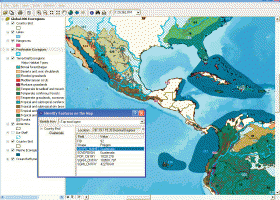
ArcReader is a free, easy-to-use desktop mapping application that allows users to view, explore, and print maps and globes. ArcReader is a free and easy-to-use application that allows users to view and print maps that are published as Published Map Files (PMF) by the ArcGIS Publisher extension to ArcView, ArcEditor, and ArcInfo. ...
Download ArcReaderAdd to Download Basket Report virus or spyware |
 [ Zoom screenshot ] |
|
| Software Info | |
|
Best Vista Download periodically updates pricing and software information of ArcReader full version from the publisher,
but some information may be out-of-date. You should confirm all information. Software piracy is theft, using crack, warez passwords, patches, serial numbers, registration codes, key generator, keymaker or keygen for ArcReader license key is illegal and prevent future development of ArcReader. Download links are directly from our mirrors or publisher's website, ArcReader torrent files or shared files from rapidshare, yousendit or megaupload are not allowed! |
|
| Released: | February 02, 2017 |
| Filesize: | 444.00 MB |
| Platform: | Windows XP, Windows Vista, Windows Vista x64, Windows 7, Windows 7 x64, Windows 8, Windows 8 x64 |
| Install | Instal And Uninstall |
| Add Your Review or Windows Vista Compatibility Report |
ArcReader- Releases History |
| Software: | ArcReader 10.5.0 B6491 |
| Date Released: | Feb 2, 2017 |
| Status: | New Release |
| Software: | ArcReader 10.4 B5524 |
| Date Released: | Apr 10, 2016 |
| Status: | New Release |
| Software: | ArcReader 10.3 B4332 |
| Date Released: | Jan 2, 2015 |
| Status: | New Release |
Most popular gis data in CAD downloads for Vista |
|
IrriPro 3.1 download by Irriworks
... possible, thanks to the INDO technology (Irrigation Network Data Object) developed by Irriworks, to draw the elements ... as objects containing hydraulic characteristics, geometries, materials and GIS informations obtained by Google Earth. Thanks to IrriPro's ...
View Details
Download
|
 |
|
wxGIS Portable 0.4.1 download by Dmitry Barishnikov
... utility and a tool for correcting the orthographic data from raster TIFF files. ...
type: Open Source
View Details
Download
categories: GIS catalog, manage geography data, geographic coordinate system, manage, catalog, geography |
 |
|
Virtual Terrain Project for Windows 1.1 110804 download by Ben Discoe
... a synergetic convergence of the fields of CAD, GIS, visual simulation, surveying and remote sensing. VTP gathers information and tracks progress in areas such as procedural scene construction, feature extraction, ...
type: Open Source
View Details
Download
categories: libraries, demos, data, open source, VirtualTerrain Project, CAD, GIS, VTP |
 |
|
Woodland Potential Calculator 2.01 download by Michell Computing
Woodland Potential Calculator was specially developed as a data collection and presentation instrument. It is designed ... across the north west of England. The data was sub-divided into sub-regions by landscape type using ...
type: Open Source
View Details
Download
categories: calculate potential, tree cover, potential calculation, calculator, potential, tree |
 |
|
wxGIS 0.2.0 download by Dmitry Barishnikov
... utility and a tool for correcting the orthographic data from raster TIFF files. ...
type: Open Source
View Details
Download
categories: GIS catalog, manage geography data, geographic coordinate system, manage, catalog, geography |
 |
|
JMARS for Windows 3.1.5 download by Arizona State University
... Space Flight Facility to provide mission planning and data-analysis tools to NASA's orbiters, instrument team members, students ... to more than a terabyte of NASA orbiter data, and has basic image and vector processing features ...
type: Freeware
View Details
Download
categories: mission analysis, geospatial information, GIS analysis, mission, analysis, GIS |
 |
|
WindRose PRO 3.1.54.0 download by Enviroware s.r.l.
... software for plotting wind roses and other directional data. Data can be loaded as comma separated values (CSV) ... DXF format for CAD environments, as shapefiles for GIS environments and as KML files for Google Earth. ...
type: Trialware ($99.00)
View Details
Download
categories: plot wind rose, save plot, plot directional data, plot, wind rose, directional |
 |
|
Thuban for Windows 1.2.2 download by Thuban Development Team
Thuban is an interactive geographic data viewer (GIS viewer) which features methods to visualize, ... geographic information. Thuban is an Interactive Geographic Data Viewer with the following features: # Vector ...
type: Open Source
View Details
Download
categories: geographic data viewer, gis viewer, analyze geographic information, information, geographic, viewer |
 |
|
ArcReader 10.5.0 B6491 download by ESRI
... PMF files preserve a live connection to the data, so the user's data view is always dynamic. ArcReader significantly increases ... that was once limited to those with advanced GIS software on their computers. With ArcReader, you ...
View Details
Download
|
 |
|
TNTmips 20240404 download by MicroImages, Inc.
... you work with virtually any type of geospatial data including imagery, terrain surfaces, and map data with associated database attributes. It provides all the tools you need ... georeference, interpret, and publish any type of geospatial data. TNTmips provides professional geospatial tools in a single ...
type: Freeware
View Details
Download
categories: GIS data analysis, analyze geodetic data, edit GIS dataset, GIS, dataset, editor, analysis |
 |