Related Keywords
for downloadsfor c c downloads
for each backup for security backup downloads
for kids downloads
for ipod downloads
for free downloads
for windows downloads
for children downloads
for 2 year olds downloads
for autocad downloads
for webnative downloads
for mac downloads
for woman downloads
for sale by owner downloads
for sale downloads
for mobile downloads
for windows xp downloads
for vista downloads
for psp downloads
for ms excel downloads
Top Software Keywords
autocad downloads3d cad downloads
cad downloads
drawing downloads
import downloads
design downloads
dwg downloads
pdf to dwg downloads
dxf downloads
convert downloads
convert pdf to dwg downloads
dwg to pdf downloads
dxf to pdf downloads
converter downloads
pdf to dxf downloads
dwf to dwg downloads
dwg converter downloads
dwg to dxf downloads
dwg to jpg downloads
dwg to bmp downloads
stl downloads
dxf to pcl downloads
dwg to tiff downloads
intellicad downloads
pdf to cad downloads
dwg to gif downloads
convert dwg to pdf downloads
dwg to png downloads
dwg to dwf downloads
dxf to ps downloads
Vista Download
Vista downloadVista antivirus download
Vista wallpaper download
Vista wallpapers download
Vista themes download
Vista pack download
Vista ultimate download
Vista home download
Vista basic download
Vista business download
Vista x64 download
Vista transformation download
Vista transformation pack download
Vista boot download
Vista dvd download
Vista sidebar download
Vista aero download
Vista product key download
Downloads RSS
Top Downloads
Top Rated
Navigation: Home
\ Graphic Apps
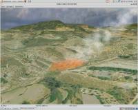
\ CAD \ Virtual Terrain Project for Windows
Virtual Terrain Project for Windows1.1 110804 by Ben Discoe |

|
Software Description:
... VTP is to foster the creation of tools for easily constructing any part of the real world in interactive, 3D digital form.This goal will require a synergetic convergence of the fields of CAD, GIS, visual simulation, surveying and remote sensing. VTP gathers information and tracks progress in areas such as procedural scene construction, feature extraction, and rendering algorithms. ...
type: Open Source
Download Virtual Terrain Project for Windowscategories: libraries, demos, data, open source, VirtualTerrain Project, CAD, GIS, VTP Add to Download Basket Report virus or spyware |
 [ Zoom screenshot ] |
|
| Software Info | |
|
Best Vista Download periodically updates pricing and software information of Virtual Terrain Project for Windows full version from the publisher,
but some information may be out-of-date. You should confirm all information. Software piracy is theft, using crack, warez passwords, patches, serial numbers, registration codes, key generator, keymaker or keygen for Virtual Terrain Project for Windows license key is illegal and prevent future development of Virtual Terrain Project for Windows. Download links are directly from our mirrors or publisher's website, Virtual Terrain Project for Windows torrent files or shared files from rapidshare, yousendit or megaupload are not allowed! |
|
| Released: | September 08, 2011 |
| Filesize: | 1.00 MB |
| Platform: | Windows 2000, Windows 2003, Windows XP, Windows Vista |
| Install | Instal And Uninstall |
| Add Your Review or Windows Vista Compatibility Report |
Virtual Terrain Project for Windows- Releases History |
| Software: | Virtual Terrain Project for Windows 1.1 110804 |
| Date Released: | Sep 8, 2011 |
| Status: | New Release |
| Release Notes: | Enviro: Exposed support for more stereo modes: Horizontal and Vertical split. Options to enable joystick and spacenavigator, rather than just always using them if present. Smooth continuous update when making buildings. Option to constrain building point to right angles. Deter user from making bad points. Made support for Collada (.dae) more explicit in the UI. Display the version number in the startup dialog. Added 'every N meters' option to Contour dialog, making it significantly more useful. Changed 'Move' mode to use Alt modifier key for up/down, to be consistent. Fixed issues with: support for elevation grids with non-unit vertical scale; removing layers from a terrain; saving snapshot and high-resolution snapshot; buildings with a Geographic CRS; draping of 2D polylines on terrain with vertical exaggeration. VTBuilder: Raw layers: Draw polygon holes as dotted lines to tell them from outer edges. |
Most popular for in CAD downloads for Vista |
|
Fourier Transform Lab Student Edition 1.2 download by JCrystalSoft
... Lab Student Edition is an advanced application designed for performing Fourier transformations, which can be useful in ... usefulness of processing images in the frequency domain for certain band filters etc. FEATURES: Forward ...
type: Freeware
View Details
Download
categories: Fourier transformation, Fourier analysis, image histogram, Fourier, transformation, histogram |
 |
|
Fun3D 1.0.4.15 Beta download by Bojan Mitrovic
... software created in Visual Basic (Visual Studio 2005) for inspecting 3d functions, parametric surfaces, 3d curves, cellular ... on Conaway Game of Life) L-Systems (also used for IFS) ISO Surfaces Cracking Structures Packing Structures Affine ...
type: Open Source
View Details
Download
categories: 3D function editor, function inspector, 3D curve, 3D function, function, curve |
 |
|
GraphPad Prism 10.3.1.509 download by GraphPad Software
... Software, stands out as a premier tool tailored for scientific research and data analysis. This versatile software ... sophisticated statistical analysis, making it an indispensable asset for researchers, biologists, and data analysts. One of ...
type: Trialware
View Details
Download
categories: GraphPad Prism, download GraphPad Prism, GraphPad Prism free download, graph creator, create curve, statistical analysis, statistics, regression, biostatistics, interpolation |
 |
|
iTrain 5.1.10 download by Xander Berkhout
... layout and keep control of the rest yourself. For example, automatic block control avoids collisions and you ... is fully scalable with an optional layout overview for large layouts, and allows different tabs for different ...
type: Trialware ($229.00)
View Details
Download
categories: railroad controller, manage railroad, track route, controller, railroad, tracker |
 |
|
GPS Utility 5.51 download by GPS Utility Ltd.
... available and can be transferred into other programs for analysis (i.e. spreadsheet programs). By using a ... moving map display. An interface monitor is available for diagnostic purposes such as logging NMEA sentences. You ...
type: Demo ($60.00)
View Details
Download
categories: Waypoint Manager, GPS Receiver, Digitise GPS, Waypoint, GPD, Digitise |
 |
|
DSI Studio .59 download by Fang-Cheng Yeh
DSI Studio is a software for diffusion MRI processing, including DTI, DSI, and QBI ... and/or regions of avoidace. · Supported file format for input ROI: text file, Analyze, NIFTI · Supported ...
View Details
Download
|
 |
|
Fun3D Portable 1.0.4.15 Beta download by Bojan Mitrovic
... software created in Visual Basic (Visual Studio 2005) for inspecting 3d functions, parametric surfaces, 3d curves, cellular ... on Conaway Game of Life) L-Systems (also used for IFS) ISO Surfaces Cracking Structures Packing Structures Affine ...
type: Open Source
View Details
Download
categories: 3D function editor, function inspector, 3D curve, 3D function, function, curve |
 |
|
Energy2D 2.6 download by Concord Consortium
... it more general and to provide sensor interfaces for creating mixed-reality applications. Energy2D may be useful in ... Energy2D can be used as a standalone application for creating energy simulations. Your simulations can be deployed ...
type: Open Source
View Details
Download
categories: heat flow simulation, simulate mass flow, analyze heat flow, simulate, simulator, simulation |
 |
|
Monterey ROV Controller 2.0.2 Beta download by Chris Konstad
... been specially written to be easy-to-use and modify. For controlling the ROV, a wide variety of joysticks are supported through the SDL library. FEATURES: · Cross-platform ROV controller ...
View Details
Download
|
|
BricsCad Classic 24.2.06-1 download by Bricsys Inc.
... Cycling through entities during selection. · Hot Grip for multiple grip point modifications. · Snap Tracking with parallel alignment to Z-axis. · Snap option for user-defined offsets. · Creation of Gradient Hatches. · ...
View Details
Download
|
 |