Related Keywords
file mapping downloadsmapping downloads
mapping software downloads
mapping utility downloads
mapping icons downloads
mapping distances downloads
mapping delphi components downloads
mapping data downloads
mapping maps downloads
mapping csv to xml downloads
mapping specification downloads
file properties changer creation date last access date last modification date file attributes file name extension downloads
file search file finder downloads
file to file downloads
file in file downloads
file rename change file name downloads
file folders multiple file folders downloads
file downloads
file transfer downloads
file attribute downloads
Top Software Keywords
autocad downloadscad downloads
3d cad downloads
drawing downloads
import downloads
design downloads
dwg downloads
pdf to dwg downloads
dxf downloads
convert downloads
convert pdf to dwg downloads
dwg to pdf downloads
dxf to pdf downloads
converter downloads
pdf to dxf downloads
dwf to dwg downloads
dwg to dxf downloads
dwg converter downloads
dwg to jpg downloads
dwg to bmp downloads
stl downloads
dxf to pcl downloads
dwg to tiff downloads
intellicad downloads
pdf to cad downloads
dwg to gif downloads
convert dwg to pdf downloads
dwg to png downloads
dwg to dwf downloads
dxf to ps downloads
Vista Download
Vista downloadVista antivirus download
Vista wallpaper download
Vista wallpapers download
Vista themes download
Vista pack download
Vista ultimate download
Vista home download
Vista basic download
Vista business download
Vista x64 download
Vista transformation download
Vista transformation pack download
Vista boot download
Vista dvd download
Vista sidebar download
Vista aero download
Vista product key download
Downloads RSS
Top Downloads
Top Rated
Navigation: Home
\ Graphic Apps
\ CAD \ GPS Utility
GPS Utility5.51 by GPS Utility Ltd. |

|
Software Description:
GPS Utility can also be set to gather the current position at regular time intervals and to show the position on a moving map display. An interface monitor is available for diagnostic purposes such as logging NMEA sentences. You can also show the current position, time, speed, course on the Position Console. ...
type: Demo ($60.00)
Download GPS Utilitycategories: Waypoint Manager, GPS Receiver, Digitise GPS, Waypoint, GPD, Digitise Buy Now Add to Download Basket Report virus or spyware |
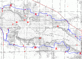 [ Zoom screenshot ] |

|
|
| Software Info | |
|
Best Vista Download periodically updates pricing and software information of GPS Utility full version from the publisher,
but some information may be out-of-date. You should confirm all information. Software piracy is theft, using crack, warez passwords, patches, serial numbers, registration codes, key generator, keymaker or keygen for GPS Utility license key is illegal and prevent future development of GPS Utility. Download links are directly from our mirrors or publisher's website, GPS Utility torrent files or shared files from rapidshare, yousendit or megaupload are not allowed! |
|
| Website: | GPS Utility Ltd. - GPS Utility homepage |
| Released: | August 19, 2023 |
| Filesize: | 2.30 MB |
| Platform: | Windows XP, Windows Vista, Windows Vista x64, Windows 7, Windows 7 x64, Windows 8, Windows 8 x64, Windows 10, Windows 10 x64, Windows 11 |
| Install | Instal And Uninstall |
| Add Your Review or Windows Vista Compatibility Report |
GPS Utility- Releases History |
| Software: | GPS Utility 5.51 |
| Date Released: | Aug 19, 2023 |
| Status: | New Release |
| Software: | GPS Utility 5.50 |
| Date Released: | Apr 1, 2023 |
| Status: | New Release |
| Software: | GPS Utility 5.41 |
| Date Released: | Apr 14, 2022 |
| Status: | New Release |
Most popular file mapping in CAD downloads for Vista |
|
QFitsView 8.6 download by Eric Mandel
... analyzing astronomical images, supporting a wide array of file formats including FITS, which is the standard in ... in the study of the cosmos. Whether you're mapping the intricate structures of a nebula or analyzing ...
type: Open Source
View Details
Download
categories: data visualization, image analysis, Colormap Analysis, Astronomy, SAOImage DS9 free download, astronomy, Astronomy Visualization, software tool, download SAOImage DS9, Colormap, Eric Mandel, FITS, SAOImage DS9, Frame, FITS Viewer |
 |
|
GPS Utility 5.51 download by GPS Utility Ltd.
... GPS receiver and store the data in PC files in one of several text formats. The ... Route cards. GPS Utility supports many import/export file formats. This makes it easy to transfer data ...
type: Demo ($60.00)
View Details
Download
categories: Waypoint Manager, GPS Receiver, Digitise GPS, Waypoint, GPD, Digitise |
 |
|
PotterDraw 1.0.02.000 download by CKCI
... palette using various patterns, or a user-specified image file can be texture-mapped via trigonometric functions. Export 3D models as color PLY file, monochrome STL file, or Wavefront OBJ file. PLY export supports both ...
type: Freeware
View Details
Download
categories: CAD, 3D design, 3D printing, 3D graphics, 3D animation, pottery, ceramics, texture mapping, mesh generation, visualization, simulation |
 |
|
Doodles 3D 0.76 download by Luigi Pino
... You can save the points to a text file that can be easily modified with a basic text editor. ...
type: Freeware
View Details
Download
categories: create 3D model, doodle creator, shape designer, create, design, designed |
 |
|
QGIS 3.36.1 download by Gary Sherman
... formats support by the OGR library · MapInfo files · GRASS integration, including view, edit, and analysis ... and multiband RGB) · Export to Mapserver map file · Digitizing support · Map overview · Plugins ...
type: Open Source
View Details
Download
categories: geographic information system, map creator, map viewer, GIS, geographic information, create, QGIS |
 |