Related Keywords
file attribute downloadsfile attribute modification downloads
file attribute setting downloads
modify file attribute downloads
change file attribute downloads
change file attribute x64 downloads
attribute sparse file downloads
attribute downloads
attribute extraction downloads
attribute extractor downloads
attribute changer downloads
attribute values downloads
attribute remover downloads
attribute edit downloads
attribute editor downloads
attribute x64 downloads
file search file finder downloads
file to file downloads
file in file downloads
file rename change file name downloads
Top Software Keywords
autocad downloads3d cad downloads
cad downloads
drawing downloads
import downloads
design downloads
dwg downloads
pdf to dwg downloads
dxf downloads
convert downloads
convert pdf to dwg downloads
dwg to pdf downloads
dxf to pdf downloads
converter downloads
pdf to dxf downloads
dwf to dwg downloads
dwg to dxf downloads
dwg converter downloads
dwg to jpg downloads
dwg to bmp downloads
stl downloads
dxf to pcl downloads
dwg to tiff downloads
intellicad downloads
pdf to cad downloads
dwg to gif downloads
convert dwg to pdf downloads
dwg to png downloads
dwg to dwf downloads
dxf to ps downloads
Vista Download
Vista downloadVista antivirus download
Vista wallpaper download
Vista wallpapers download
Vista themes download
Vista pack download
Vista ultimate download
Vista home download
Vista basic download
Vista business download
Vista x64 download
Vista transformation download
Vista transformation pack download
Vista boot download
Vista dvd download
Vista sidebar download
Vista aero download
Vista product key download
Top Downloads
Top Rated
Navigation: Home
\ Graphic Apps
\ CAD \ QGIS
QGIS3.36.1 by Gary Sherman |

|
Software Description:
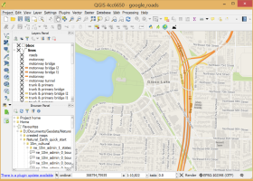
QGIS supports vector, raster, and database formats and lets you browse and create map data on your computer.QGIS supports many common spatial data formats (e.g. ESRI ShapeFile, geotiff). QGIS supports plugins to do things like display tracks from your GPS. QGIS aims to be an easy to use GIS, providing common functions and features. The initial goal was to provide a GIS data viewer. ...
type: Open Source
Download QGIScategories: geographic information system, map creator, map viewer, GIS, geographic information, create, QGIS Add to Download Basket Report virus or spyware |
 [ Zoom screenshot ] |
|
| Software Info | |
|
Best Vista Download periodically updates pricing and software information of QGIS full version from the publisher,
but some information may be out-of-date. You should confirm all information. Software piracy is theft, using crack, warez passwords, patches, serial numbers, registration codes, key generator, keymaker or keygen for QGIS license key is illegal and prevent future development of QGIS. Download links are directly from our mirrors or publisher's website, QGIS torrent files or shared files from rapidshare, yousendit or megaupload are not allowed! |
|
| Released: | March 26, 2024 |
| Filesize: | 1000.00 MB |
| Platform: | Windows XP, Windows Vista, Windows Vista x64, Windows 7, Windows 7 x64, Windows 8, Windows 8 x64, Windows 10, Windows 10 x64, Windows 11 |
| Install | Instal And Uninstall |
| Add Your Review or Windows Vista Compatibility Report |
QGIS- Releases History |
| Software: | QGIS 3.36.1 |
| Date Released: | Mar 26, 2024 |
| Status: | New Release |
| Software: | QGIS 3.36.2 |
| Date Released: | Apr 25, 2024 |
| Status: | New Release |
| Software: | QGIS 3.36.1 |
| Date Released: | Mar 26, 2024 |
| Status: | New Release |
Most popular file attribute in CAD downloads for Vista |
|
Gephi 0.10.1 download by Mathieu Bastian
... component. · Import temporal graph with the GEXF file format · Graph streaming ready Create cartography: ... or network traffic graphs. Aggregate networks using data attributes or use built-in clustering algorithm. · Expand and ...
type: Open Source
View Details
Download
categories: interactive visualization, exploration platform, visualization platform, visualization, exploration, graph |
 |
|
CADopia 23 Professional 22.3.1.4100 download by CADopia
... DWG conversion, voice notes, and support for DGN files as underlays in addition to all standard drawing ... CAD functionality: AutoCAD 2.5-2018 DWG Support Microstation DGN file Underlays A comprehensive suite of drafting, design, and ...
type: Demo ($745.00)
View Details
Download
categories: corelcad, autocad, intellicad, bricscad, progecad, draftsight, zwcad, ARES Commander, dwg viewer, drawing viewer, drawing, dxf, dwg, survey, CAD, drafting, BIM, Revit, fusion 360 |
 |
|
CADopia 23 Standard 22.3.1.4100 download by CADopia
... DWG conversion, voice notes, and support for DGN files as underlays in addition to all standard drawing ... AutoCAD 2.5-2018 DWG Support Export Adobe Acrobat (PDF) files from your drawings Import PDF files and save ...
type: Demo ($595.00)
View Details
Download
categories: corelcad, autocad, intellicad, bricscad, progecad, draftsight, zwcad, dwg viewer, drawing viewer, drawing, dxf, dwg, survey, CAD, drafting |
 |
|
QGIS 3.36.1 download by Gary Sherman
... formats support by the OGR library · MapInfo files · GRASS integration, including view, edit, and analysis ... · Map composer · Identify features · Display attribute table · Select features · Label features · ...
type: Open Source
View Details
Download
categories: geographic information system, map creator, map viewer, GIS, geographic information, create, QGIS |
 |