Related Keywords
fields downloadsfields rivers screensaver downloads
fields of wheat downloads
fields separation downloads
fields of gold downloads
asterisks fields downloads
password fields downloads
export outlook custom fields downloads
export custom fields downloads
import outlook custom fields downloads
text fields downloads
data fields downloads
compare dbf fields downloads
custom fields downloads
form fields downloads
save form fields downloads
filling xfa fields in pdf downloads
scripts and fields downloads
export fields downloads
key fields downloads
Top Software Keywords
autocad downloadscad downloads
3d cad downloads
drawing downloads
import downloads
design downloads
dwg downloads
pdf to dwg downloads
dxf downloads
convert downloads
convert pdf to dwg downloads
dwg to pdf downloads
dxf to pdf downloads
converter downloads
pdf to dxf downloads
dwf to dwg downloads
dwg to dxf downloads
dwg converter downloads
dwg to jpg downloads
dwg to bmp downloads
stl downloads
dxf to pcl downloads
dwg to tiff downloads
intellicad downloads
pdf to cad downloads
dwg to gif downloads
convert dwg to pdf downloads
dwg to png downloads
dwg to dwf downloads
dxf to ps downloads
Vista Download
Vista downloadVista antivirus download
Vista wallpaper download
Vista wallpapers download
Vista themes download
Vista pack download
Vista ultimate download
Vista home download
Vista basic download
Vista business download
Vista x64 download
Vista transformation download
Vista transformation pack download
Vista boot download
Vista dvd download
Vista sidebar download
Vista aero download
Vista product key download
Downloads RSS
Top Downloads
Top Rated
Navigation: Home
\ Graphic Apps
\ CAD \ Virtual Terrain Project for Windows
Virtual Terrain Project for Windows1.1 110804 by Ben Discoe |

|
Software Description:
... goal will require a synergetic convergence of the fields of CAD, GIS, visual simulation, surveying and remote sensing. VTP gathers information and tracks progress in areas such as procedural scene construction, feature extraction, and rendering algorithms. ...
type: Open Source
Download Virtual Terrain Project for Windowscategories: libraries, demos, data, open source, VirtualTerrain Project, CAD, GIS, VTP Add to Download Basket Report virus or spyware |
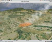 [ Zoom screenshot ] |
|
| Software Info | |
|
Best Vista Download periodically updates pricing and software information of Virtual Terrain Project for Windows full version from the publisher,
but some information may be out-of-date. You should confirm all information. Software piracy is theft, using crack, warez passwords, patches, serial numbers, registration codes, key generator, keymaker or keygen for Virtual Terrain Project for Windows license key is illegal and prevent future development of Virtual Terrain Project for Windows. Download links are directly from our mirrors or publisher's website, Virtual Terrain Project for Windows torrent files or shared files from rapidshare, yousendit or megaupload are not allowed! |
|
| Released: | September 08, 2011 |
| Filesize: | 1.00 MB |
| Platform: | Windows 2000, Windows 2003, Windows XP, Windows Vista |
| Install | Instal And Uninstall |
| Add Your Review or Windows Vista Compatibility Report |
Virtual Terrain Project for Windows- Releases History |
| Software: | Virtual Terrain Project for Windows 1.1 110804 |
| Date Released: | Sep 8, 2011 |
| Status: | New Release |
| Release Notes: | Enviro: Exposed support for more stereo modes: Horizontal and Vertical split. Options to enable joystick and spacenavigator, rather than just always using them if present. Smooth continuous update when making buildings. Option to constrain building point to right angles. Deter user from making bad points. Made support for Collada (.dae) more explicit in the UI. Display the version number in the startup dialog. Added 'every N meters' option to Contour dialog, making it significantly more useful. Changed 'Move' mode to use Alt modifier key for up/down, to be consistent. Fixed issues with: support for elevation grids with non-unit vertical scale; removing layers from a terrain; saving snapshot and high-resolution snapshot; buildings with a Geographic CRS; draping of 2D polylines on terrain with vertical exaggeration. VTBuilder: Raw layers: Draw polygon holes as dotted lines to tell them from outer edges. |
Most popular fields in CAD downloads for Vista |
|
Open3DQSAR 2.24 download by Paolo Tosco
... exploration by high-throughput chemometric analysis of molecular interaction fields (MIFs). Open3DQSAR can generate steric potential, electron density and MM/QM electrostatic potential fields; furthermore, it can import GRIDKONT binary files produced by GRID and CoMFA/CoMSIA fields (exported from SYBYL with the aid of a ...
type: Open Source
View Details
Download
categories: chemometric analysis, analyze MIF, pharmacophore exploration, MIF, analysis, chemometry |
 |
|
TriSpace 2021.24.3.652 download by GEOSTRU
... program becomes a useful tool both in geological fields due to the extreme facility in creation of longitudinal sections, as in the more strictly topographical one as it imposes no ...
type: Trialware ($500.00)
View Details
Download
categories: Terrain Calculation, 3D Terrain Viewer, View 3D Surface, Calculation, Terrain, Surface |
 |
|
Gnuplot for Windows 5.2.7 download by Philipp K. Janert
... can draw using lines, points, boxes, contours, vector fields, surfaces, and various associated text. It also supports various specialized plot types. Gnuplot supports many different types of output: interactive ...
type: Open Source
View Details
Download
categories: portable, Gnuplot, Gnu plot, utility, graph plotter, plot graph, plotter, graph |
 |
|
TriSpace 2021.24.3.652 download by GEOSTRU
... program becomes a useful tool both in geological fields due to the extreme facility in creation of longitudinal sections, as in the more strictly topographical one as it imposes no ...
type: Trialware ($500.00)
View Details
Download
categories: Terrain Calculation, 3D Terrain Viewer, View 3D Surface, Calculation, Terrain, Surface |
 |
|
WindRose PRO 3.1.54.0 download by Enviroware s.r.l.
... Meteorological Year files (TMY2 and TMY3) Loads ASCII fields delimited files Loads Microsoft Excel files (XLS and XLSX) Loads NOAA ISH (Integrated Surface Hourly) or ISD (Integrated Surface Data) Loads ...
type: Trialware ($99.00)
View Details
Download
categories: plot wind rose, save plot, plot directional data, plot, wind rose, directional |
 |
|
BricsCad Classic 24.2.06-1 download by Bricsys Inc.
... Export plot style tables · Gradient Hatches · Fields in Multiline Text · Reference Editing · Multiline ... Trim improvements. · Wide range of variables with Fields in multiline texts. · Drawing password protection. · ...
View Details
Download
|
 |
|
Amira 2019.2 download by Visage Imaging, Inc.
... · Multichannel imaging · Image fusion · Vector fields · Tensors · Filament tracing · Spatial grids · Molecular visualization Analyze: · Measurement tools · Tissue statistics · Co-localization ...
type: Trialware
View Details
Download
categories: 3D visualization platform, medical data viewer, Life Science visualizer, 3D visualization, Life Science, medical data |
|
|
AutoFEM Thermal Analysis 1.7 download by AutoFEM Software LLP
... - the calculation of the steady (stationary) temperature fields of structures under the applied thermal boundary conditions; ... time-dependent thermal conductivity - the calculation of temperature fields of construction is dependent on the time, that ...
type: Shareware ($1 495.00)
View Details
Download
categories: autocad, finite element, analysis, stress, frequency, buckling, thermal, strength, force, temperature |
 |
|
Simstat 2.6 download by Kovach Computing Services
... standard DBF files up to 1024 variables (or fields). Can import and export comma or tab separated text files, Paradox, Lotus 1-2-3, Symphony, Excel, Quattro Pro, - SPSS/PC+ and SPSS ...
type: Demo ($695.00)
View Details
Download
categories: statistical analyses, analyze data, data analyzer, statistical, analyses, analyzer |
 |
|
MVSP 3.22 download by Kovach Computing Services
... of multivariate numerical analyses useful in many scientific fields. It calculates three basic types of eigenanalysis ordinations: principal components, principal coordinates, and correspondence/detrended correspondence analyses. MVSP uses the KCS ...
type: Trialware ($165.00)
View Details
Download
categories: numerical analyses, data matrix, matrix transformation, analyses, numerical, matrix |
 |