Related Keywords
dxf to images downloadsdxf to dxf downloads
dxf to pdf downloads
dxf to jpeg downloads
dxf to bmp downloads
dxf to jpg downloads
dxf to dwf downloads
dxf to tiff downloads
dxf to gif downloads
dxf to png downloads
dxf to svg downloads
dxf to wmf downloads
dxf to word downloads
dxf to dwf converter downloads
dxf to dwg downloads
dxf to dwg converter downloads
dxf to dwg conversion downloads
dxf to tif converter downloads
dxf to svg converter downloads
dxf to tiff converter downloads
Top Software Keywords
photoshop downloadsphoto editing downloads
picture downloads
images downloads
graphics downloads
image editing downloads
photos downloads
image editor downloads
image downloads
effects downloads
gif downloads
editor downloads
photo editor downloads
resize downloads
free photo editor downloads
graphic downloads
digital downloads
edit downloads
texture downloads
digital photography downloads
free photo editing software downloads
jpeg downloads
photo downloads
photo editing software downloads
digital photo downloads
photography downloads
jpg downloads
bmp downloads
watermark downloads
batch downloads
Vista Download
Vista downloadVista antivirus download
Vista wallpaper download
Vista wallpapers download
Vista themes download
Vista pack download
Vista ultimate download
Vista home download
Vista basic download
Vista business download
Vista x64 download
Vista transformation download
Vista transformation pack download
Vista boot download
Vista dvd download
Vista sidebar download
Vista aero download
Vista product key download
Downloads RSS
Featured Download

PicaJet FX
Digital photo
management software

AKVIS Enhancer
Photo Enhancement
Software
Top Downloads
Top Rated
Navigation: Home
\ Graphic Apps
\ Editors \ RoboGEO
RoboGEO6.3.2 by Pretek, Inc. |

|
Software Description:
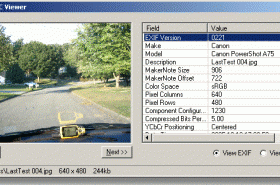
Geotag digital images with latitude, longitude, altitude, and direction information. RoboGEO stamps this information onto the actual photo or writes it to the EXIF headers. In addition, RoboGEO allows you to permanently geotag and link your photos to the GPS coordinates. ...
type: Demo ($79.95)
Download RoboGEOcategories: georeference image, Geographical Information System, geotag EXIF photo, geotag, reference, geocode Add to Download Basket Report virus or spyware |
 [ Zoom screenshot ] |
|
| Software Info | |
|
Best Vista Download periodically updates pricing and software information of RoboGEO full version from the publisher,
but some information may be out-of-date. You should confirm all information. Software piracy is theft, using crack, warez passwords, patches, serial numbers, registration codes, key generator, keymaker or keygen for RoboGEO license key is illegal and prevent future development of RoboGEO. Download links are directly from our mirrors or publisher's website, RoboGEO torrent files or shared files from rapidshare, yousendit or megaupload are not allowed! |
|
| Released: | February 27, 2012 |
| Filesize: | 13.40 MB |
| Platform: | Windows XP, Windows Vista, Windows Vista x64, Windows 7, Windows 7 x64, Windows 8, Windows 8 x64, Windows 10, Windows 10 x64 |
| Install | Instal And Uninstall |
| Add Your Review or Windows Vista Compatibility Report |
RoboGEO- Releases History |
| Software: | RoboGEO 6.3.2 |
| Date Released: | Feb 27, 2012 |
| Status: | New Release |
| Release Notes: | · Added Google Earth polygon file support and the ability to export HTML |
| Software: | RoboGEO 6.3.1 |
| Date Released: | Jan 3, 2012 |
| Status: | New Release |
| Release Notes: | · Added Google Earth polygon file support and the ability to export HTML |
| Software: | RoboGEO 6.3.0 |
| Date Released: | Oct 11, 2011 |
| Status: | New Release |
| Release Notes: | · Added Google Earth polygon file support and the ability to export HTML |
Most popular dxf to images in Editors downloads for Vista |
|
Google SketchUp Pro 2020 download by Google
... automatically in LayOut. When it’s time, export PDFs, images and CAD files. Get good, fast. ... Ready for some alphabet soup? With importers for DXF, DWG, 3DS, DAE, KMZ, TIF, JPG, PNG and ...
type: Shareware ($495.00)
View Details
Download
categories: complete, create, earth, email, files, google, google earth, google earth pro, google sketchup, ideas, process, select, sketchup, time, tool |
 |
|
Vextractor 7.20 download by VextraSoft
Vextractor is a vectorizer program for transforming raster images into vector formats by building centerlines and outlines. ... the vectorizing photo, logotypes and other line art images for use in Vector Graphics Design software. You ...
type: Shareware ($99.95)
View Details
Download
categories: raster to vector, image to vector, raster, vector, vectorise, vectorize, vectorization, vectorizing, trace, convert, conversion, r2v, scan, cad, autocad, dxf, tiff, gif, bmp.jpg, jpeg, polyline, centerline, outline, image, gis, digitize, digitizing |
 |
|
RoboGEO 6.3.2 download by Pretek, Inc.
Geotag digital images with latitude, longitude, altitude, and direction information. RoboGEO stamps this information onto the actual photo or writes it to the EXIF headers. In addition, RoboGEO allows you ...
type: Demo ($79.95)
View Details
Download
categories: georeference image, Geographical Information System, geotag EXIF photo, geotag, reference, geocode |
 |
|
CorelDRAW X5 15.2.0.686 download by Corel Corporation
... templates and learning materials. Find graphics, fonts and images on your computer faster than ever with new ... 2* Content 10,000 high-quality clipart and digital images, 2,000 vehicle templates, 1,000 high-resolution digital photos, 1,000 ...
type: Trialware ($499.00)
View Details
Download
categories: graphic editor, bitmap creation, Vector illustration, Corel, CorelDRAW, graphic, Corel DRAW |
 |
|
WinTopo 1.752 download by SoftSoft
... TIF, JPG, PNG, GIF, BMP files and scanned images into useful vector files suitable for CAD, GIS ... Download it right now and start converting your images with the One-Touch Vectorisation button. Features: Load ...
View Details
Download
|
 |
|
Normica View Pro 2020 download by Normica GmbH | Normica Software
... DWF (Drawing Web Format), SVG (Scalable Vector Graphics), DXF (Drawing eXchange Format); Export to bitmaps: BMP, TIFF, ... results possible, fast. Normica View Pro improves your images. Photographs, drawings and renderings can be imported into ...
type: Demo ($437.00)
View Details
Download
categories: Normica View Pro 2020, PDF, PDF/A, HP-GL/2, HP-GL, RTL, CALS, Bitmaps, BMP, TIFF, JPEG, PNG, View, Check, Analyze, Optimize, Print with any Windows system printer; Plot via LAN and TCP/IP, Export |
 |
|
RasterVect 27.5 download by RasterVect Software
... the converted file as one of vector formats: DXF, WMF, EMF, EPS or AI that can be read by any CAD program that supports these formats, including AutoCAD R14, 2000, ...
type: Trialware ($79.95)
View Details
Download
categories: image, vector, raster, CAD, graphic, Raster Vect, image vectorization, generate vector, vectorize image, rasterization, vectorization, vectorize |
 |