Related Keywords
digital maps downloadsdigital movie video recovery digital audio downloads
maps downloads
maps flash downloads
maps in flash downloads
maps for website downloads
maps puzzle downloads
maps icon downloads
maps icons downloads
maps x64 downloads
maps downloader downloads
digital downloads
digital camera downloads
digital photo downloads
digital photos downloads
digital photography downloads
digital photo software downloads
digital imaging downloads
digital publishing downloads
digital web book downloads
Top Software Keywords
file downloadssecurity downloads
access downloads
web downloads
network downloads
performance downloads
server downloads
windows downloads
iis downloads
active directory downloads
client downloads
ftp downloads
active directory reports downloads
tool downloads
area code downloads
dns downloads
domain name downloads
isp downloads
can t open xls downloads
idd code downloads
password downloads
convert downloads
sql downloads
internet downloads
city downloads
zip code downloads
time zone downloads
isapi downloads
restart downloads
latitude longitude downloads
Vista Download
Vista downloadVista antivirus download
Vista wallpaper download
Vista wallpapers download
Vista themes download
Vista pack download
Vista ultimate download
Vista home download
Vista basic download
Vista business download
Vista x64 download
Vista transformation download
Vista transformation pack download
Vista boot download
Vista dvd download
Vista sidebar download
Vista aero download
Vista product key download
Top Downloads
Top Rated
Navigation: Home
\ Servers
\ Other Server Applications \ Geo Data International Admin
Geo Data International Admin14.02 by Killet Softwareentwicklung GbR |

|
Software Description:
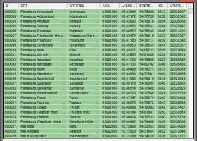
Geodata International is a world-wide database of countries with georeferenced towns, municipalities, postal codes and administrative units with WGS84 and UTM coordinates and ground level elevations for geocoding, proximity search, navigation and distance calculation. ...
type: Demo ($1200.00)
Download Geo Data International Admincategories: International countries, postal codes, geographical longitude, country, postal, code Add to Download Basket Report virus or spyware |
 [ Zoom screenshot ] |
|
| Software Info | |
|
Best Vista Download periodically updates pricing and software information of Geo Data International Admin full version from the publisher,
but some information may be out-of-date. You should confirm all information. Software piracy is theft, using crack, warez passwords, patches, serial numbers, registration codes, key generator, keymaker or keygen for Geo Data International Admin license key is illegal and prevent future development of Geo Data International Admin. Download links are directly from our mirrors or publisher's website, Geo Data International Admin torrent files or shared files from rapidshare, yousendit or megaupload are not allowed! |
|
| Released: | April 27, 2022 |
| Filesize: | 2.30 MB |
| Platform: | Windows XP, Windows Vista, Windows Vista x64, Windows 7, Windows 7 x64, Windows 8, Windows 8 x64, Windows 10, Windows 10 x64, Windows 11 |
| Install | Instal And Uninstall |
| Add Your Review or Windows Vista Compatibility Report |
Geo Data International Admin- Releases History |
| Software: | Geo Data International Admin 14.02 |
| Date Released: | Apr 27, 2022 |
| Status: | New Release |
| Software: | Geo Data International Admin 13.05 |
| Date Released: | Dec 17, 2021 |
| Status: | New Release |
| Software: | Geo Data International Admin 13.03 |
| Date Released: | Apr 15, 2021 |
| Status: | New Release |
| Release Notes: | All databases updated to on status April 2021. Database "Germany" updated on status 1 January 2021. High-resolution country versions without extra charge. Ten new countries added. Google Plus code coordinates added to all data tables. World time UTC_DIF and beginning / end of Daylight Saving Time added. |
Most popular digital maps in Other Server Applications downloads for Vista |
|
Geo Data International Admin 14.02 download by Killet Softwareentwicklung GbR
... of the georeferences business zones, statistics or general maps can be made. Towns, municipalities and postal codes ... deg/min/sec notation. With the elevation data from a Digital Elevation Model the ground level height of each ...
type: Demo ($1 200.00)
View Details
Download
categories: International countries, postal codes, geographical longitude, country, postal, code |
 |