Related Keywords
database tables downloadsconvert database tables downloads
compare database tables downloads
recover access database tables downloads
recover sql database tables downloads
editing oracle database tables downloads
tables downloads
tables in flash downloads
tables records editing downloads
tables scripter downloads
tables and text frames downloads
tables data downloads
tables rows downloads
tables conversion downloads
tables f downloads
tables editor downloads
tables to web page downloads
tables to web site downloads
tables compare downloads
tables viewer downloads
Top Software Keywords
autocad downloads3d cad downloads
cad downloads
drawing downloads
import downloads
design downloads
dwg downloads
pdf to dwg downloads
dxf downloads
convert downloads
convert pdf to dwg downloads
dwg to pdf downloads
dxf to pdf downloads
converter downloads
pdf to dxf downloads
dwf to dwg downloads
dwg to dxf downloads
dwg converter downloads
dwg to jpg downloads
dwg to bmp downloads
stl downloads
dxf to pcl downloads
dwg to tiff downloads
intellicad downloads
pdf to cad downloads
dwg to gif downloads
convert dwg to pdf downloads
dwg to png downloads
dwg to dwf downloads
dxf to ps downloads
Vista Download
Vista downloadVista antivirus download
Vista wallpaper download
Vista wallpapers download
Vista themes download
Vista pack download
Vista ultimate download
Vista home download
Vista basic download
Vista business download
Vista x64 download
Vista transformation download
Vista transformation pack download
Vista boot download
Vista dvd download
Vista sidebar download
Vista aero download
Vista product key download
Top Downloads
Top Rated
Navigation: Home
\ Graphic Apps
\ CAD \ TNTatlas
TNTatlas2024 B20240606 by MicroImages, Inc. |

|
Software Description:
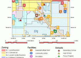
TNTatlas is a powerful free geodata viewer that lets you publish and distribute your maps and geospatial data — from a single geodata file to complex map layouts prepared using TNTmips. TNTatlas lets you display massive sized geodata and will directly display numerous file formats including shapefiles, GeoTIFF, JP2, PNG, MrSID, DXF, and DWG. ...
type: Freeware
Download TNTatlascategories: geospatial viewer, view atlas, visualize geospatial data, atlas, map, viewer Add to Download Basket Report virus or spyware |
 [ Zoom screenshot ] |
|
| Software Info | |
|
Best Vista Download periodically updates pricing and software information of TNTatlas full version from the publisher,
but some information may be out-of-date. You should confirm all information. Software piracy is theft, using crack, warez passwords, patches, serial numbers, registration codes, key generator, keymaker or keygen for TNTatlas license key is illegal and prevent future development of TNTatlas. Download links are directly from our mirrors or publisher's website, TNTatlas torrent files or shared files from rapidshare, yousendit or megaupload are not allowed! |
|
| Released: | June 06, 2024 |
| Filesize: | 59.00 MB |
| Platform: | Windows XP, Windows Vista, Windows Vista x64, Windows 7, Windows 7 x64, Windows 8, Windows 8 x64, Windows 10, Windows 10 x64, Windows 11 |
| Install | Instal And Uninstall |
| Add Your Review or Windows Vista Compatibility Report |
TNTatlas- Releases History |
| Software: | TNTatlas 2024 B202406 |
| Date Released: | Jun 6, 2024 |
| Status: | New Release |
| Software: | TNTatlas 2022 B202212 |
| Date Released: | Dec 7, 2022 |
| Status: | New Release |
| Software: | TNTatlas 2022 B202211 |
| Date Released: | Nov 30, 2022 |
| Status: | New Release |
Most popular database tables in CAD downloads for Vista |
|
TopoLT 15.2 download by CADWARE Engineering
... or in formats defined by user; · coordinates tables for selected points can be created, including a ... automatically according to the codes interpretation file; · tables with areas calculation can be created in the ...
type: Trialware ($600.00)
View Details
Download
categories: topographical plan, cadastral plan, terrain model, topography, cadaster, terrain |
 |
|
TNTatlas 2024 B20240606 download by MicroImages, Inc.
... rapidly assemble and distribute existing electronic map and database materials for those working in natural disaster relief, ... browsed its pages of maps, pictures, and reference tables. Where the map runs off the side of ...
type: Freeware
View Details
Download
categories: geospatial viewer, view atlas, visualize geospatial data, atlas, map, viewer |
 |
|
Maxsurf 17.07 download by Bentley Systems
... is opened in other modules. Designs in the database file are extremely compact making them ideal for ... of curve of areas, upright hydrostatic calculations and tables of offsets. Data exchange is a key requirement ...
View Details
Download
|
 |
|
Archiva 7.7.0.0.001 download by AngelSystems.net Inc.
... list found anywhere can be imported into a database with just a click away. If you have ... Archiva can save almost anything: Scientific Symbols, Pictures, Tables, Spreadsheets and more. With the help of ...
type: Trialware ($29.00)
View Details
Download
categories: reference collection, database backup, collection mangement, collection, archive, collector |
 |
|
GedScape 3.0.01 download by Tenset Technologies Ltd.
... you to rapidly view GEDCOM's without creating other database files on your computer. View indexes of individuals, ... including pedigrees, family charts, descendants charts. Display summary tables of individuals with links to their individual records ...
type: Trialware ($39.00)
View Details
Download
categories: GEDCOM viewer, GEDCOM extractor, GEDCOM browser, GEDCOM, genealogy, family tree |
 |
|
Maxsurf 17.07 download by Bentley Systems
... is opened in other modules. Designs in the database file are extremely compact making them ideal for ... of curve of areas, upright hydrostatic calculations and tables of offsets. Data exchange is a key requirement ...
View Details
Download
|
 |
|
QGIS 3.36.1 download by Gary Sherman
... Software (FOSS). QGIS supports vector, raster, and database formats and lets you browse and create map ... "QGIS": · Support for spatially enabled PostgreSQL tables using PostGIS · Support for ESRI shapefiles and ...
type: Open Source
View Details
Download
categories: geographic information system, map creator, map viewer, GIS, geographic information, create, QGIS |
 |