Related Keywords
data to map downloadsdata on map downloads
to map your function key downloads
data to hard downloads
data to dvd downloads
data to mobile phone downloads
data to plot x64 downloads
data to viz downloads
recover ost data to pst data downloads
convert ost data to pst data downloads
restore ost data to pst data downloads
ost data to pst data downloads
export ost data to pst data downloads
how to convert mac data to pc downloads
how to convert ost data to pst downloads
how to export outlook data to gmail downloads
export data to text file downloads
export data to sql script downloads
export data to excel downloads
import data to sql server downloads
Top Software Keywords
tool downloadsdigital downloads
pdf downloads
image downloads
design downloads
photo downloads
images downloads
adobe downloads
jpeg downloads
photos downloads
processing downloads
color downloads
scanner downloads
graphics downloads
bmp downloads
jpg downloads
screen downloads
photoshop downloads
picture downloads
graphic downloads
zoom downloads
print downloads
utility downloads
pictures downloads
corel downloads
video downloads
gif downloads
printing downloads
watermark downloads
paint downloads
Vista Download
Vista downloadVista antivirus download
Vista wallpaper download
Vista wallpapers download
Vista themes download
Vista pack download
Vista ultimate download
Vista home download
Vista basic download
Vista business download
Vista x64 download
Vista transformation download
Vista transformation pack download
Vista boot download
Vista dvd download
Vista sidebar download
Vista aero download
Vista product key download
Downloads RSS

Top Downloads
Top Rated
Navigation: Home
\ Graphic Apps
\ Other \ PixGPS
PixGPS1.1.8 by BR Software |

|
Software Description:
... (latitude and longitude) into the photos EXIF meta data. GeoGPS makes geotagging your digital photos easy. Just download the photos from your camera and get the track log from your GPS Receiver. The PixGPS Geotagger will in matter of seconds calculate the latitude and longitude for each of the photos. ...
type: Trialware ($19.95)
Download PixGPScategories: digital photo geotagging, photos EXIF metadata, photo GPS, metadata, geotag, GPS Add to Download Basket Report virus or spyware |
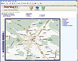 [ Zoom screenshot ] |
|
| Software Info | |
|
Best Vista Download periodically updates pricing and software information of PixGPS full version from the publisher,
but some information may be out-of-date. You should confirm all information. Software piracy is theft, using crack, warez passwords, patches, serial numbers, registration codes, key generator, keymaker or keygen for PixGPS license key is illegal and prevent future development of PixGPS. Download links are directly from our mirrors or publisher's website, PixGPS torrent files or shared files from rapidshare, yousendit or megaupload are not allowed! |
|
| Released: | August 09, 2017 |
| Filesize: | 3.40 MB |
| Platform: | Windows XP, Windows Vista, Windows Vista x64, Windows 7, Windows 7 x64, Windows 8, Windows 8 x64, Windows 10, Windows 10 x64 |
| Install | Instal And Uninstall |
| Add Your Review or Windows Vista Compatibility Report |
PixGPS- Releases History |
| Software: | PixGPS 1.1.8 |
| Date Released: | Aug 9, 2017 |
| Status: | New Release |
| Release Notes: | Fixed a problem that caused the program to fail if installed after a certain date. Making it possible to choose between several maps. Some minor bug fixes. |
| Software: | PixGPS 1.1.7 |
| Date Released: | Sep 9, 2015 |
| Status: | New Release |
| Release Notes: | Fixed a problem that caused the program to fail if installed after a certain date. Making it possible to choose between several maps. Some minor bug fixes. |
| Software: | PixGPS 1.1.6 |
| Date Released: | Oct 3, 2013 |
| Status: | New Release |
| Release Notes: | · can now also show location in Google Maps. · improved error handling when updating image files. · several bug fixes. |
Most popular data to map in Other downloads for Vista |
|
WeatherStudio 2 download by PaulMarv Software
WeatherStudio combines a vast array of live weather data, products, maps, and charts into a single map that the user can pan and zoom. GFS/NDFD/NAM/RAP Model Data, Placefiles, Radar Loops, Satellite, Storm Reports, Hurricane Paths, ...
type: Shareware ($80.00)
View Details
Download
categories: weather, weather tracking software, storm tracking software, weather data, noaa, nws, radar, satellite, software, hurricanes, storms, blizzards, graphics, animations, meteorology, storm chasing, tornadoes, severe weather, spotter, placefiles, model data, GFS, NAM, RAP |
 |
|
Name Dropper 3.7 download by Cognitial Software
... and functions too! Name Dropper allows you to map (connect) network drives to a local drive letter ... the flash fire? You can view the EXIF data of any JPG or TIF image taken with ...
type: Demo ($10.00)
View Details
Download
categories: name dropper, rename multiple image, name changer, name, change, changer |
 |
|
ClickCharts FlowCharts Software Pro 3.09 download by NCH Software
Create flowcharts easily with this Windows software. Whether you're mapping out ideas, laying out the structure of your organization or creating UML diagrams, ClickCharts is the perfect user-friendly program to get ...
View Details
Download
|
 |
|
Mkgmap 4922 download by Steve Ratcliffe
... versatile software tool designed to convert OpenStreetMap (OSM) data into Garmin-compatible map files. This powerful utility serves a niche but ... standout features is its ability to handle large datasets with remarkable efficiency. It supports a wide array ...
type: Open Source
View Details
Download
categories: route, GPS, Mkgmap, mapping, OSM to IMG, create map, software, Steve Ratcliffe, mapper, open-source, GPS map, Mkgmap free download, download Mkgmap, OSM2IMG |
 |
|
GeoSetter 3.5.3 download by Friedemann Schmidt
... for Windows for of imshowing and changing geo data of image files (e.g. images taken by digital ... (Leica) Uses ExifTool by Phil Harvey for writing data Shows existing geo coordinates, image directions and tracks ...
type: Freeware
View Details
Download
categories: change geographical data, change picture date, geo tag images, synchronize, geographic, localication |
 |
|
ACDSee Canvas 12 with GIS+ 12.00.1389 download by ACD Systems
... that require accurate and powerful visualization of technical data rely on Canvas to facilitate collaboration and improve ... that support all leading GIS formats, define complex map projections, and perform advanced property operations. Canvas provides ...
type: Shareware ($899.00)
View Details
Download
categories: Technical illustration, CAD, precision drawing, aerospace, biotechnology manufacturing, oil, gas, vector, raster, WebCGM, CGM, CGM4, flowchart, GIS, visualization, technical graphics, dimensioning, IEEE |
|
ClickCharts Free Flowchart Software 9.57 download by NCH Software
Create flowcharts easily with this free Windows software. Whether you're mapping out ideas, laying out the structure of your organization or creating UML diagrams, ClickCharts is the perfect user-friendly program to ...
type: Freeware
View Details
Download
categories: free flowchart software, flowchart software, Flow diagram, flowchart maker, free diagram software, diagram software, process flowchart software, free process flowchart, free flow diagram |
 |
|
World Heatmap Creator 1.4 download by VOVSOFT
... parameter value using color codes throughout a regular map. Aside from being visually appealing, these statistical instruments are capable of representing large data sets in a simple manner. World Heatmap Creator ...
View Details
Download
|
 |
|
ClickCharts FlowCharts Software Free 3.09 download by NCH Software
Create flowcharts easily with this free Windows software. Whether you're mapping out ideas, laying out the structure of your organization or creating UML diagrams, ClickCharts is the perfect user-friendly program to ...
type: Freeware
View Details
Download
categories: free flowchart software, flowchart software, Flow diagram, flowchart maker, free diagram software, diagram software, process flowchart software, free process flowchart, free flow diagram |
 |
|
PixGPS 1.1.8 download by BR Software
... (latitude and longitude) into the photos EXIF meta data. GeoGPS makes geotagging your digital photos easy. Just ... latitude and longitude in each photos EXIF meta data so it will stay with the photo. You ...
type: Trialware ($19.95)
View Details
Download
categories: digital photo geotagging, photos EXIF metadata, photo GPS, metadata, geotag, GPS |
 |