Related Keywords
data source downloadsdata source paging downloads
data source icons downloads
data source name downloads
sharepoint data source downloads
connect data source downloads
source code downloads
source downloads
source control downloads
source code documentation downloads
source codes downloads
source code metrics downloads
source editor downloads
source code obfuscator downloads
source code editor downloads
source code print downloads
source code library downloads
source code manager downloads
source code font downloads
source code organizer downloads
Top Software Keywords
autocad downloadscad downloads
3d cad downloads
drawing downloads
import downloads
design downloads
dwg downloads
pdf to dwg downloads
dxf downloads
convert downloads
convert pdf to dwg downloads
dwg to pdf downloads
dxf to pdf downloads
converter downloads
pdf to dxf downloads
dwf to dwg downloads
dwg to dxf downloads
dwg converter downloads
dwg to jpg downloads
dwg to bmp downloads
stl downloads
dxf to pcl downloads
dwg to tiff downloads
intellicad downloads
pdf to cad downloads
dwg to gif downloads
convert dwg to pdf downloads
dwg to png downloads
dwg to dwf downloads
dxf to ps downloads
Vista Download
Vista downloadVista antivirus download
Vista wallpaper download
Vista wallpapers download
Vista themes download
Vista pack download
Vista ultimate download
Vista home download
Vista basic download
Vista business download
Vista x64 download
Vista transformation download
Vista transformation pack download
Vista boot download
Vista dvd download
Vista sidebar download
Vista aero download
Vista product key download
Downloads RSS
Top Downloads
Top Rated
Navigation: Home
\ Graphic Apps
\ CAD \ Virtual Terrain Project for Windows
Virtual Terrain Project for Windows1.1 110804 by Ben Discoe |

|
Software Description:
The goal of VTP is to foster the creation of tools for easily constructing any part of the real world in interactive, 3D digital form.This goal will require a synergetic convergence of the fields of CAD, GIS, visual simulation, surveying and remote sensing. VTP gathers information and tracks progress in areas such as procedural scene construction, feature extraction, and rendering algorithms. ...
type: Open Source
Download Virtual Terrain Project for Windowscategories: libraries, demos, data, open source, VirtualTerrain Project, CAD, GIS, VTP Add to Download Basket Report virus or spyware |
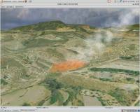 [ Zoom screenshot ] |
|
| Software Info | |
|
Best Vista Download periodically updates pricing and software information of Virtual Terrain Project for Windows full version from the publisher,
but some information may be out-of-date. You should confirm all information. Software piracy is theft, using crack, warez passwords, patches, serial numbers, registration codes, key generator, keymaker or keygen for Virtual Terrain Project for Windows license key is illegal and prevent future development of Virtual Terrain Project for Windows. Download links are directly from our mirrors or publisher's website, Virtual Terrain Project for Windows torrent files or shared files from rapidshare, yousendit or megaupload are not allowed! |
|
| Released: | September 08, 2011 |
| Filesize: | 1.00 MB |
| Platform: | Windows 2000, Windows 2003, Windows XP, Windows Vista |
| Install | Instal And Uninstall |
| Add Your Review or Windows Vista Compatibility Report |
Virtual Terrain Project for Windows- Releases History |
| Software: | Virtual Terrain Project for Windows 1.1 110804 |
| Date Released: | Sep 8, 2011 |
| Status: | New Release |
| Release Notes: | Enviro: Exposed support for more stereo modes: Horizontal and Vertical split. Options to enable joystick and spacenavigator, rather than just always using them if present. Smooth continuous update when making buildings. Option to constrain building point to right angles. Deter user from making bad points. Made support for Collada (.dae) more explicit in the UI. Display the version number in the startup dialog. Added 'every N meters' option to Contour dialog, making it significantly more useful. Changed 'Move' mode to use Alt modifier key for up/down, to be consistent. Fixed issues with: support for elevation grids with non-unit vertical scale; removing layers from a terrain; saving snapshot and high-resolution snapshot; buildings with a Geographic CRS; draping of 2D polylines on terrain with vertical exaggeration. VTBuilder: Raw layers: Draw polygon holes as dotted lines to tell them from outer edges. |
Most popular data source in CAD downloads for Vista |
|
Open3DQSAR 2.24 download by Paolo Tosco
... training/test set combinations, superposition schemes, variable selection and data scrambling procedures, etc. High computational performance is attained ... molecular structures · Comprehensive output, including SDF molecular databases, 3D maps and many different plots to ease ...
type: Open Source
View Details
Download
categories: chemometric analysis, analyze MIF, pharmacophore exploration, MIF, analysis, chemometry |
 |
|
PreviSat 6.1.0.3 download by Astropedia
... of orbital elements from the Internet and uploading data from TXT, TLE, or GZ file format. ...
type: Open Source
View Details
Download
categories: track satellite, satellite tracker, satellite position, track, tracker, position |
 |
|
Fityk 1.3.1 download by Marcin Wojdyr
... nonlinear fitting of analytical functions (especially peak-shaped) to data (usually experimental data). There are also people using it to remove the baseline from data, or to display data only. Fityk is reportedly ...
type: Open Source
View Details
Download
categories: analytical functions, photoelectron spectroscopy, Raman spectroscopy, crystallography, analytical, chromatography |
 |
|
Euler Math Toolbox 2024-01-14 download by Rene Grothmann
... or under Linux in Wine. Free and open source. FEATURES: Euler Language: · interactive ... calculation, · exact solutions of linear systems, · data type for sparse matrices, Programming Language: · ...
type: Open Source
View Details
Download
categories: math toolbox, numerical software, mathematical tool, math, mathematical, numeric |
 |
|
MITO 2.0 download by Giuseppe De Pietro
... MITO provides interaction techniques for manipulating 3D medical data in a virtual environment by 2 DOF input devices. FEATURES: · DICOM compliant · 2D / 3D / S3D ...
type: Open Source
View Details
Download
categories: view DICOM file, DICOM file viewer, image segmentation, display, view, viewer |
 |
|
Gnuplot for Windows 5.2.7 download by Philipp K. Janert
... Windows, OSX, VMS, and many other platforms. The source code is copyrighted but freely distributed (i.e., you ... scientists and students to visualize mathematical functions and data interactively, but has grown to support many non-interactive ...
type: Open Source
View Details
Download
categories: portable, Gnuplot, Gnu plot, utility, graph plotter, plot graph, plotter, graph |
 |
|
VarScan 2.4.6 download by Dan Koboldt
... of sequencing throughput. The analysis and interpretation of data from next-generation sequencing platforms presents a substantial informatics ... parallel sequencing of individual and pooled samples. Given data for a single sample, VarScan identifies and filters ...
type: Open Source
View Details
Download
categories: SNP identifier, identify SNP, filter variant, identify, identifier, SNP |
 |
|
QtGrace 0.2.6 download by Andreas_Winter
... offer users a program to display or plot data, analyze data and prepare it for printing. This software is ... automated tasks. FEATURES: · Import numerical data (like scientific measurements, statistics) · Organize and plot ...
View Details
Download
|
 |
|
QFitsView 8.6 download by Eric Mandel
... is a robust and versatile astronomical imaging and data visualization software that has become an indispensable tool ... Designed to handle the complex demands of astronomical data analysis, DS9 offers a comprehensive suite of features ...
type: Open Source
View Details
Download
categories: data visualization, image analysis, Colormap Analysis, Astronomy, SAOImage DS9 free download, astronomy, Astronomy Visualization, software tool, download SAOImage DS9, Colormap, Eric Mandel, FITS, SAOImage DS9, Frame, FITS Viewer |
 |
|
OpenAPC 2.5 download by OpenAPC Project Group
OpenAPC is an Open Source APC (Advanced Process Control) solution that is highly ... can be used to create motion and processing data for controlling e.g. XY-tables and connected tools for
View Details
Download
|
 |