Related Keywords
data on map downloadsdata to map downloads
photos on map downloads
wipe data on your disk downloads
record data on cdr autorun downloads
recovering data on memory card downloads
recover data on android downloads
access mac data on windows downloads
restore data on mac quickly downloads
recover lost data on ipod downloads
restore data on android phone downloads
erase data on iphone downloads
erase all data on iphone downloads
recover lost data on iphone downloads
manage data on ios devices downloads
erase data on ios devices downloads
encrypt data on usb drives downloads
data map downloads
map data field downloads
data recovery on pen drive downloads
Top Software Keywords
tool downloadsdigital downloads
pdf downloads
design downloads
image downloads
photo downloads
images downloads
jpeg downloads
adobe downloads
photos downloads
processing downloads
color downloads
scanner downloads
graphics downloads
bmp downloads
jpg downloads
screen downloads
photoshop downloads
picture downloads
graphic downloads
zoom downloads
print downloads
utility downloads
pictures downloads
corel downloads
video downloads
gif downloads
printing downloads
watermark downloads
paint downloads
Vista Download
Vista downloadVista antivirus download
Vista wallpaper download
Vista wallpapers download
Vista themes download
Vista pack download
Vista ultimate download
Vista home download
Vista basic download
Vista business download
Vista x64 download
Vista transformation download
Vista transformation pack download
Vista boot download
Vista dvd download
Vista sidebar download
Vista aero download
Vista product key download
Downloads RSS

Top Downloads
Top Rated
Navigation: Home
\ Graphic Apps
\ Other \ GeoSetter
GeoSetter3.5.3 by Friedemann Schmidt |

|
Software Description:
... tool for Windows for showing and changing geo data of image files (e.g. images taken by digital cameras).The user interface is available in English, German, French, Italian, Swedish, Czech, Spanish, Danish, Dutch, Russian, Japanese, Chinese and Norwegian by now. ...
type: Freeware
Download GeoSettercategories: change geographical data, change picture date, geo tag images, synchronize, geographic, localication Add to Download Basket Report virus or spyware |
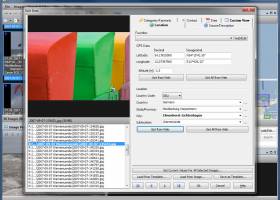 [ Zoom screenshot ] |
|
| Software Info | |
|
Best Vista Download periodically updates pricing and software information of GeoSetter full version from the publisher,
but some information may be out-of-date. You should confirm all information. Software piracy is theft, using crack, warez passwords, patches, serial numbers, registration codes, key generator, keymaker or keygen for GeoSetter license key is illegal and prevent future development of GeoSetter. Download links are directly from our mirrors or publisher's website, GeoSetter torrent files or shared files from rapidshare, yousendit or megaupload are not allowed! |
|
| Released: | October 29, 2019 |
| Filesize: | 23.40 MB |
| Platform: | Windows Vista, Windows Vista x64, Windows 7, Windows 7 x64, Windows 8, Windows 8 x64, Windows 10, Windows 10 x64 |
| Install | Instal And Uninstall |
| Add Your Review or Windows Vista Compatibility Report |
GeoSetter- Releases History |
| Software: | GeoSetter 3.5.3 |
| Date Released: | Oct 29, 2019 |
| Status: | New Release |
| Release Notes: | Changes: Sometimes GeoSetter crashed when checking changed languages, for example after startup |
| Software: | GeoSetter 3.1.20 |
| Date Released: | Aug 18, 2009 |
| Status: | New Release |
| Release Notes: | ! ExifTool could corrupt Nikon NRW files (834) ! Renaming file in GeoSetter doesn't rename sidecar file (832) ! GPX not valid with specific description data (810) ! Problems with support for Exif Artist (784, 814, 815) + Support for CoPilot track files (811) |
Most popular data on map in Other downloads for Vista |
|
Name Dropper 3.7 download by Cognitial Software
... and functions too! Name Dropper allows you to map (connect) network drives to a local drive letter ... the flash fire? You can view the EXIF data of any JPG or TIF image taken with ...
type: Demo ($10.00)
View Details
Download
categories: name dropper, rename multiple image, name changer, name, change, changer |
 |
|
WeatherStudio 2 download by PaulMarv Software
WeatherStudio combines a vast array of live weather data, products, maps, and charts into a single map that the user can pan and zoom. GFS/NDFD/NAM/RAP Model Data, Placefiles, Radar Loops, Satellite, Storm Reports, Hurricane Paths, ...
type: Shareware ($80.00)
View Details
Download
categories: weather, weather tracking software, storm tracking software, weather data, noaa, nws, radar, satellite, software, hurricanes, storms, blizzards, graphics, animations, meteorology, storm chasing, tornadoes, severe weather, spotter, placefiles, model data, GFS, NAM, RAP |
 |
|
GeoSetter 3.5.3 download by Friedemann Schmidt
... for Windows for of imshowing and changing geo data of image files (e.g. images taken by digital ... (Leica) Uses ExifTool by Phil Harvey for writing data Shows existing geo coordinates, image directions and tracks ...
type: Freeware
View Details
Download
categories: change geographical data, change picture date, geo tag images, synchronize, geographic, localication |
 |
|
ACDSee Canvas 12 with GIS+ 12.00.1389 download by ACD Systems
... that require accurate and powerful visualization of technical data rely on Canvas to facilitate collaboration and improve ... that support all leading GIS formats, define complex map projections, and perform advanced property operations. Canvas provides ...
type: Shareware ($899.00)
View Details
Download
categories: Technical illustration, CAD, precision drawing, aerospace, biotechnology manufacturing, oil, gas, vector, raster, WebCGM, CGM, CGM4, flowchart, GIS, visualization, technical graphics, dimensioning, IEEE |
|
uDig 2.0.0 download by Jody Garnett
... provide a complete Java solution for desktop GIS data access, editing, and viewing. uDig aims to be: User friendly, providing a familiar graphical environment for GIS users; Desktop ...
type: Open Source
View Details
Download
categories: spatial data viewer, spatial data editor, geospatial application, uDig, spatial data, viewer |
 |
|
uDig x64 1.4.0 download by Jody Garnett
... provide a complete Java solution for desktop GIS data access, editing, and viewing. uDig aims to be: User friendly, providing a familiar graphical environment for GIS users; Desktop ...
type: Open Source
View Details
Download
categories: x64 spatial data viewer, x64 spatial data editor, x64 geospatial application, uDig x64, spatial data, x64 viewer, x64 |
 |
|
World Heatmap Creator 1.4 download by VOVSOFT
... parameter value using color codes throughout a regular map. Aside from being visually appealing, these statistical instruments are capable of representing large data sets in a simple manner. World Heatmap Creator ...
View Details
Download
|
 |
|
Mkgmap 4922 download by Steve Ratcliffe
... versatile software tool designed to convert OpenStreetMap (OSM) data into Garmin-compatible map files. This powerful utility serves a niche but ... standout features is its ability to handle large datasets with remarkable efficiency. It supports a wide array ...
type: Open Source
View Details
Download
categories: route, GPS, Mkgmap, mapping, OSM to IMG, create map, software, Steve Ratcliffe, mapper, open-source, GPS map, Mkgmap free download, download Mkgmap, OSM2IMG |
 |
|
PixGPS 1.1.8 download by BR Software
... (latitude and longitude) into the photos EXIF meta data. GeoGPS makes geotagging your digital photos easy. Just ... latitude and longitude in each photos EXIF meta data so it will stay with the photo. You ...
type: Trialware ($19.95)
View Details
Download
categories: digital photo geotagging, photos EXIF metadata, photo GPS, metadata, geotag, GPS |
 |
|
TatukGIS Viewer 5.83.0.3269 download by TatukGIS
... an indispensable asset for anyone involved in spatial data analysis, mapping, and visualization. At its core, ... built to handle a wide range of GIS data formats, ensuring seamless integration and compatibility with various ...
type: Freeware
View Details
Download
categories: TatukGIS Viewer, download TatukGIS Viewer, TatukGIS Viewer free download, raster image Viewer, GIS editor, GIS map, viewer, graphic, view, edit |
 |