Related Keywords
create table downloadscreate partitioned table downloads
create html table in excel downloads
table downloads
table games downloads
table graphs downloads
table of contents downloads
table generator downloads
table tennis downloads
table animator downloads
table soccer downloads
table football downloads
table cells downloads
table view downloads
table grid downloads
table planner downloads
table structure downloads
table selection downloads
table viewer downloads
table making tool downloads
Top Software Keywords
autocad downloadscad downloads
3d cad downloads
drawing downloads
import downloads
design downloads
dwg downloads
pdf to dwg downloads
dxf downloads
convert downloads
convert pdf to dwg downloads
dwg to pdf downloads
dxf to pdf downloads
converter downloads
pdf to dxf downloads
dwf to dwg downloads
dwg to dxf downloads
dwg converter downloads
dwg to jpg downloads
dwg to bmp downloads
stl downloads
dxf to pcl downloads
dwg to tiff downloads
intellicad downloads
pdf to cad downloads
dwg to gif downloads
convert dwg to pdf downloads
dwg to png downloads
dwg to dwf downloads
dxf to ps downloads
Vista Download
Vista downloadVista antivirus download
Vista wallpaper download
Vista wallpapers download
Vista themes download
Vista pack download
Vista ultimate download
Vista home download
Vista basic download
Vista business download
Vista x64 download
Vista transformation download
Vista transformation pack download
Vista boot download
Vista dvd download
Vista sidebar download
Vista aero download
Vista product key download
Downloads RSS
Top Downloads
Top Rated
Navigation: Home
\ Graphic Apps
\ CAD \ TopoLT
TopoLT15.2 by CADWARE Engineering |

|
Software Description:
TopoLT is an application offering tools for 2D and 3D aplications and functionalities useful for all those who design topographical or cadastral plans in digital format, who develop 3D terrain models and contours, fill and cut volumes calculation, raster image georeferencing and automatic printing. 3D model of the terrain and contour lines can be generated, volumes can be calculated without any restrictions. ...
type: Trialware ($600.00)
Download TopoLTcategories: topographical plan, cadastral plan, terrain model, topography, cadaster, terrain Add to Download Basket Report virus or spyware |
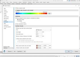 [ Zoom screenshot ] |
|
| Software Info | |
|
Best Vista Download periodically updates pricing and software information of TopoLT full version from the publisher,
but some information may be out-of-date. You should confirm all information. Software piracy is theft, using crack, warez passwords, patches, serial numbers, registration codes, key generator, keymaker or keygen for TopoLT license key is illegal and prevent future development of TopoLT. Download links are directly from our mirrors or publisher's website, TopoLT torrent files or shared files from rapidshare, yousendit or megaupload are not allowed! |
|
| Released: | October 16, 2023 |
| Filesize: | 67.80 MB |
| Platform: | Windows XP, Windows Vista, Windows Vista x64, Windows 7, Windows 7 x64, Windows 8, Windows 8 x64, Windows 10, Windows 10 x64, Windows 11 |
| Install | Instal And Uninstall |
| Add Your Review or Windows Vista Compatibility Report |
TopoLT- Releases History |
| Software: | TopoLT 15.2 |
| Date Released: | Oct 16, 2023 |
| Status: | New Release |
| Software: | TopoLT 15.1 |
| Date Released: | Mar 3, 2023 |
| Status: | New Release |
| Software: | TopoLT 14.0 |
| Date Released: | Feb 24, 2022 |
| Status: | New Release |
Most popular create table in CAD downloads for Vista |
|
LabQuest Emulator 1.5 download by Vernier Software & Technology
... software features like graph analysis, built-in labs, periodic table, stopwatch, and more. Explore built-in curriculum including experiments ... of the LabQuest to a class or group. Create screenshot images of the LabQuest software for use ...
type: Freeware
View Details
Download
categories: emulate LabQuest, LabQuest simulator, emulate interface, LabQuest, simulator, emulator |
 |
|
MagicPlot Pro 2.9.3 download by MagicPlot.com
... Smart Text Data Import Use ‘?Import Text Table’ menu item to open your data saved in ... scripting. Fitting of series results in parameters summary table. Style Templates Format one figure and save ...
type: Trialware ($198.00)
View Details
Download
categories: Nonlinear Fitting, Create Plot, customizable plot, Plotter, Plot, fitter |
 |
|
TopoLT 15.2 download by CADWARE Engineering
... CAD platform and adding specific functions necessary to create topographical and cadastral plans in digital format. ... TopoLT is the oldest topography application in Romania, created to help surveyors to carry out topographic and ...
type: Trialware ($600.00)
View Details
Download
categories: topographical plan, cadastral plan, terrain model, topography, cadaster, terrain |
 |
|
Gephi 0.10.1 download by Mathieu Bastian
... GEXF file format · Graph streaming ready Create cartography: · Use ranking or partition data to ... interface to filter the network in real-time. · Create complex filter query without scripting · Build new ...
type: Open Source
View Details
Download
categories: interactive visualization, exploration platform, visualization platform, visualization, exploration, graph |
 |
|
CurveExpert Professional 2.7.3 download by Daniel G. Hyams
... you to import your data, generate results, and create publication-quality plots with very minimal effort. In fact, ... graphs: an arbitrary number of graphs can be created and saved. The rendering of the plots is ...
View Details
Download
|
 |
|
tinyFLP 1.30 download by Wolfgang Arthofer
... automatic peak selection and scoring of AFLP data tables witten by Wolfgang Arthofer, University of Innsbruck. Austria. ...
type: Open Source
View Details
Download
categories: automatic peak selection, AFLP data table, analyze data, analyzer, select, analysis |
 |
|
p3d 2.6.2 download by Christer Sandin
... contains tools to handle the following tasks: Create a master-bias image – any available prescan and ... spectra on the detector; automatically, in most cases. Create a dispersion mask for wavelength calibration. Create a ...
type: Freeware
View Details
Download
categories: field spectrograph, data reduction, astronomical data, reduction, reduce, spectrograph |
 |
|
Shadow Analyzer 2.2.1.1.1 download by Dr. Baum Research e.K.
... 2-axes trackers. Both the products allow you to create the 3D model of your solar project in ... curves of the calculated characteristics), or use the Table window that displays their numerical values in tables. ...
type: Demo ($1 985.00)
View Details
Download
categories: Parametric CAD, Shading Analysis, sun-tracking and static PV-systems, Solar Energy Engineering |
 |
|
QGIS 3.36.1 download by Gary Sherman
... and database formats and lets you browse and create map data on your computer. QGIS supports ... "QGIS": · Support for spatially enabled PostgreSQL tables using PostGIS · Support for ESRI shapefiles and ...
type: Open Source
View Details
Download
categories: geographic information system, map creator, map viewer, GIS, geographic information, create, QGIS |
 |
|
SolidFace 3D CAD PTV 24.0.0.X download by SolidFace Technology Inc
... using CSV format (Excel files Association) or TXT table files; Configurable toolbars; Possibility of managing multiple projects ... of parametric variables via commands, questions, or variable tables; Logical conditions If-then-else; Parametric generation of bill of ...
View Details
Download
|
 |