Related Keywords
corporate downloadscorporate email encryption downloads
corporate instant messenger downloads
corporate im downloads
corporate mail systems downloads
corporate portal downloads
corporate logos downloads
corporate administration downloads
corporate security downloads
corporate monkeys downloads
corporate icons downloads
corporate icon downloads
corporate directory downloads
corporate spyware protection downloads
corporate server downloads
corporate messaging downloads
corporate dashboard downloads
corporate messenger downloads
corporate identity downloads
corporate edition downloads
Top Software Keywords
autocad downloadscad downloads
3d cad downloads
drawing downloads
import downloads
design downloads
dwg downloads
pdf to dwg downloads
dxf downloads
convert downloads
convert pdf to dwg downloads
dwg to pdf downloads
converter downloads
dxf to pdf downloads
pdf to dxf downloads
dwg to dxf downloads
dwf to dwg downloads
dwg converter downloads
dwg to jpg downloads
dwg to bmp downloads
stl downloads
dxf to pcl downloads
dwg to tiff downloads
intellicad downloads
pdf to cad downloads
dwg to gif downloads
convert dwg to pdf downloads
dwg to png downloads
dwg to dwf downloads
dxf to ps downloads
Vista Download
Vista downloadVista antivirus download
Vista wallpaper download
Vista wallpapers download
Vista themes download
Vista pack download
Vista ultimate download
Vista home download
Vista basic download
Vista business download
Vista x64 download
Vista transformation download
Vista transformation pack download
Vista boot download
Vista dvd download
Vista sidebar download
Vista aero download
Vista product key download
Top Downloads
Top Rated
Navigation: Home
\ Graphic Apps
\ CAD \ TNTatlas
TNTatlas2024 B20240606 by MicroImages, Inc. |

|
Software Description:
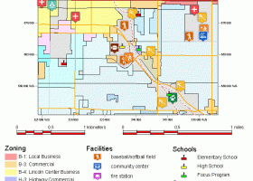
TNTatlas is a powerful free geodata viewer that lets you publish and distribute your maps and geospatial data — from a single geodata file to complex map layouts prepared using TNTmips. TNTatlas lets you display massive sized geodata and will directly display numerous file formats including shapefiles, GeoTIFF, JP2, PNG, MrSID, DXF, and DWG. ...
type: Freeware
Download TNTatlascategories: geospatial viewer, view atlas, visualize geospatial data, atlas, map, viewer Add to Download Basket Report virus or spyware |
 [ Zoom screenshot ] |
|
| Software Info | |
|
Best Vista Download periodically updates pricing and software information of TNTatlas full version from the publisher,
but some information may be out-of-date. You should confirm all information. Software piracy is theft, using crack, warez passwords, patches, serial numbers, registration codes, key generator, keymaker or keygen for TNTatlas license key is illegal and prevent future development of TNTatlas. Download links are directly from our mirrors or publisher's website, TNTatlas torrent files or shared files from rapidshare, yousendit or megaupload are not allowed! |
|
| Released: | June 06, 2024 |
| Filesize: | 59.00 MB |
| Platform: | Windows XP, Windows Vista, Windows Vista x64, Windows 7, Windows 7 x64, Windows 8, Windows 8 x64, Windows 10, Windows 10 x64, Windows 11 |
| Install | Instal And Uninstall |
| Add Your Review or Windows Vista Compatibility Report |
TNTatlas- Releases History |
| Software: | TNTatlas 2024 B202406 |
| Date Released: | Jun 6, 2024 |
| Status: | New Release |
| Software: | TNTatlas 2022 B202212 |
| Date Released: | Dec 7, 2022 |
| Status: | New Release |
| Software: | TNTatlas 2022 B202211 |
| Date Released: | Nov 30, 2022 |
| Status: | New Release |
Most popular corporate in CAD downloads for Vista |
|
TNTatlas 2024 B20240606 download by MicroImages, Inc.
... may be responsible for the distribution of sensitive corporate or military materials to a user group. Or you may have to rapidly assemble and distribute existing electronic map and database ...
type: Freeware
View Details
Download
categories: geospatial viewer, view atlas, visualize geospatial data, atlas, map, viewer |
 |
|
VID 1.163 download by Codemachine Ltd.
... a globally distributed system using the Internet or Corporate VPN. Each NetCommander monitoring unit can provide up to 16 analogue input and outputs, 16 switch (relay) control outputs and ...
type: Trialware ($120.00)
View Details
Download
categories: plant monitor, control system, plant control, plant, control, monitor |
 |