Related Keywords
coordinate import downloadsimport geographic coordinate downloads
coordinate downloads
coordinate transformation downloads
coordinate system downloads
coordinate calculator downloads
coordinate converter downloads
coordinate reference system downloads
coordinate translation downloads
coordinate systems downloads
coordinate conversion downloads
coordinate system calculator downloads
coordinate geometry software downloads
coordinate geometry calculator downloads
coordinate agent downloads
coordinate x downloads
import software to import pst downloads
import downloads
import points downloads
import access to mysql downloads
Top Software Keywords
autocad downloadscad downloads
3d cad downloads
drawing downloads
import downloads
design downloads
dwg downloads
pdf to dwg downloads
dxf downloads
convert downloads
convert pdf to dwg downloads
dwg to pdf downloads
dxf to pdf downloads
converter downloads
pdf to dxf downloads
dwf to dwg downloads
dwg to dxf downloads
dwg converter downloads
dwg to jpg downloads
dwg to bmp downloads
stl downloads
dxf to pcl downloads
dwg to tiff downloads
intellicad downloads
pdf to cad downloads
dwg to gif downloads
convert dwg to pdf downloads
dwg to png downloads
dwg to dwf downloads
dxf to ps downloads
Vista Download
Vista downloadVista antivirus download
Vista wallpaper download
Vista wallpapers download
Vista themes download
Vista pack download
Vista ultimate download
Vista home download
Vista basic download
Vista business download
Vista x64 download
Vista transformation download
Vista transformation pack download
Vista boot download
Vista dvd download
Vista sidebar download
Vista aero download
Vista product key download
Downloads RSS
Top Downloads
Top Rated
Navigation: Home
\ Graphic Apps
\ CAD \ TopoLT
TopoLT15.2 by CADWARE Engineering |

|
Software Description:
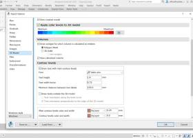
TopoLT is an application offering tools for 2D and 3D aplications and functionalities useful for all those who design topographical or cadastral plans in digital format, who develop 3D terrain models and contours, fill and cut volumes calculation, raster image georeferencing and automatic printing. 3D model of the terrain and contour lines can be generated, volumes can be calculated without any restrictions. ...
type: Trialware ($600.00)
Download TopoLTcategories: topographical plan, cadastral plan, terrain model, topography, cadaster, terrain Add to Download Basket Report virus or spyware |
 [ Zoom screenshot ] |
|
| Software Info | |
|
Best Vista Download periodically updates pricing and software information of TopoLT full version from the publisher,
but some information may be out-of-date. You should confirm all information. Software piracy is theft, using crack, warez passwords, patches, serial numbers, registration codes, key generator, keymaker or keygen for TopoLT license key is illegal and prevent future development of TopoLT. Download links are directly from our mirrors or publisher's website, TopoLT torrent files or shared files from rapidshare, yousendit or megaupload are not allowed! |
|
| Released: | October 16, 2023 |
| Filesize: | 67.80 MB |
| Platform: | Windows XP, Windows Vista, Windows Vista x64, Windows 7, Windows 7 x64, Windows 8, Windows 8 x64, Windows 10, Windows 10 x64, Windows 11 |
| Install | Instal And Uninstall |
| Add Your Review or Windows Vista Compatibility Report |
TopoLT- Releases History |
| Software: | TopoLT 15.2 |
| Date Released: | Oct 16, 2023 |
| Status: | New Release |
| Software: | TopoLT 15.1 |
| Date Released: | Mar 3, 2023 |
| Status: | New Release |
| Software: | TopoLT 14.0 |
| Date Released: | Feb 24, 2022 |
| Status: | New Release |
Most popular coordinate import in CAD downloads for Vista |
|
GPS Utility 5.51 download by GPS Utility Ltd.
... program converts between different map datums and many coordinate formats (Lat/Long, UTM/UPS, country grids etc.). Information can ... as Route cards. GPS Utility supports many import/export file formats. This makes it easy to transfer ...
type: Demo ($60.00)
View Details
Download
categories: Waypoint Manager, GPS Receiver, Digitise GPS, Waypoint, GPD, Digitise |
 |
|
TopoLT 15.2 download by CADWARE Engineering
... FEATURES: · draws directly points from coordinate files, draws coordinates from total station or sends coordinates from drawing directly to total station; · point ... etc.) which don’t have points at margins; · coordinates of sightshot points (polar points) can be calculated ...
type: Trialware ($600.00)
View Details
Download
categories: topographical plan, cadastral plan, terrain model, topography, cadaster, terrain |
 |
|
TNTmips 20240404 download by MicroImages, Inc.
... variety of data types and a multitude of Coordinate Reference Systems. Include layers in a wide variety of external formats without importing. Overlay your geodata on Bing Maps imagery and ... using a reference image; place control points with coordinates from GPS devices ... Import and export ...
type: Freeware
View Details
Download
categories: GIS data analysis, analyze geodetic data, edit GIS dataset, GIS, dataset, editor, analysis |
 |
|
CADopia 23 Professional 22.3.1.4100 download by CADopia
... Wizard Improved batch printing Layer support in PDF import The major features supported in CADopia Professional are: ... a block Edit block attribute properties Dynamic custom coordinate system Formulas in tables and export to Excel ...
type: Demo ($745.00)
View Details
Download
categories: corelcad, autocad, intellicad, bricscad, progecad, draftsight, zwcad, ARES Commander, dwg viewer, drawing viewer, drawing, dxf, dwg, survey, CAD, drafting, BIM, Revit, fusion 360 |
 |
|
CADopia 23 Standard 22.3.1.4100 download by CADopia
... hatching Improved batch printing Layer support in PDF import Security enhancements The major features supported in CADopia ... Export Adobe Acrobat (PDF) files from your drawings Import PDF files and save as DWG file Microstation ...
type: Demo ($595.00)
View Details
Download
categories: corelcad, autocad, intellicad, bricscad, progecad, draftsight, zwcad, dwg viewer, drawing viewer, drawing, dxf, dwg, survey, CAD, drafting |
 |
|
CADopia 23 Professional 22.3.1.4100 download by CADopia
... Wizard Improved batch printing Layer support in PDF import The major features supported in CADopia Professional are: ... a block Edit block attribute properties Dynamic custom coordinate system Formulas in tables and export to Excel ...
type: Demo ($745.00)
View Details
Download
categories: corelcad, autocad, intellicad, bricscad, progecad, draftsight, zwcad, ARES Commander, dwg viewer, drawing viewer, drawing, dxf, dwg, survey, CAD, drafting, BIM, Revit, fusion 360 |
 |
|
VideoCAD Lite 8.2.0.0 download by CCTVCAD Software
... *.bmp, *.jpg, *.emf, *.wmf, *.dwg, *.dxf formats. To import *.dwg and *.dxf files the CAD Import module by CAD Soft Tools homepage was used. ... images, calculated view areas and cables, and with coordinate grid and titles to be used in graphical ...
type: Trialware ($350.00)
View Details
Download
categories: develop CCTV, design CCTV, video surveillance designer, CAD, surveillance, design |
 |
|
VideoCAD Starter II Kit 7.1 download by CCTVCAD Software
... spaces; VideoCAD Plugin for Google SketchUp allows to import 3D models and scenes from Google SketchUp. With ... with camera images, calculated view areas, and with coordinate grid to be used in graphical path of ...
type: Demo ($198.00)
View Details
Download
categories: CCTV planing, CCTV system design, 3D CCTV, CCTV AutoCAD, video surveillance, camera, lens, focal length, field of view, IP camera, megapixel, camera resolution, lens calculator, cctv calculator, field of view calculator, camera calculator |
 |